Area Overview for CM15 8PR
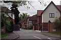
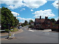
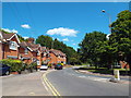
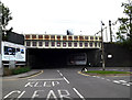
Photos of CM15 8PR


Area Information
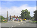
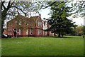
Shenfield stands as an affluent commuter suburb within the Borough of Brentwood, Essex, situated roughly one mile north-east of Brentwood town centre. Located in the CM15 district, this specific postcode area encompasses a small residential cluster with a population of 1,779 people. The location sits approximately 27 miles from central London, placing it firmly within the London commuter belt while also being around 20 miles north-east of Charing Cross. The area forms part of the wider Brentwood conurbation and borders the Essex countryside, offering a balance between suburban living and rural proximity. Historically, the name Shenfield originates from the Anglo-Saxon *Chenefield*, meaning 'good lands'. The original village developed along an ancient Roman road now known as the A1023, which connected London and Colchester. Although the area is an ancient parish, it currently functions primarily as a dormitory town for commuters working in London, Romford, and Basildon. The coordinates 51.64712, 0.316966 identify this specific segment of the suburb, which is experiencing investment and growth driven by enhanced transport connections. Residents here benefit from a setting that merges historical significance with modern connectivity, making it a deliberate choice for those seeking a home in a established yet evolving neighbourhood.
- Area Type
- Postcode
- Area Size
- Not available
- Population
- 1779
- Population Density
- 431 people/km²
The property market in CM15 8PR is defined by a strong bias toward ownership rather than renting. Data confirms that 92% of homes in this postcode are owner-occupied, leaving only a very small cohort as rental properties. This overwhelming preference for ownership indicates that the housing stock comprises predominantly owned houses, consistent with the accommodation type data. The market here does not operate like a typical student rental hub or a high-velocity lease market; instead, it reflects a stable environment where buyers seek to settle down permanently. Prospective homebuyers looking at this small area and its immediate surroundings will find an inventory dominated by private homeownership. The high ownership rate implies that sellers are likely local residents looking to upsize, downsize, or move, rather than professional landlords seeking quick turnovers. This structure provides a reliable market dynamic where price negotiations often involve long-term residents with deep knowledge of the neighbourhood value. For anyone considering purchasing homes in CM15, the facts suggest a market where security of tenure is possible and where the properties have likely been cared for by their owners over extended periods.
House Prices in CM15 8PR
No properties found in this postcode.
Energy Efficiency in CM15 8PR
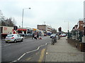
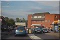
Daily life in CM15 8PR benefits from a convenient cluster of amenities located within practical reach of residents. For shopping needs, there are five retail options nearby, including Morrisons Daily Shenfield 214, Co-op Shenfield, and M&S Hutton Mount BP. This variety ensures that household groceries and daily essentials remain accessible without long journeys. Residents also have five railway stations within easy reach, including Shenfield Railway Station, Brentwood Railway Station, and Ingatestone Railway Station, facilitating daily commutes and weekend outings. Recreational facilities include the Courage playing fields on Chelmsford Road, which contains a play area and cricket pitch. The Shenfield Cricket Club is located adjacent to these fields, with land historically granted by the Courage brewing family. Playing fields on Alexander Lane further provide space for sports and leisure activities. A busy shopping area along the high street adds to the local character, offering additional retail and social opportunities. The area balances residential quietness with the convenience of a shopping street and active leisure spaces, creating a lifestyle where practical needs and recreational interests sit side by side for those living here.
Amenities
Schools
Families residing in CM15 8PR have access to education facilities that cater to various stages of learning. The nearest primary education provider is St Mary's primary school, which serves the younger generation within the immediate vicinity. For secondary education, Shenfield High School stands as a key institution available to local children. The academy sector includes Shenfield High School, which holds a Good Ofsted rating. This designation confirms that the school meets the required standards for educational quality and provision. The presence of both primary and secondary options in close proximity simplifies logistics for parents moving to the area. Having a state school with a Good rating available directly nearby is a significant factor for families prioritising education outcomes. The mix of school types ensures coverage from early years through to the end of compulsory education, reducing the need for long-distance travel just for schooling. Residents can expect their children to attend institutions that are familiar to the local community and integrated into the area's social fabric. The focus remains on verifiable quality, with the academy status and Ofsted result providing clear indicators for prospective parents evaluating homes in these neighbourhoods.
| Rank | School | Type | Entry gender | Ages |
|---|
Explore more schools in this area
Go to Schools tabDemographics
The community in CM15 8PR displays a distinct demographic profile characterised by stability and maturity. The median age for residents is 47 years, with the most common age range falling within adults aged 30 to 64 years. This distribution indicates an area populated primarily by people in their middle years rather than young families or retirees. The prevailing accommodation type consists of houses, which aligns with the mature nature of the household composition. Home ownership is exceptionally high within this postcode area, standing at 92%. This figure suggests that the vast majority of residents have purchased their properties rather than renting, pointing to a secure and settled population. The predominant ethnic group is White, reflecting the traditional demographic makeup of many established Essex suburbs. With a population density of 431 people per square kilometre, the area is neither tightly packed nor sparse, offering a level of livability that balances convenience with space. The absence of significant migration or extreme age skewing creates a predictable environment where long-term residents form the backbone of the local community.
Household Size
Accommodation Type
Tenure
Ethnic Group
Religion
Household Composition
Age
Household Deprivation
NS-SEC
Explore more demographic insights in this area
Go to Demographics tabPlanning
Planning Constraints
- Flood RiskPremium
- Ramsar Wetland SitesPremium
- Area of Outstanding Natural BeautyPremium
- Protected Nature ReservePremium
- Protected WoodlandPremium