Area Overview for CM15 8NY
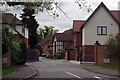
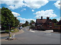
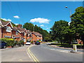
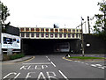
Photos of CM15 8NY

Area Information
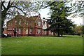
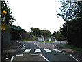
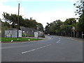
Living in CM15 8NY means inhabiting a small, tightly knit residential cluster in Shenfield, Essex. With a population of 1,933 and a density of 1,082 people per square kilometre, this area balances suburban comfort with proximity to London. Shenfield, historically rooted in Anglo-Saxon *Chenefield*, sits within the Brentwood conurbation, just 27 miles from central London. Its role as a commuter suburb is evident, with residents often working in nearby towns like Romford, Basildon, or London itself. The area’s appeal lies in its blend of quiet residential living and access to transport networks. Families are drawn here by the presence of quality schools, while the local economy thrives on its position in the London commuter belt. The A12 and M25 motorways are within easy reach, and Shenfield Railway Station offers direct links to Liverpool Street, with journeys to central London under 30 minutes. Daily life here is defined by a mix of small-scale retail, green spaces, and a community that prioritises stability and family-oriented living.
- Area Type
- Postcode
- Area Size
- Not available
- Population
- 1933
- Population Density
- 1082 people/km²
The property market in CM15 8NY is characterised by a strong emphasis on owner-occupied homes. With 71% of residents owning their properties, the area leans heavily towards private homeownership rather than rental activity. The predominant accommodation type is houses, which aligns with the suburban, family-oriented nature of Shenfield. This housing stock appeals to those seeking spacious, long-term living arrangements, though the small size of the postcode area may limit the range of available properties. Buyers should consider nearby areas within the CM15 postcode district for more options. The focus on owner-occupied homes suggests a stable market with properties likely retaining value over time, particularly given the area’s proximity to transport links and schools.
House Prices in CM15 8NY
No properties found in this postcode.
Energy Efficiency in CM15 8NY
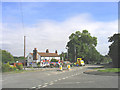
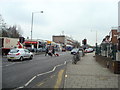
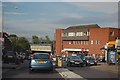
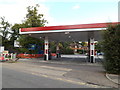
The lifestyle in CM15 8NY is shaped by its proximity to retail, leisure, and green spaces. Local shops include Morrisons Daily Shenfield, Co-op Shenfield, and Tesco Shenfield, offering everyday essentials. The high street hosts a modest but busy shopping area, complemented by nearby rail stations that connect to broader retail hubs. Recreational opportunities include Courage playing fields on Chelmsford Road, featuring a cricket pitch and play area, and Alexander Lane’s playing fields. These spaces cater to active lifestyles, while the area’s border with the Essex countryside provides a contrast to suburban living. The mix of retail, transport, and open spaces ensures a convenient, balanced lifestyle for residents.
Amenities
Schools
CM15 8NY is served by two primary schools, both affiliated with the Church of England. St Mary’s Church of England Voluntary Aided Primary School in Shenfield and Shenfield St. Mary’s Church of England Primary School cater to younger children, with the latter holding an outstanding Ofsted rating. These institutions reflect the area’s emphasis on education, particularly for families. The presence of two primary schools within close proximity ensures that children have access to quality early education, though parents may need to consider secondary school options further afield. The mix of schools supports a community where education is a priority, and the outstanding rating at one school highlights the potential for high academic standards.
| Rank | School | Type | Entry gender | Ages |
|---|
Explore more schools in this area
Go to Schools tabDemographics
CM15 8NY’s population skews towards adults aged 30–64, with a median age of 47. This suggests a community of established professionals and families, many of whom are homeowners—71% of households own their homes, compared to 29% renting. The area is predominantly composed of houses rather than flats, reflecting a preference for single-family dwellings. The dominant ethnic group is White, which aligns with the broader demographics of the Brentwood borough. The age profile indicates a mature, settled population, with fewer young children or retirees than average. This demographic balance supports a stable local economy but may limit the availability of rental properties or housing tailored to younger or older residents. The high home ownership rate also suggests long-term residency, with many properties likely passed down through generations.
Household Size
Accommodation Type
Tenure
Ethnic Group
Religion
Household Composition
Age
Household Deprivation
NS-SEC
Explore more demographic insights in this area
Go to Demographics tabPlanning
Planning Constraints
- Flood RiskPremium
- Ramsar Wetland SitesPremium
- Area of Outstanding Natural BeautyPremium
- Protected Nature ReservePremium
- Protected WoodlandPremium