Area Overview for CM15 0UB
Photos of CM15 0UB
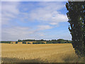
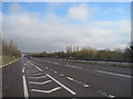
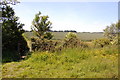
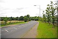


34 photos from this area
Area Information
Key information about the CM15 0UB including its size, population, and administrative classification.
- Area Type
- Postcode
- Area Size
- 20.4 hectares
- Population
- 1841
- Population Density
- 151 people/km²
House Prices in CM15 0UB
5
Properties
£290,998
Average Sold Price
£77,995
Lowest Price
£420,000
Highest Price
Showing 5 properties
| Address | Type | Beds | Baths | Last Sale Price | Last Sale Date | |
|---|---|---|---|---|---|---|
| 58 Roman Road, Mountnessing, CM15 0UB | Detached | 3 | 3 | £375,000 | Jun 2021 | |
| Lendol, 62 Roman Road, Mountnessing, CM15 0UB | Bungalow | 2 | - | £420,000 | Jul 2017 | |
| Wetherall, 60 Roman Road, Mountnessing, CM15 0UB | Detached | - | - | £77,995 | Apr 1996 | |
| Normanton, 64 Roman Road, Ingatestone, CM15 0UB | Detached | - | - | - | - | |
| 64 Roman Road, Mountnessing, CM15 0UB | Detached | - | - | - | - |
Energy Efficiency in CM15 0UB
Amenities
Schools
| Rank | School | Type | Entry gender | Ages |
|---|
Explore more schools in this area
Go to Schools tabDemographics
Household Size
Family (3-5 people)
most common
Accommodation Type
Houses
most common
Tenure
74
majority
Ethnic Group
White
most common
Religion
N/A
most common
Household Composition
N/A
most common
Age
47
median
Adults (30-64 years)
most common
Household Deprivation
N/A
with no deprivation
NS-SEC
39
in Lower managerial occupations
Explore more demographic insights in this area
Go to Demographics tabPlanning
Planning Constraints
- Flood RiskPremium
- Ramsar Wetland SitesPremium
- Area of Outstanding Natural BeautyPremium
- Protected Nature ReservePremium
- Protected WoodlandPremium