Area Overview for CM15 0LL
Photos of CM15 0LL

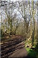
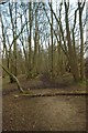
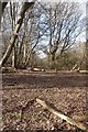
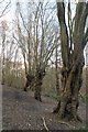
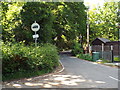
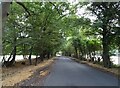

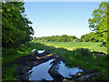
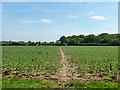
18 photos from this area
Area Information
Key information about the CM15 0LL including its size, population, and administrative classification.
- Area Type
- Postcode
- Area Size
- 42.3 hectares
- Population
- 1053
- Population Density
- 208 people/km²
House Prices in CM15 0LL
16
Properties
£612,625
Average Sold Price
£235,000
Lowest Price
£1,055,000
Highest Price
Showing 16 properties
| Address | Type | Beds | Baths | Last Sale Price | Last Sale Date | |
|---|---|---|---|---|---|---|
| Mellow Cottage, Chivers Road, Stondon Massey, CM15 0LL | Bungalow | 3 | 3 | £1,055,000 | Feb 2022 | |
| Purgess Lodge, Chivers Road, Stondon Massey, CM15 0LL | Bungalow | 3 | 3 | £825,000 | Jun 2021 | |
| Chivers Cottage, Chivers Road, Stondon Massey, CM15 0LL | Detached | 3 | 2 | £756,000 | Jun 2021 | |
| Chivers Lodge, Chivers Road, Stondon Massey, CM15 0LL | Detached | - | - | £640,000 | Nov 2009 | |
| Brooke Cottage, Chivers Road, Stondon Massey, CM15 0LL | Detached | - | - | £335,000 | Oct 2003 | |
| Cavalier Cottage, Chivers Road, Stondon Massey, CM15 0LL | house | - | - | £235,000 | Feb 2003 | |
| Amberley House, Chivers Road, Stondon Massey, CM15 0LL | Detached | - | - | £640,000 | Apr 2001 | |
| Choi Lodge, Chivers Road, Stondon Massey, CM15 0LL | Bungalow | 3 | 1 | £415,000 | Jan 1999 | |
| Chivers, Chivers Road, Stondon Massey, CM15 0LL | Detached | 8 | 6 | - | - | |
| The Loft, Chivers Road, Stondon Massey, CM15 0LL | Farm | 2 | 2 | - | - |
Page 1 of 2
Energy Efficiency in CM15 0LL
Amenities
Schools
| Rank | School | Type | Entry gender | Ages |
|---|
Explore more schools in this area
Go to Schools tabDemographics
Household Size
Two person
most common
Accommodation Type
Houses
most common
Tenure
80
majority
Ethnic Group
White
most common
Religion
N/A
most common
Household Composition
N/A
most common
Age
47
median
Adults (30-64 years)
most common
Household Deprivation
N/A
with no deprivation
NS-SEC
37
in Lower managerial occupations
Explore more demographic insights in this area
Go to Demographics tabPlanning
Planning Constraints
- Flood RiskPremium
- Ramsar Wetland SitesPremium
- Area of Outstanding Natural BeautyPremium
- Protected Nature ReservePremium