Area Overview for CM14 5WW
Photos of CM14 5WW
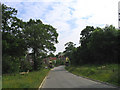

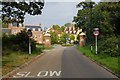
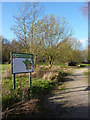

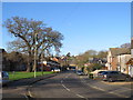
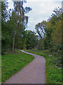
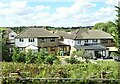

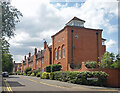
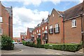
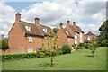
27 photos from this area
Area Information
Key information about the CM14 5WW including its size, population, and administrative classification.
- Area Type
- Postcode
- Area Size
- 1.0 hectares
- Population
- 1448
- Population Density
- 3842 people/km²
House Prices in CM14 5WW
18
Properties
£542,531
Average Sold Price
£249,950
Lowest Price
£780,000
Highest Price
Showing 18 properties
| Address | Type | Beds | Baths | Last Sale Price | Last Sale Date | |
|---|---|---|---|---|---|---|
| 13 Kipling Close, Warley, CM14 5WW | Flat | 2 | 2 | £300,000 | Nov 2025 | |
| 18 Kipling Close, Warley, CM14 5WW | Terraced | 3 | 2 | £770,000 | Jan 2024 | |
| 5 Kipling Close, Warley, CM14 5WW | Flat | 2 | 2 | £695,000 | Oct 2023 | |
| 7 Kipling Close, Warley, CM14 5WW | Terraced | 4 | 2 | £780,000 | Jan 2023 | |
| 14 Kipling Close, Warley, CM14 5WW | house | 3 | 2 | £732,000 | Dec 2022 | |
| 4 Kipling Close, Warley, CM14 5WW | Terraced | 3 | 3 | £750,000 | Nov 2022 | |
| 9 Kipling Close, Warley, CM14 5WW | Terraced | 4 | 2 | £750,000 | Oct 2022 | |
| 16 Kipling Close, Warley, CM14 5WW | Terraced | 4 | 2 | £692,500 | Aug 2022 | |
| 1 Kipling Close, Warley, CM14 5WW | house | 4 | - | £715,000 | Dec 2018 | |
| 8 Kipling Close, Warley, CM14 5WW | Terraced | 3 | 2 | £632,500 | Oct 2016 |
Page 1 of 2
Energy Efficiency in CM14 5WW
Amenities
Schools
| Rank | School | Type | Entry gender | Ages |
|---|
Explore more schools in this area
Go to Schools tabDemographics
Household Size
Two person
most common
Accommodation Type
Houses
most common
Tenure
65
majority
Ethnic Group
White
most common
Religion
N/A
most common
Household Composition
N/A
most common
Age
47
median
Adults (30-64 years)
most common
Household Deprivation
N/A
with no deprivation
NS-SEC
52
in Lower managerial occupations
Explore more demographic insights in this area
Go to Demographics tabPlanning
Planning Constraints
- Flood RiskPremium
- Ramsar Wetland SitesPremium
- Area of Outstanding Natural BeautyPremium
- Protected Nature ReservePremium
- Protected WoodlandPremium