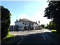
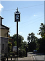
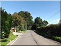
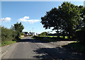
Area Overview for CM14 5PU
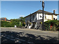
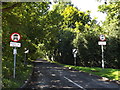
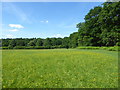
Photos of CM14 5PU

Area Information
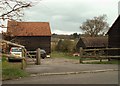
CM14 5PU is a small residential cluster in the heart of Essex, nestled within the Borough of Brentwood. With a population of 2012 and a density of 169 people per square kilometre, it reflects a quiet, close-knit community. The area’s character is shaped by its historical roots, including Saxon settlements and 12th-century churches, yet it remains a modern suburb with practical amenities. Residents here are predominantly adults aged 30–64, many of whom own their homes. Daily life balances suburban tranquillity with easy access to transport networks, including rail links to Brentwood and Shenfield. The postcode’s proximity to villages like Stondon Massey and South Weald adds a layer of historical charm, while nearby retail hubs and schools ensure convenience. Living in CM14 5PU means navigating a compact, well-serviced environment where heritage and modernity intersect, offering a lifestyle that prioritises stability and accessibility.
- Area Type
- Postcode
- Area Size
- Not available
- Population
- 2012
- Population Density
- 169 people/km²
The property market in CM14 5PU is dominated by owner-occupied homes, with 81% of residents owning their properties. This high ownership rate indicates a stable market with limited rental activity, suggesting that properties here are often held long-term by families or retirees. The accommodation type is primarily houses, which is typical of suburban areas with lower density. This mix of ownership and housing stock implies a focus on traditional, spacious homes rather than apartments or high-density developments. For buyers, this means a market that prioritises private ownership and family living, with properties likely to be larger and more spread out. The small size of the area means that the immediate surroundings offer similar housing stock, creating a uniformity in property types and values.
House Prices in CM14 5PU
No properties found in this postcode.
Energy Efficiency in CM14 5PU
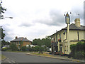
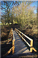
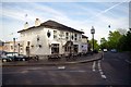
Living in CM14 5PU offers access to a range of nearby amenities, including five retail outlets such as M&S Ongar Rd Brentwood BP, Co-op Pilgrims, and Morrisons Daily. These shops provide convenience for everyday needs, from groceries to fuel. The area’s transport links to rail and metro stations enhance mobility, allowing residents to reach larger towns and cities easily. While the data does not list parks or leisure facilities explicitly, the proximity to villages like Stondon Massey and South Weald suggests access to local greens and community events. The presence of a village green in Stondon Massey, for instance, hints at opportunities for outdoor activities and social gatherings. Overall, the lifestyle in CM14 5PU balances suburban simplicity with practical amenities, catering to those who value convenience without sacrificing a sense of place.
Amenities
Schools
The primary school nearest to CM14 5PU is St Peter’s Church of England Voluntary Aided Primary School in South Weald, which holds an outstanding Ofsted rating. This school serves the local community and is a key factor for families prioritising quality education. The presence of a primary school with such a high rating ensures access to a well-regarded educational environment, though no secondary schools are listed in the data. The mix of school types is limited to primary education, meaning families may need to look beyond the immediate area for secondary schooling. For those valuing strong early education, St Peter’s provides a solid foundation, but parents should consider the broader catchment area for secondary options.
| Rank | School | Type | Entry gender | Ages |
|---|
Explore more schools in this area
Go to Schools tabDemographics
The community in CM14 5PU is predominantly composed of adults aged 30–64, with a median age of 47. Home ownership is high, at 81%, reflecting a stable, long-term resident base. Most properties are houses, suggesting a family-oriented demographic. The predominant ethnic group is White, though specific diversity statistics are not provided. The area’s population density of 169 people per square kilometre indicates a low-rise, spread-out settlement pattern. While no deprivation data is available, the high home ownership rate and age profile suggest a mature, established community with strong ties to local institutions. This demographic profile aligns with a lifestyle that values security, familiarity, and proximity to essential services, reinforcing the area’s appeal as a settled, low-maintenance suburb.
Household Size
Accommodation Type
Tenure
Ethnic Group
Religion
Household Composition
Age
Household Deprivation
NS-SEC
Explore more demographic insights in this area
Go to Demographics tabPlanning
Planning Constraints
- Flood RiskPremium
- Ramsar Wetland SitesPremium
- Area of Outstanding Natural BeautyPremium
- Protected Nature ReservePremium
- Protected WoodlandPremium