Area Overview for CM14 5LP
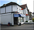
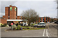
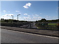
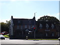
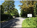
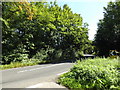
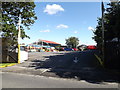
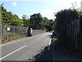
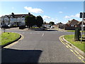
Photos of CM14 5LP

Area Information
Living in CM14 5LP places you in a small residential cluster within the Brizes, Stondon Massey & South Weald area of Essex. The postcode covers a compact community with a population of 2,012 people, spread across 169 residents per square kilometre. This is a village-oriented area with historical roots, including Saxon settlements and 12th-century churches. The local character is defined by its proximity to Stondon Massey and South Weald, where features like the Church of St Peter’s & St Paul’s and Brizes Park add a sense of heritage. Daily life here is shaped by a mix of quiet residential streets and nearby amenities. Residents benefit from easy access to rail networks, including Brentwood and Shenfield stations, which connect to London and surrounding towns. The area is well-served by primary schools, with St Peter’s Church of England Voluntary Aided Primary School nearby, offering an outstanding Ofsted rating. This makes CM14 5LP appealing to families seeking a stable, community-focused environment with historical and practical advantages.
- Area Type
- Postcode
- Area Size
- Not available
- Population
- 2012
- Population Density
- 169 people/km²
The property market in CM14 5LP is dominated by owner-occupied homes, with 81% of properties in private ownership. This high rate of home ownership suggests a stable market with limited rental activity, making the area attractive to buyers seeking long-term investment. The accommodation type is primarily houses, which is typical of rural and semi-rural areas in Essex. This contrasts with urban centres where flats are more common. The small size of the postcode area means the housing stock is limited, and properties are likely to be spread across the surrounding villages of Stondon Massey and South Weald. For buyers, this implies a competitive market with a focus on family homes, given the presence of a high-quality primary school. The lack of large-scale development projects suggests that properties here retain their character and value over time.
House Prices in CM14 5LP
No properties found in this postcode.
Energy Efficiency in CM14 5LP
The lifestyle in CM14 5LP is shaped by its mix of retail, transport, and community amenities. Nearby shops include Tesco Brentwood, Waitrose Little, and Tesco Warley, offering a range of grocery and retail options. These stores provide convenience for daily errands, reducing the need for long trips to larger centres. The area’s rail and metro stations, such as Brentwood and Shenfield, connect residents to broader networks, enabling access to cultural, leisure, and professional opportunities. The village green in Stondon Massey, where an annual fete is held, adds to the local character, offering a space for community events and socialising. While the data does not list specific parks or leisure facilities, the historical sites like St Peter’s Church and Brizes Park suggest a blend of natural and cultural attractions. This balance of practical amenities and historical context creates a lifestyle that is both functional and rooted in tradition.
Amenities
Schools
The nearest school to CM14 5LP is St Peter’s Church of England Voluntary Aided Primary School in South Weald, which serves the local community with an outstanding Ofsted rating. This primary school is a key asset for families, offering high-quality education in a small, village-based setting. The school’s voluntary aided status means it benefits from both state and church funding, ensuring resources and support for students. While no secondary schools are listed in the data, the proximity to South Weald suggests access to broader educational facilities in nearby towns. The presence of a top-rated primary school enhances the area’s appeal for families, particularly those prioritising strong early education. The school’s location within walking distance of many homes in CM14 5LP further reinforces the area’s family-friendly character.
| Rank | School | Type | Entry gender | Ages |
|---|
Explore more schools in this area
Go to Schools tabDemographics
The community in CM14 5LP is predominantly composed of adults aged 30–64, with a median age of 47. This suggests a mature population, likely with established careers and family ties. Home ownership is high at 81%, indicating a stable housing market with a focus on long-term residency. The area is characterised by houses rather than flats, reflecting a preference for private, family-oriented living spaces. The predominant ethnic group is White, which aligns with the broader demographic trends in the Borough of Brentwood. While specific data on deprivation is not provided, the high home ownership rate and moderate population density suggest a community with relatively strong economic stability. The age profile indicates a balance between active professionals and retirees, contributing to a mix of social and economic activity.
Household Size
Accommodation Type
Tenure
Ethnic Group
Religion
Household Composition
Age
Household Deprivation
NS-SEC
Explore more demographic insights in this area
Go to Demographics tabPlanning
Planning Constraints
- Flood RiskPremium
- Ramsar Wetland SitesPremium
- Area of Outstanding Natural BeautyPremium
- Protected Nature ReservePremium
- Protected WoodlandPremium