Area Overview for CM14 5JN
Photos of CM14 5JN
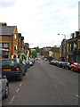
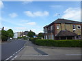
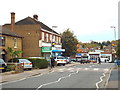
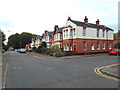
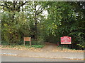
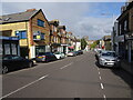
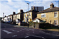
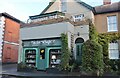

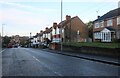
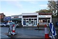
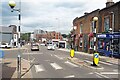
39 photos from this area
Area Information
Key information about the CM14 5JN including its size, population, and administrative classification.
- Area Type
- Postcode
- Area Size
- 8965 m²
- Population
- 1379
- Population Density
- 7523 people/km²
House Prices in CM14 5JN
28
Properties
£367,745
Average Sold Price
£134,000
Lowest Price
£775,000
Highest Price
Showing 28 properties
| Address | Type | Beds | Baths | Last Sale Price | Last Sale Date | |
|---|---|---|---|---|---|---|
| 16 Junction Road, Warley, CM14 5JN | Cottage | 2 | 1 | £400,000 | Aug 2025 | |
| 52 Junction Road, Warley, CM14 5JN | Terraced | 2 | 1 | £410,000 | Sep 2023 | |
| 38 JUNCTION ROAD, Warley, CM14 5JN | Semi-detached | 2 | 1 | £375,000 | Nov 2022 | |
| 2 Junction Road, Warley, CM14 5JN | Semi-detached | 2 | 1 | £380,000 | May 2022 | |
| 24 Junction Road, Warley, CM14 5JN | Semi-detached | 2 | 1 | £399,000 | Aug 2020 | |
| 26 Junction Road, Warley, CM14 5JN | Semi-detached | 3 | - | £685,000 | May 2018 | |
| 8 Junction Road, Warley, CM14 5JN | Detached | 4 | - | £775,000 | Jan 2016 | |
| 48 Junction Road, Warley, CM14 5JN | Cottage | 3 | - | £380,000 | Nov 2015 | |
| 22 Junction Road, Warley, CM14 5JN | Semi-detached | 2 | 1 | £333,000 | May 2015 | |
| 46 Junction Road, Warley, CM14 5JN | Semi-detached | 2 | 1 | £337,500 | Apr 2015 |
Page 1 of 3
Energy Efficiency in CM14 5JN
Amenities
Schools
| Rank | School | Type | Entry gender | Ages |
|---|
Explore more schools in this area
Go to Schools tabDemographics
Household Size
One person
most common
Accommodation Type
Flats
most common
Tenure
53
majority
Ethnic Group
White
most common
Religion
N/A
most common
Household Composition
N/A
most common
Age
47
median
Adults (30-64 years)
most common
Household Deprivation
N/A
with no deprivation
NS-SEC
39
in Lower managerial occupations
Explore more demographic insights in this area
Go to Demographics tabPlanning
Planning Constraints
- Flood RiskPremium
- Ramsar Wetland SitesPremium
- Area of Outstanding Natural BeautyPremium
- Protected Nature ReservePremium
- Protected WoodlandPremium