Area Overview for CM14 4YX
Photos of CM14 4YX

Area Information
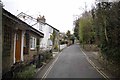
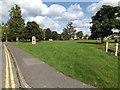
CM14 4YX is a small residential postcode cluster in Brentwood Borough, Essex, with a population of 1438. It lies within the urban built-up area of Brentwood, a town with a well-established infrastructure and proximity to major transport routes. The area is characterised by its compact layout, with flats forming the predominant housing type. Residents benefit from proximity to Brentwood town centre, offering a mix of retail, dining, and services. The area is ranked among the least deprived in the region, with an average household income of £58,900, reflecting a stable economic environment. Daily life here is shaped by its connectivity to rail networks, including Brentwood and Shenfield stations, and a range of schools within walking distance. The community is largely composed of adults aged 30–64, with a median age of 47, suggesting a mature, settled population. Living in CM14 4YX means access to both local amenities and the broader opportunities of nearby towns like Chelmsford.
- Area Type
- Postcode
- Area Size
- Not available
- Population
- 1438
- Population Density
- 3463 people/km²
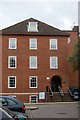
The property market in CM14 4YX is dominated by flats, with 66% of homes owner-occupied. This suggests a mix of long-term residents and a smaller proportion of renters, though the exact rental market dynamics are not specified. The compact nature of the area, typical of urban postcode clusters, means housing options are limited to flats, which are well-suited to smaller households or those prioritising convenience over space. Buyers in this area should consider the proximity to Brentwood town centre and transport links as key selling points. The relatively low population (1438) indicates a small, stable market with limited new developments. For those seeking owner-occupied properties, the high home ownership rate suggests a reliable investment potential, though the availability of larger homes may be constrained by the area’s size.
House Prices in CM14 4YX
No properties found in this postcode.
Energy Efficiency in CM14 4YX
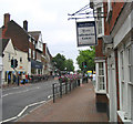
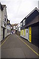
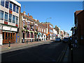
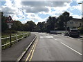
The lifestyle in CM14 4YX is shaped by its proximity to Brentwood’s High Street, a key local thoroughfare with shops, dining, and services. Retail options include Budgens Brentwood, Tesco Warley, and Tesco Brentwood, ensuring convenience for daily needs. The area’s rail and metro links connect residents to broader regional amenities, while nearby hospitals like Nuffield Health Brentwood (0.5 miles) and Brentwood Community Hospital (0.7 miles) provide healthcare access. The compact layout encourages walking or cycling to local amenities, with the town centre offering a blend of traditional and modern services. The presence of both independent and chain retailers, combined with transport links, makes daily life practical and varied, balancing local charm with accessibility.
Amenities
Schools
Residents of CM14 4YX have access to a range of schools, including Brentwood County High School (primary and academy) and Brentwood Ursuline Convent High School (primary and academy with a good Ofsted rating). Vine School, an independent institution, offers an alternative to state education. The presence of both state-funded and independent schools provides flexibility for families, whether prioritising affordability or specific educational approaches. The proximity of schools like St Thomas of Canterbury Church of England Aided Primary (800 yards) and St Helen’s Catholic Junior and Infant Schools (0.6 miles) ensures ease of access for parents. The good Ofsted rating for Brentwood Ursuline Convent High School indicates a reliable standard of education, enhancing the area’s appeal for families.
| Rank | School | Type | Entry gender | Ages |
|---|
Explore more schools in this area
Go to Schools tabDemographics
The community in CM14 4YX is predominantly composed of adults aged 30–64, with a median age of 47. Home ownership is high at 66%, reflecting a stable, long-term resident base. The area’s housing stock is largely flats, which are common in urban settings. The predominant ethnic group is White, though specific diversity metrics are not detailed in the data. The area ranks 24,441/32,844 in the Index of Multiple Deprivation, placing it in the least deprived category. This suggests access to better services, lower crime rates, and higher average incomes (£58,900). The demographic profile indicates a mature population with established careers and family structures, contributing to a cohesive, low-turnover community.
Household Size
Accommodation Type
Tenure
Ethnic Group
Religion
Household Composition
Age
Household Deprivation
NS-SEC
Explore more demographic insights in this area
Go to Demographics tabPlanning
Planning Constraints
- Flood RiskPremium
- Ramsar Wetland SitesPremium
- Area of Outstanding Natural BeautyPremium
- Protected Nature ReservePremium
- Protected WoodlandPremium