Area Overview for CM14 4RS
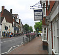
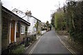
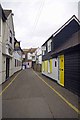
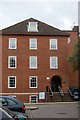
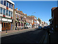
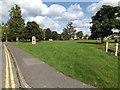
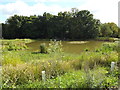
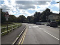
Photos of CM14 4RS

Area Information
Living in CM14 4RS means being part of a small, tightly knit residential cluster in Essex, with a population of 1,415 people. This postcode area is part of the Brentwood West Ward, situated near postcodes such as CM14 4GW and CM14 4LQ on Common Road in Brentwood. The area is defined by its compact size and proximity to key transport routes, including rail stations and metro stops. Daily life here is shaped by its modest scale, with a median age of 47 and a community predominantly composed of adults aged 30–64. The area lacks large-scale amenities but offers practical access to nearby shops, schools, and transport links. Its location in the Brentwood and Ongar parliamentary constituency places it within a broader network of suburban and commuter-focused development. While not a sprawling town, CM14 4RS provides a quiet, manageable environment for those seeking a balance between residential comfort and connectivity to larger urban hubs.
- Area Type
- Postcode
- Area Size
- Not available
- Population
- 1415
- Population Density
- 3843 people/km²
The property market in CM14 4RS is characterised by a 51% home ownership rate, with flats making up the majority of accommodation types. This suggests a housing stock that is primarily owner-occupied but also includes a significant rental segment. The prevalence of flats indicates a focus on smaller, manageable properties, possibly appealing to couples, single professionals, or retirees. Given the area’s small size, the housing market is unlikely to offer a wide variety of property types, but the availability of flats may suit buyers seeking affordability or ease of maintenance. The balance between owner-occupied and rental properties implies a moderate level of turnover, though the compact nature of the postcode area means buyers should consider proximity to larger residential clusters for more options. For those prioritising convenience over scale, CM14 4RS offers a practical base, but its limited size may require looking beyond immediate surroundings for larger homes or alternative property types.
House Prices in CM14 4RS
No properties found in this postcode.
Energy Efficiency in CM14 4RS
Residents of CM14 4RS have access to a range of local amenities within practical reach. Retail options include Budgens Brentwood, Tesco High, and Iceland Brentwood, offering everyday shopping needs. The area’s rail stations—Brentwood, Shenfield, and Harold Wood—provide direct links to London and surrounding areas, while metro stops at Upminster Bridge and Hornchurch enhance regional mobility. Although the area lacks large parks or leisure facilities, its proximity to Brentwood and nearby towns ensures access to recreational spaces, dining, and cultural venues. The modest scale of CM14 4RS means its lifestyle is defined by convenience and simplicity, with a focus on essential services and transport. For those prioritising practicality over sprawling amenities, this area offers a straightforward, no-frills approach to daily living, with minimal need for long commutes or extensive travel.
Amenities
Schools
| Rank | School | Type | Entry gender | Ages |
|---|
Explore more schools in this area
Go to Schools tabDemographics
The community in CM14 4RS is predominantly composed of adults aged 30–64, with a median age of 47. This suggests a mature, stable population, likely with established careers and families. Home ownership rates stand at 51%, indicating a slight majority of owner-occupied properties, while 49% of households are renters. The accommodation type is primarily flats, reflecting a housing stock tailored to smaller households or those seeking low-maintenance living. The predominant ethnic group is White, with no specific data provided on other demographics. The population size of 1,415 implies a close-knit environment, where social interactions are likely to be frequent. The age profile suggests a community with a mix of professionals and retirees, though the lack of younger residents may impact local schools and amenities. This demographic profile shapes a lifestyle focused on stability and practicality, with limited demand for high-density housing or youth-oriented facilities.
Household Size
Accommodation Type
Tenure
Ethnic Group
Religion
Household Composition
Age
Household Deprivation
NS-SEC
Explore more demographic insights in this area
Go to Demographics tabPlanning
Planning Constraints
- Flood RiskPremium
- Ramsar Wetland SitesPremium
- Area of Outstanding Natural BeautyPremium
- Protected Nature ReservePremium
- Protected WoodlandPremium