Area Overview for CM14 4QJ
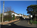
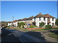
Photos of CM14 4QJ


Area Information
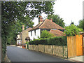
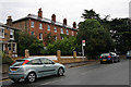
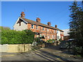
Living in CM14 4QJ means being part of a small, tightly knit residential cluster in the Brentwood West Ward, a defined area within Essex’s Brentwood district. The postcode covers a population of 1,415, with its coordinates placing it near Weald Road and Common Road in Brentwood. This area is part of the Brentwood and Ongar parliamentary constituency, situated close to postcodes like CM14 4GW and CM14 4LQ. The community here is predominantly composed of adults aged 30–64, reflecting a mature, stable demographic. Daily life is shaped by proximity to retail hubs like Tesco Brentwood and local railway stations, offering easy access to commuting routes. The area’s compact nature means residents are likely to know their neighbours, with a balance of local amenities and connections to broader transport networks. While it lacks natural conservation designations, its practical location within the Brentwood borough ensures a mix of suburban convenience and regional connectivity.
- Area Type
- Postcode
- Area Size
- Not available
- Population
- 1415
- Population Density
- 3843 people/km²
The property market in CM14 4QJ is characterised by a 51% home ownership rate, with flats making up the majority of accommodation types. This suggests a focus on smaller, managed housing units rather than detached homes or larger family properties. The relatively low population density and compact postcode area imply that the housing stock is likely to be concentrated in purpose-built residential blocks or converted buildings. For buyers, this means the market is not dominated by single-family homes but rather by flats, which may appeal to those seeking urban living or rental investment opportunities. The proximity to Brentwood’s rail network also positions the area as a viable option for commuters, though the small size of the postcode means the immediate surroundings are key to assessing broader property availability.
House Prices in CM14 4QJ
No properties found in this postcode.
Energy Efficiency in CM14 4QJ
Residents of CM14 4QJ have access to a range of nearby amenities, including five retail outlets such as Tesco Brentwood and Budgens Brentwood, ensuring convenient shopping options. The proximity to rail stations like Brentwood and Shenfield, along with metro stops at Upminster Bridge and Hornchurch, enhances mobility for both daily commutes and weekend excursions. While the area lacks detailed information on parks or leisure facilities, its retail and transport networks contribute to a functional lifestyle. The presence of major supermarkets and transport hubs suggests a focus on practicality, with residents able to meet everyday needs without long journeys. This balance of accessibility and local services supports a straightforward, efficient way of life.
Amenities
Schools
| Rank | School | Type | Entry gender | Ages |
|---|
Explore more schools in this area
Go to Schools tabDemographics
The population of CM14 4QJ is 1,415, with a median age of 47, indicating a community skewed towards middle-aged adults. The most common age group is 30–64 years, suggesting a stable, established population. Home ownership rates stand at 51%, with flats being the predominant type of accommodation. This reflects a mix of owner-occupied properties and rental units, though the exact proportion of renters is not specified. The predominant ethnic group is White, though no further breakdown of diversity is provided. The absence of specific data on deprivation means it is unclear how economic factors might influence quality of life, but the age profile and housing stock suggest a relatively settled, low-turnover community.
Household Size
Accommodation Type
Tenure
Ethnic Group
Religion
Household Composition
Age
Household Deprivation
NS-SEC
Explore more demographic insights in this area
Go to Demographics tabPlanning
Planning Constraints
- Flood RiskPremium
- Ramsar Wetland SitesPremium
- Area of Outstanding Natural BeautyPremium
- Protected Nature ReservePremium
- Protected WoodlandPremium