Area Overview for CM14 4QG
Photos of CM14 4QG
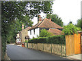
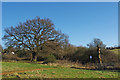

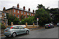

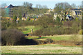
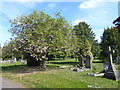
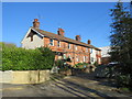

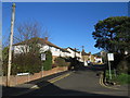
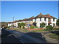
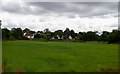
30 photos from this area
Area Information
Key information about the CM14 4QG including its size, population, and administrative classification.
- Area Type
- Postcode
- Area Size
- 2.4 hectares
- Population
- 2234
- Population Density
- 2657 people/km²
House Prices in CM14 4QG
34
Properties
£566,588
Average Sold Price
£142,000
Lowest Price
£1,370,000
Highest Price
Showing 34 properties
| Address | Type | Beds | Baths | Last Sale Price | Last Sale Date | |
|---|---|---|---|---|---|---|
| 28 London Road, Brentwood, CM14 4QG | Detached | 6 | 2 | £1,370,000 | Feb 2024 | |
| 50 London Road, Brentwood, CM14 4QG | Retail | - | - | £960,000 | Feb 2022 | |
| 22 London Road, Brentwood, CM14 4QG | house | - | - | £765,000 | Oct 2020 | |
| 48 London Road, Brentwood, CM14 4QG | house | - | - | £640,000 | Oct 2015 | |
| 32 London Road, Brentwood, CM14 4QG | Semi-detached | 5 | 4 | £630,000 | Sep 2013 | |
| 36 London Road, Brentwood, CM14 4QG | Detached | 3 | - | £545,000 | Sep 2013 | |
| 42A London Road, Brentwood, CM14 4QG | Detached | 5 | 3 | £520,000 | Sep 2010 | |
| 20 London Road, Brentwood, CM14 4QG | house | - | - | £565,000 | Jul 2009 | |
| 16 London Road, Brentwood, CM14 4QG | Detached | 5 | 2 | £405,000 | Mar 2007 | |
| 38 London Road, Brentwood, CM14 4QG | Detached | - | - | £705,000 | Sep 2006 |
Page 1 of 4
Energy Efficiency in CM14 4QG
Amenities
Schools
| Rank | School | Type | Entry gender | Ages |
|---|
Explore more schools in this area
Go to Schools tabDemographics
Household Size
Family (3-5 people)
most common
Accommodation Type
Houses
most common
Tenure
88
majority
Ethnic Group
White
most common
Religion
N/A
most common
Household Composition
N/A
most common
Age
47
median
Adults (30-64 years)
most common
Household Deprivation
N/A
with no deprivation
NS-SEC
50
in Lower managerial occupations
Explore more demographic insights in this area
Go to Demographics tabPlanning
Planning Constraints
- Flood RiskPremium
- Ramsar Wetland SitesPremium
- Area of Outstanding Natural BeautyPremium
- Protected Nature ReservePremium
- Protected WoodlandPremium