Area Overview for CM14 4JF
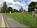
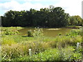
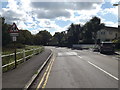
Photos of CM14 4JF

Area Information
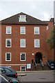
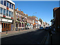
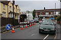
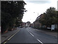
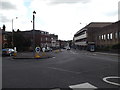
Living in CM14 4JF means being part of a tightly packed residential cluster in the heart of Brentwood, Essex. This postcode area covers just 1.0 hectare, yet it is home to 1,438 people, making it one of the most densely populated areas in the region. The community is centred around William Hunter Way, near Brentwood town centre, blending urban convenience with a sense of local identity. Daily life here is shaped by proximity to amenities, with shops, schools, and transport links all within practical reach. The area is part of the Brentwood Borough, a town known for its historical significance and modern infrastructure. While the housing stock is limited to flats, the high home ownership rate (66%) suggests a stable, long-term resident base. The area’s compact size means residents are likely to know their neighbours, creating a close-knit community feel. For buyers, CM14 4JF offers a snapshot of urban living in a town with strong transport links and access to nearby towns like Shenfield and Billericay.
- Area Type
- Postcode
- Area Size
- 1.0 hectares
- Population
- 1438
- Population Density
- 3463 people/km²
The property market in CM14 4JF is defined by its high home ownership rate (66%) and the prevalence of flats. This suggests a focus on owner-occupied housing rather than a rental market, though the small area size means the stock is limited. Flats dominate the accommodation type, likely due to the area’s urban setting and proximity to Brentwood town centre. For buyers, this presents a challenge: the small footprint means competition for available properties, and the housing stock is unlikely to expand significantly. However, the area’s location near key transport links and amenities may offset the limited supply. Nearby towns such as Shenfield and Billericay offer broader options for those seeking larger properties or different housing types. The compact nature of CM14 4JF also means that property values are closely tied to the broader Brentwood market, which has seen an annual price change of 0.7% in the Chelmsford travel to work area.
House Prices in CM14 4JF
No properties found in this postcode.
Energy Efficiency in CM14 4JF
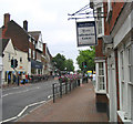
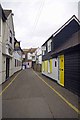
The lifestyle in CM14 4JF is shaped by its proximity to essential amenities and the character of Brentwood town centre. Retail options include Iceland Brentwood, Budgens Brentwood, and M&S Brentwood, providing everyday shopping needs. High Street is a key local thoroughfare, with bus stops and nearby Sainsburys adding to its convenience. The area’s compact size means residents can access services without lengthy trips, though the lack of larger leisure or entertainment venues may require travel to nearby towns. Healthcare is within reach, with Nuffield Health Brentwood and Brentwood Community Hospital both under a mile away. The presence of multiple schools and transport links reinforces the area’s appeal for families. While the housing stock is limited to flats, the surrounding region offers broader options for those seeking different lifestyles. The blend of urban convenience and nearby natural spaces, such as nearby parks, ensures a balanced daily life.
Amenities
Schools
Residents of CM14 4JF have access to a range of schools, including Brentwood County High School, which operates as both a primary school and an academy. Brentwood Ursuline Convent High School is also present, offering primary education and holding a ‘good’ Ofsted rating. For independent schooling, Vine School provides an alternative. The mix of state and independent schools gives families flexibility, whether they prioritise public education or seek specialist provision. Nearby, St Thomas of Canterbury Church of England Aided Primary and St Helen’s Catholic Junior and Infant Schools are within 0.6 miles, further expanding options. The presence of multiple schools within walking distance supports a family-friendly environment, reducing reliance on long commutes. The ‘good’ rating at Brentwood Ursuline Convent High School indicates a reliable standard of education, though no other schools in the area have Ofsted ratings listed.
| Rank | School | Type | Entry gender | Ages |
|---|
Explore more schools in this area
Go to Schools tabDemographics
The population of CM14 4JF is 1,438, with a median age of 47 and the majority of residents falling into the 30-64 age bracket. This suggests a mature, established community with a focus on family life and stability. Home ownership is high at 66%, indicating a preference for long-term residency over rental properties. The accommodation type is predominantly flats, reflecting the area’s compact footprint. The predominant ethnic group is White, though no specific diversity statistics are provided. The area ranks among the least deprived in the region, with an Index of Multiple Deprivation rank of 24,441 out of 32,844, suggesting access to better services and lower poverty levels. This contributes to a quality of life characterised by reliable infrastructure, including schools and healthcare, and a lower risk of environmental or safety issues. The average household income of £58,900 further supports the area’s economic stability.
Household Size
Accommodation Type
Tenure
Ethnic Group
Religion
Household Composition
Age
Household Deprivation
NS-SEC
Explore more demographic insights in this area
Go to Demographics tabPlanning
Planning Constraints
- Flood RiskPremium
- Ramsar Wetland SitesPremium
- Area of Outstanding Natural BeautyPremium
- Protected Nature ReservePremium
- Protected WoodlandPremium