Area Overview for CM14 4HU
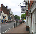
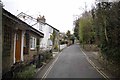
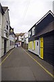
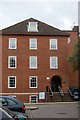
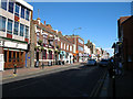
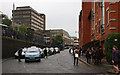
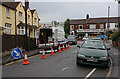
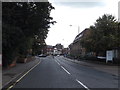
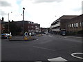
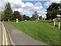
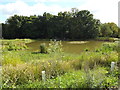
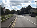
Photos of CM14 4HU
Area Information
Living in CM14 4HU places you within a specific residential cluster covering 3.876 square metres, a designation that reflects the precise nature of this postcode area within greater Brentwood. This small zone forms part of the Brentwood South district council ward, situated in the unparished urban area of East of England. The population stands at 1438 residents, creating a tight-knit community structure where daily routines intersect frequently. You are located near the town centre on William Hunter Way, which anchors this built-up environment. The area represents a functional extension of Brentwood, offering proximity to major local services without the sprawl of outlying suburbs. As a specific cluster, the location benefits from established infrastructure while maintaining distinct local character. Daily life here centres around immediate accessibility to the town core and surrounding facilities. The density of 371045 people per square kilometre highlights the concentrated nature of this housing footprint. This makes CM14 4HU a practical choice for those seeking proximity to urban amenities within a defined residential boundary.
- Area Type
- Postcode
- Area Size
- 3876 m²
- Population
- 1438
- Population Density
- 3463 people/km²
The property market in CM14 4HU is defined by a consistent pattern of home ownership, where 66% of residences are owner-occupied. This substantial majority points to a stable environment rather than a volatile rental sector. Flats comprise the main accommodation type found within this residential cluster, consistent with the urban built-up area classification of Brentwood. You will find housing concentrated along William Hunter Way and nearby streets in the town centre. The average property price for the wider Chelmsford travel to work area stands at £409,833, providing context for the value in this immediate locality. This figure correlates with the area's status as part of the least deprived wards in the borough. The high ownership rate indicates that buyers here typically purchase properties for long-term residence. The market reflects a neighbourhood where residents have invested in their permanent homes. Potential buyers seeking flats in this postcode can expect a stock dominated by established ownership rather than private landlording.
House Prices in CM14 4HU
Showing 13 properties
| Address | Type | Beds | Baths | Last Sale Price | Last Sale Date | |
|---|---|---|---|---|---|---|
| 3 Leasway, Brentwood, CM14 4HU | Maisonette | 2 | 1 | £335,000 | May 2022 | |
| 14A Leasway, Brentwood, CM14 4HU | Detached | 3 | 3 | £610,000 | Feb 2019 | |
| 10A Leasway, Brentwood, CM14 4HU | house | - | - | £543,000 | Dec 2017 | |
| 1A Leasway, Brentwood, CM14 4HU | Flat | - | - | £205,000 | Oct 2014 | |
| 1 Leasway, Brentwood, CM14 4HU | Maisonette | - | - | £166,000 | Aug 2005 | |
| 12 Leasway, Brentwood, CM14 4HU | Flat | - | - | £152,000 | Oct 2004 | |
| 6 Leasway, Brentwood, CM14 4HU | Semi-detached | - | - | £127,500 | Oct 1997 | |
| 10 Leasway, Brentwood, CM14 4HU | Semi-detached | 5 | 1 | - | - | |
| 3A Leasway, Brentwood, CM14 4HU | Flat | 2 | 1 | - | - | |
| 8 Leasway, Brentwood, CM14 4HU | house | - | - | - | - |
Energy Efficiency in CM14 4HU
Daily life in CM14 4HU benefits from immediate access to essential amenities. Budgens Brentwood, Iceland Brentwood, and Tesco High serve as primary retail destinations within the reach of residents. Five retail outlets operate in this convenient zone. Brentwood Railway Station, Shenfield Railway Station, and Harold Wood Station anchor the transport network, five stations providing rail links. Two metro connections pass through the wider network, including Upminster Bridge and Hornchurch. Nuffield Health Brentwood stands 0.5 miles away, while Brentwood Community Hospital sits 0.7 miles distant. Bus stops on High Street, specifically at Sainsburys, facilitate local shopping trips. The High Street acts as a key local street for daily errands. St Thomas of Canterbury Church of England Aided Primary is located 800 yards away, adding to the local fabric. This concentration of services means you do not need to travel far for groceries, healthcare, or transport connections. The surroundings on William Hunter Way support a functional and convenient lifestyle.
Amenities
Schools
Families living in CM14 4HU have access to a range of educational institutions nearby. Brentwood County High School operates as both a primary and academy institution in the vicinity. Brentwood Ursuline Convent High School functions as a primary academy holding a good Ofsted rating. Vine School operates as an independent option for families seeking alternative education models. St Thomas of Canterbury Church of England Aided Primary sits approximately 800 yards from the area. St Helen's Catholic Junior and Infant Schools are located 0.6 miles away. This mix provides primary and secondary choices across state and private sectors. The presence of a school with a good Ofsted rating nearby offers reassurance regarding educational standards. Brentwood County High School and Brentwood Ursuline Convent High School serve as key anchors for local education. The variety includes faith-based and independent options alongside the maintained sector, giving parents multiple paths for their children's schooling.
| Rank | School | Type | Entry gender | Ages |
|---|
Explore more schools in this area
Go to Schools tabDemographics
The community in CM14 4HU reflects a mature demographic profile with a median age of 47 years. Adults between 30 and 64 years represent the most common age range, indicating a population settled into long-term residences. Home ownership dominates the residential landscape with a 66% ownership rate. This high figure suggests a stable population deeply rooted in the local housing stock. Flats constitute the primary accommodation type, aligning with the urban city and town setting classification of the area. The predominant ethnic group is White, mirroring the broader demographic trends of the greater Brentwood area. Deprivation data places this location as the least deprived ward in the borough, with an Index of Multiple Deprivation rank of 24441 out of 32844. Average household income reaches £58,900, supporting the ownership levels and general standard of living. These statistics confirm CM14 4HU as a sector where established families and home owners maintain a high quality of life within a distinctly localised urban environment.
Household Size
Accommodation Type
Tenure
Ethnic Group
Religion
Household Composition
Age
Household Deprivation
NS-SEC
Explore more demographic insights in this area
Go to Demographics tabPlanning
Planning Constraints
- Flood RiskPremium
- Ramsar Wetland SitesPremium
- Area of Outstanding Natural BeautyPremium
- Protected Nature ReservePremium
- Protected WoodlandPremium