Area Overview for CM14 4FD
Photos of CM14 4FD

Area Information
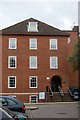
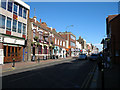
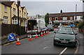
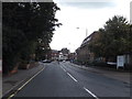
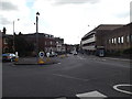
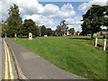
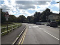
CM14 4FD is a small residential cluster within Brentwood Borough, Essex, positioned near the town centre and integrated into the broader urban fabric of the area. With a population of 1,178, it reflects a compact, community-focused environment. The area is part of the Brentwood South district, a ward noted for its relatively low deprivation levels, with average household incomes of £58,900. Daily life here is shaped by proximity to local amenities and transport links, making it accessible for both commuters and those preferring a quieter, semi-urban existence. The built-up character of the area is evident, with properties like those on William Hunter Way forming part of the Brentwood Town Centre policing neighbourhood. Residents benefit from nearby schools, healthcare facilities, and retail hubs, while the area’s connectivity to rail and metro networks ensures ease of travel to larger towns such as Chelmsford. This postcode is ideal for those seeking a balance between urban convenience and a lower-deprivation setting, though its small size means it is best suited for buyers prioritising proximity to essential services over expansive living spaces.
- Area Type
- Postcode
- Area Size
- Not available
- Population
- Not available
- Population Density
- Not available
The property market in CM14 4FD is characterised by a high proportion of flats, with 34% of homes owned outright by residents. This suggests a rental-oriented market, where ownership is less common than in other areas. The prevalence of flats indicates a focus on smaller, often purpose-built housing, which may appeal to buyers seeking affordability or proximity to urban amenities. Given the area’s small size, the housing stock is limited, and buyers should consider the surrounding regions for more options. The low home ownership rate could reflect a mix of long-term renters and those in shared ownership schemes, though specific data on rental prices or property turnover is absent. For those prioritising ownership, the area’s compact nature may necessitate looking beyond CM14 4FD for larger properties, while the existing stock offers a practical solution for those comfortable with flat living.
House Prices in CM14 4FD
No properties found in this postcode.
Energy Efficiency in CM14 4FD
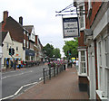
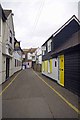
Living in CM14 4FD offers access to a range of amenities within practical reach. Retail options include major chains such as Tesco High, Iceland Brentwood, and M&S Brentwood, providing everyday shopping convenience. The area’s proximity to schools like St Thomas of Canterbury Church of England Aided Primary and St Helen’s Catholic Junior and Infant Schools makes it family-friendly. Healthcare is accessible via Nuffield Health Brentwood and Brentwood Community Hospital, both within a mile. The High Street serves as a focal point for local activity, with bus stops and shops adding to its vibrancy. Nearby parks and open spaces are not explicitly detailed, but the area’s integration into Brentwood’s urban layout suggests opportunities for leisure within the town. The combination of retail, education, and healthcare facilities, paired with transport links, creates a self-contained environment where daily needs are met without requiring long commutes.
Amenities
Schools
| Rank | School | Type | Entry gender | Ages |
|---|
Explore more schools in this area
Go to Schools tabDemographics
The population of CM14 4FD has a median age of 47, with the majority of residents falling within the 30-64 age range. This suggests a community of middle-aged adults, likely including families and professionals. Home ownership is relatively low at 34%, indicating that a significant portion of the housing stock is rented. The predominant accommodation type is flats, reflecting a housing market that leans towards smaller, managed properties rather than detached homes. The predominant ethnic group is White, though no specific data on diversity beyond this is provided. The area’s deprivation rank of 24,441/32,844 places it in the least deprived category, which correlates with higher average incomes and better access to services. This context implies a quality of life supported by stable employment opportunities and well-maintained infrastructure, though the low home ownership rate may suggest a reliance on rental markets or shared housing arrangements.
Household Size
Accommodation Type
Tenure
Ethnic Group
Religion
Household Composition
Age
Household Deprivation
NS-SEC
Explore more demographic insights in this area
Go to Demographics tabPlanning
Planning Constraints
- Flood RiskPremium
- Ramsar Wetland SitesPremium
- Area of Outstanding Natural BeautyPremium
- Protected Nature ReservePremium
- Protected WoodlandPremium