Area Overview for CM14 4EX
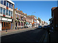
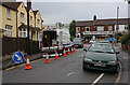
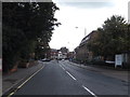
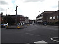
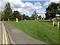
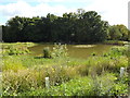
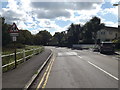
Photos of CM14 4EX

Area Information
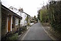
CM14 4EX is a small residential cluster within the town of Brentwood, Essex, part of a built-up area with a population of 1,438. Situated near the town centre on William Hunter Way, it falls within the Brentwood Borough, a region classified as least deprived in England. The area’s character is defined by its proximity to local amenities, including retail hubs, rail networks, and educational institutions. Daily life here is shaped by the urban setting, with access to key services within short distances. The postcode is part of the Brentwood South district, a ward known for its average household income of £58,900 and a mix of flats as the predominant housing type. Residents benefit from low crime rates and minimal environmental constraints, such as flood risks or protected natural sites. The area’s appeal lies in its balance of convenience and tranquility, offering a foothold in a town with strong transport links to nearby cities like Chelmsford. For those seeking a compact, well-connected home in a low-deprivation area, CM14 4EX provides a practical option.
- Area Type
- Postcode
- Area Size
- Not available
- Population
- 1438
- Population Density
- 3463 people/km²
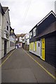
The property market in CM14 4EX is characterised by a high proportion of flats, with 66% of homes owned by residents rather than rented. This reflects a compact, urban housing stock typical of inner-town areas. The prevalence of flats suggests limited scope for large family homes, making the area more suited to couples, smaller families, or individuals seeking manageable living spaces. Given the small size of the postcode, the immediate surroundings offer similar housing patterns, creating a cohesive residential cluster. Buyers should consider the limited availability of larger properties, as the area’s focus on flats may not cater to those requiring more space. However, the high home ownership rate indicates a stable market with potential for long-term value retention, particularly for those prioritising proximity to local amenities and transport links.
House Prices in CM14 4EX
Showing 1 properties
| Address | Type | Beds | Baths | Last Sale Price | Last Sale Date | |
|---|---|---|---|---|---|---|
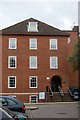
| Cathedral House, Queens Road, Brentwood, CM14 4EX | commercial | - | - | - | - |
Energy Efficiency in CM14 4EX
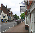
The lifestyle in CM14 4EX is shaped by its proximity to retail, dining, and transport hubs. The High Street is a focal point, featuring shops like Iceland Brentwood, Tesco High, and M&S Brentwood, offering everyday essentials. Nearby rail stations, including Brentwood and Shenfield, provide easy access to regional centres, while metro links to Upminster Bridge and Hornchurch add flexibility. The area’s urban setting ensures a blend of convenience and character, with local streets serving as social and commercial arteries. For leisure, the presence of hospitals and pharmacies within a mile reflects the area’s commitment to healthcare accessibility. While parks and green spaces are not explicitly detailed, the lack of environmental constraints suggests a focus on built environments rather than natural landscapes. This makes CM14 4EX ideal for those prioritising proximity to services over expansive outdoor recreation.
Amenities
Schools
Residents of CM14 4EX have access to a range of schools, including Brentwood Ursuline Convent High School, which operates as both a primary school and an academy with a good Ofsted rating. Brentwood County High School is another key institution, offering primary and academy education. Vine School, an independent school, provides an alternative to state education. The presence of both state-funded and independent options allows families to choose between free public schooling and private institutions. The good Ofsted rating at the Ursuline Convent academy underscores its quality, though parents should consider the specific needs of their children when selecting a school. The proximity of these institutions to the area reinforces its appeal for families prioritising educational opportunities.
| Rank | School | Type | Entry gender | Ages |
|---|
Explore more schools in this area
Go to Schools tabDemographics
The population of CM14 4EX has a median age of 47, with the majority of residents aged between 30 and 64. This suggests a mature, stable community with a strong presence of working-age adults. Home ownership stands at 66%, indicating a mix of owner-occupied properties and rental stock, though the accommodation type is predominantly flats. The predominant ethnic group is White, reflecting the broader demographic trends in the region. The area’s low deprivation rank (24,441/32,844) signals better access to services, education, and employment opportunities. With an average household income of £58,900, residents enjoy a quality of life that supports local amenities and infrastructure. The demographic profile suggests a community focused on stability, with families and professionals coexisting in a setting that prioritises convenience over sprawling suburban development.
Household Size
Accommodation Type
Tenure
Ethnic Group
Religion
Household Composition
Age
Household Deprivation
NS-SEC
Explore more demographic insights in this area
Go to Demographics tabPlanning
Planning Constraints
- Flood RiskPremium
- Ramsar Wetland SitesPremium
- Area of Outstanding Natural BeautyPremium
- Protected Nature ReservePremium
- Protected WoodlandPremium