Area Overview for CM14 4EN
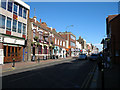
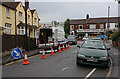
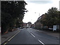
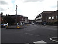
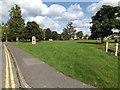
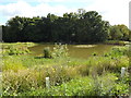
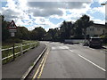
Photos of CM14 4EN

Area Information
CM14 4EN is a small residential postcode in the heart of Brentwood, Essex, with a population of 2,183. It lies within the built-up urban area of Brentwood town centre, close to key local amenities and transport links. The area is part of the Brentwood South district council ward, situated near William Hunter Way, a main thoroughfare connecting to the town’s core. Residents benefit from proximity to Brentwood’s historic architecture, retail hubs, and community spaces. The postcode reflects a mature, low-deprivation community, with average household incomes of £58,900, suggesting a stable local economy. Daily life here is characterised by access to essential services, including schools, healthcare, and transport networks, while the area’s compact size fosters a sense of familiarity. Its location within the Chelmsford travel-to-work area also offers opportunities for commuting to larger towns. For those seeking a balance between urban convenience and suburban tranquillity, CM14 4EN provides a compact, well-connected environment.
- Area Type
- Postcode
- Area Size
- Not available
- Population
- 2183
- Population Density
- 4067 people/km²
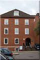
The property market in CM14 4EN is characterised by a 62% home ownership rate, with houses forming the predominant accommodation type. This indicates a community where long-term residency is common, and the housing stock is largely owner-occupied rather than rental-based. The small postcode area suggests a limited number of properties, which may mean competition for available homes. The presence of houses rather than flats or apartments implies a focus on family-friendly living spaces, potentially appealing to those seeking more space and privacy. For buyers, this area’s compact size means the immediate surroundings—such as nearby towns like Shenfield (1.4 miles) and Billericay (5.1 miles)—may offer additional property options. However, the lack of specific property price data for CM14 4EN itself means buyers should consider broader regional trends, such as the average property price in the Chelmsford travel-to-work area (£409,833).
House Prices in CM14 4EN
Showing 8 properties
| Address | Type | Beds | Baths | Last Sale Price | Last Sale Date | |
|---|---|---|---|---|---|---|
| 86 William Hunter Way, Brentwood, CM14 4EN | Flat | 1 | 1 | £167,500 | Feb 2025 | |
| 88 William Hunter Way, Brentwood, CM14 4EN | Flat | 1 | 1 | £145,000 | Aug 2024 | |
| 92 William Hunter Way, Brentwood, CM14 4EN | Flat | - | - | £215,000 | Nov 2018 | |
| 90 William Hunter Way, Brentwood, CM14 4EN | Flat | - | - | £200,000 | Mar 2018 | |
| Continental Market, High Street, Brentwood, CM14 4EN | Retail | - | - | - | - | |
| Italian Market, High Street, Brentwood, CM14 4EN | Retail | - | - | - | - | |
| 70 William Hunter Way, Brentwood, CM14 4EN | Flat | 1 | 1 | - | - | |
| 72 William Hunter Way, Brentwood, CM14 4EN | Flat | - | - | - | - |
Energy Efficiency in CM14 4EN
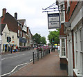
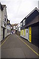
The lifestyle in CM14 4EN is shaped by its proximity to retail, dining, and transport hubs. Within practical reach are notable retail outlets such as Tesco High, Iceland Brentwood, and M&S Brentwood, offering everyday shopping convenience. The area’s rail network, including Brentwood and Shenfield stations, provides swift access to regional centres, while Metro links to Upminster Bridge and Hornchurch connect to London. Local amenities like Sainsburys on High Street and nearby healthcare facilities, such as Nuffield Health Brentwood and Brentwood Community Hospital, enhance daily life. The High Street itself is a key local thoroughfare, hosting shops, services, and community spaces. This mix of retail, transport, and healthcare options supports a practical, accessible lifestyle, ideal for those seeking a balance between urban and suburban living.
Amenities
Schools
Residents of CM14 4EN have access to two primary schools within close proximity. St Thomas of Canterbury Church of England Aided Primary School in Brentwood is rated ‘good’ by Ofsted, offering a solid educational foundation for young children. Nearby is St Thomas of Canterbury Church of England Aided Infant School, which caters to younger primary years. The presence of two primary schools within a short distance suggests a well-served community for early education, though no secondary schools are listed in the data. Families may need to look further afield for secondary education, such as in Brentwood town centre or surrounding areas. The mix of school types ensures options for early years education but highlights the need for planning when considering long-term family needs.
| Rank | School | Type | Entry gender | Ages |
|---|
Explore more schools in this area
Go to Schools tabDemographics
The population of CM14 4EN is predominantly adults aged 30–64, with a median age of 47. This suggests a community of established professionals and families, rather than a younger or elderly demographic. Home ownership rates are 62%, indicating a stable housing market with a mix of owner-occupied properties. The area is composed mainly of houses, reflecting a traditional residential layout. The predominant ethnic group is White, which aligns with broader trends in the region. The area is classified as least deprived, with an Index of Multiple Deprivation rank of 24,441 out of 32,844, implying access to essential services and lower socioeconomic challenges. This translates to quality of life benefits, such as proximity to healthcare and education, and relatively low poverty rates. The demographic profile suggests a community focused on stability, with fewer transient populations compared to more diverse or rapidly developing areas.
Household Size
Accommodation Type
Tenure
Ethnic Group
Religion
Household Composition
Age
Household Deprivation
NS-SEC
Explore more demographic insights in this area
Go to Demographics tabPlanning
Planning Constraints
- Flood RiskPremium
- Ramsar Wetland SitesPremium
- Area of Outstanding Natural BeautyPremium
- Protected Nature ReservePremium
- Protected WoodlandPremium