Area Overview for CM13 2NR
Photos of CM13 2NR
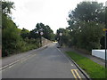
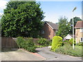
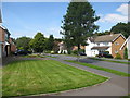
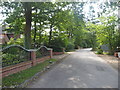
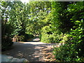
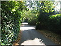
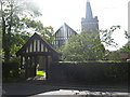
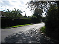
67 photos from this area
Area Information
Key information about the CM13 2NR including its size, population, and administrative classification.
- Area Type
- Postcode
- Area Size
- 2.6 hectares
- Population
- Not available
- Population Density
- Not available
House Prices in CM13 2NR
16
Properties
£2,131,607
Average Sold Price
£1,150,000
Lowest Price
£4,900,000
Highest Price
Showing 16 properties
| Address | Type | Beds | Baths | Last Sale Price | Last Sale Date | |
|---|---|---|---|---|---|---|
| The Lyches, Greenway, Hutton, CM13 2NR | house | - | - | £4,900,000 | May 2024 | |
| St Briavels, 21 Greenway, Hutton, CM13 2NR | Detached | 5 | 3 | £2,995,000 | Dec 2023 | |
| Red Roofs, 6 Greenway, Hutton, CM13 2NR | Detached | 5 | 3 | £2,450,000 | Jun 2023 | |
| Elmwood, 18 Greenway, Hutton, CM13 2NR | house | - | - | £2,825,000 | Apr 2023 | |
| Handley Croft, 16 Greenway, Hutton, CM13 2NR | house | - | - | £2,200,000 | Sep 2021 | |
| Elderfield, 12 Greenway, Hutton, CM13 2NR | house | - | - | £2,000,000 | Feb 2018 | |
| Oaklands, 2 Greenway, Hutton, CM13 2NR | house | - | - | £1,715,000 | May 2017 | |
| Poslingford, Greenway, Hutton, CM13 2NR | house | - | - | £2,900,000 | Nov 2016 | |
| Blinden, 14 Greenway, Hutton, CM13 2NR | house | - | - | £1,520,000 | Feb 2016 | |
| Mackery End, 1 Greenway, Hutton, CM13 2NR | house | 4 | - | £1,180,000 | Sep 2013 |
Page 1 of 2
Energy Efficiency in CM13 2NR
Amenities
Schools
| Rank | School | Type | Entry gender | Ages |
|---|
Explore more schools in this area
Go to Schools tabDemographics
Household Size
Family (3-5 people)
most common
Accommodation Type
Houses
most common
Tenure
94
majority
Ethnic Group
White
most common
Religion
N/A
most common
Household Composition
N/A
most common
Age
47
median
Adults (30-64 years)
most common
Household Deprivation
N/A
with no deprivation
NS-SEC
57
in Lower managerial occupations
Explore more demographic insights in this area
Go to Demographics tabPlanning
Planning Constraints
- Flood RiskPremium
- Ramsar Wetland SitesPremium
- Area of Outstanding Natural BeautyPremium
- Protected Nature ReservePremium
- Protected WoodlandPremium