Area Overview for CM13 2LA
Photos of CM13 2LA
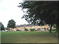
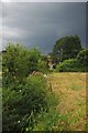
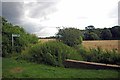
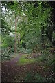
28 photos from this area
Area Information
Key information about the CM13 2LA including its size, population, and administrative classification.
- Area Type
- Postcode
- Area Size
- 4.1 hectares
- Population
- Not available
- Population Density
- Not available
House Prices in CM13 2LA
27
Properties
£560,316
Average Sold Price
£129,500
Lowest Price
£1,050,000
Highest Price
Showing 27 properties
| Address | Type | Beds | Baths | Last Sale Price | Last Sale Date | |
|---|---|---|---|---|---|---|
| 24 Spurgate, Hutton, CM13 2LA | Detached | 3 | 1 | £815,000 | Feb 2025 | |
| 20 Spurgate, Hutton, CM13 2LA | Detached | 4 | 1 | £925,000 | Jul 2023 | |
| 9 Spurgate, Hutton, CM13 2LA | Detached | 3 | 1 | £727,500 | Mar 2023 | |
| 28 Spurgate, Hutton, CM13 2LA | Detached | 4 | 3 | £1,050,000 | Dec 2022 | |
| 19 Spurgate, Hutton, CM13 2LA | house | 4 | 2 | £680,000 | Mar 2021 | |
| 5 Spurgate, Hutton, CM13 2LA | Detached | 4 | 2 | £700,000 | May 2019 | |
| 12 Spurgate, Hutton, CM13 2LA | Detached | 3 | 1 | £695,000 | Oct 2018 | |
| 7 Spurgate, Hutton, CM13 2LA | house | 3 | - | £675,000 | Mar 2017 | |
| 3 Spurgate, Hutton, CM13 2LA | Detached | 3 | - | £650,000 | Jun 2016 | |
| 26 Spurgate, Hutton, CM13 2LA | house | - | - | £640,000 | Dec 2015 |
Page 1 of 3
Energy Efficiency in CM13 2LA
Amenities
Schools
| Rank | School | Type | Entry gender | Ages |
|---|
Explore more schools in this area
Go to Schools tabDemographics
Household Size
Family (3-5 people)
most common
Accommodation Type
Houses
most common
Tenure
78
majority
Ethnic Group
White
most common
Religion
N/A
most common
Household Composition
N/A
most common
Age
47
median
Adults (30-64 years)
most common
Household Deprivation
N/A
with no deprivation
NS-SEC
48
in Lower managerial occupations
Explore more demographic insights in this area
Go to Demographics tabPlanning
Planning Constraints
- Flood RiskPremium
- Ramsar Wetland SitesPremium
- Area of Outstanding Natural BeautyPremium
- Protected Nature ReservePremium
- Protected WoodlandPremium