Area Overview for CM13 2DF
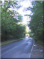
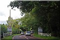
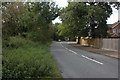
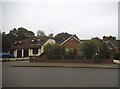
Photos of CM13 2DF


Area Information
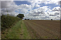
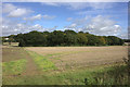
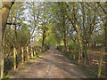
CM13 2DF is a small residential postcode area nestled in the outskirts of Brentwood, Essex, with a population of 1781. It lies within the Hutton South electoral ward, a historically rooted suburb east of Brentwood town centre. The area’s charm stems from its compact size and proximity to key transport hubs, such as Shenfield Railway Station, just 1 mile away. Residents benefit from swift links to Central London, around 20 miles south-west, via rail networks. The older parts of Hutton village, including Hutton Hall and All Saints’ Church, are protected as a conservation area, offering a blend of historic architecture and community character. Daily life here is shaped by its quiet residential nature, with local amenities within practical reach. The area’s modest size means it feels intimate, yet it connects seamlessly to larger urban centres. For those seeking a balance between rural tranquillity and commuter convenience, CM13 2DF provides a foothold in a region known for its strategic transport links and historical depth.
- Area Type
- Postcode
- Area Size
- Not available
- Population
- Not available
- Population Density
- Not available
The property market in CM13 2DF is dominated by houses, with 49% of residents owning their homes. This suggests a modest mix of owner-occupied and rental properties, though the exact proportion of rentals is not specified. The area’s small size means the housing stock is likely limited to traditional family homes, reflecting the local demographic of middle-aged adults. For buyers, this implies a focus on established properties rather than new developments. The proximity to Shenfield Railway Station and other transport links may enhance the appeal of homes here for commuters. However, the limited data on property types or price ranges means the market’s dynamics remain opaque. Buyers should consider the area’s compact nature and its integration with nearby towns when evaluating long-term value or investment potential.
House Prices in CM13 2DF
No properties found in this postcode.
Energy Efficiency in CM13 2DF
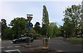
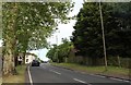
The lifestyle in CM13 2DF is shaped by its proximity to retail and transport hubs. Within walking or short driving distance are M&S Ingrave BP, Morrisons Daily Shenfield 88, and Tesco Shenfield, offering everyday shopping needs. The area’s rail network is particularly strong, with Shenfield, Brentwood, and West Horndon stations providing links to London and beyond. These stations also connect to the Metro system via Upminster Bridge, expanding regional mobility. The conservation area status of Hutton village adds a layer of historical interest, with Hutton Hall and All Saints’ Church offering cultural and architectural appeal. While the area lacks large-scale leisure facilities, its practical amenities and transport links make it convenient for daily life. The small size of CM13 2DF means residents are close to both local services and broader urban centres, blending suburban comfort with commuter efficiency.
Amenities
Schools
| Rank | School | Type | Entry gender | Ages |
|---|
Explore more schools in this area
Go to Schools tabDemographics
The population of CM13 2DF skews towards adults aged 30–64, with a median age of 47. This suggests a community of established professionals and families, rather than a younger or retired demographic. Home ownership sits at 49%, indicating a mix of owner-occupied properties and rental stock. The predominant accommodation type is houses, which aligns with the area’s residential character. The predominant ethnic group is White, reflecting the broader demographic trends in the Brentwood Borough. While the data does not specify further diversity metrics, the age profile and housing stock suggest a stable, middle-aged population with long-term ties to the area. The absence of detailed deprivation data means the quality of life cannot be assessed through socioeconomic indicators, but the low crime risk and practical transport links imply a functional, if unremarkable, community environment.
Household Size
Accommodation Type
Tenure
Ethnic Group
Religion
Household Composition
Age
Household Deprivation
NS-SEC
Explore more demographic insights in this area
Go to Demographics tabPlanning
Planning Constraints
- Flood RiskPremium
- Ramsar Wetland SitesPremium
- Area of Outstanding Natural BeautyPremium
- Protected Nature ReservePremium
- Protected WoodlandPremium