Area Overview for CM13 1SY
Photos of CM13 1SY


Area Information
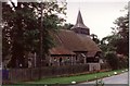
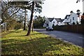
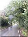
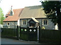
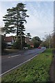
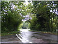
Living in CM13 1SY means being part of a small, tightly knit residential cluster in Essex, just 3 miles east of Brentwood town centre. The area, part of the Hutton suburb, sits on the edge of the built-up region, offering a quiet, semi-rural feel with historical roots. With a population of 1,671 and a density of 430 people per square kilometre, it’s a compact community where the past meets modern convenience. The area’s name appears in the Domesday Book, reflecting its long-standing agricultural heritage, and today it retains a village-like character. Residents benefit from proximity to Shenfield Railway Station, just 1 mile away, linking them to Central London and beyond. Nearby, Hutton Country Park offers green space on former farmland, while the conservation area around Hutton Hall and All Saints’ Church preserves historic architecture. CM13 1SY is ideal for those seeking a stable, low-traffic environment with access to transport, retail, and natural amenities.
- Area Type
- Postcode
- Area Size
- Not available
- Population
- 1671
- Population Density
- 430 people/km²
The property market in CM13 1SY is characterised by high home ownership (69%) and a focus on houses, which dominate the accommodation type. This suggests a market skewed towards owner-occupied properties rather than rental units, offering stability for buyers seeking long-term investment. The area’s small size means housing options are limited, but the presence of traditional houses aligns with a demand for spacious, family-friendly homes. Proximity to Shenfield Railway Station and nearby retail hubs like Tesco Brentwood and Co-op Rayleigh enhances the area’s appeal, balancing suburban tranquillity with accessibility. For buyers, the market may present opportunities in established properties, though the limited scale of the area could mean competition for available homes. The focus on houses also implies a preference for private, low-density living, which may suit those prioritising space over urban convenience.
House Prices in CM13 1SY
No properties found in this postcode.
Energy Efficiency in CM13 1SY
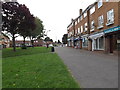
Life in CM13 1SY combines practical amenities with a touch of rural charm. Within reach are five retail venues, including Co-op Rayleigh, Tesco Brentwood, and Chelmsford Star Co-operative Society, offering everyday essentials. The nearby rail stations provide access to larger towns and cities, while Hutton Country Park offers walking and leisure opportunities on former farmland. The conservation area around All Saints’ Church and Hutton Hall preserves historic architecture, adding character to the district. For dining, the area’s proximity to Brentwood ensures a range of options, though specific restaurants are not listed. The mix of retail, green space, and transport links supports a convenient, low-stress lifestyle, ideal for those valuing balance between quiet living and accessibility.
Amenities
Schools
The nearest school to CM13 1SY is Woodlands School Hutton Manor, an independent institution. While no Ofsted rating is provided, independent schools often cater to specific educational preferences, including smaller class sizes and tailored curricula. The absence of state schools in the immediate vicinity means families may need to travel to nearby areas for alternative options. For those prioritising independent education, Woodlands School offers a structured environment, but its exclusivity may limit accessibility for some. The lack of detailed performance data means prospective parents should investigate further to assess whether the school aligns with their child’s needs. Overall, the school landscape in CM13 1SY is limited, requiring careful consideration of commuting distances and alternative educational provisions.
| Rank | School | Type | Entry gender | Ages |
|---|
Explore more schools in this area
Go to Schools tabDemographics
CM13 1SY has a median age of 47, with the majority of residents aged 30–64, indicating a mature, family-oriented community. Home ownership is high at 69%, and the area is predominantly composed of houses rather than flats, reflecting a preference for traditional, spacious living. The predominant ethnic group is White, though specific diversity statistics are not detailed in the data. This demographic profile suggests a stable, middle-aged population likely invested in long-term residency. The low population density of 430 people per square kilometre further supports a less crowded, more private lifestyle. While no explicit data on deprivation is provided, the combination of high home ownership and a mature age group may indicate a relatively affluent community with established roots.
Household Size
Accommodation Type
Tenure
Ethnic Group
Religion
Household Composition
Age
Household Deprivation
NS-SEC
Explore more demographic insights in this area
Go to Demographics tabPlanning
Planning Constraints
- Flood RiskPremium
- Ramsar Wetland SitesPremium
- Area of Outstanding Natural BeautyPremium
- Protected Nature ReservePremium
- Protected WoodlandPremium