Area Overview for CM13 1HG
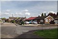
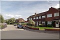
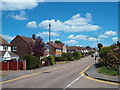
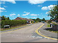
Photos of CM13 1HG


Area Information
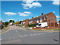
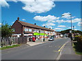
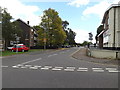
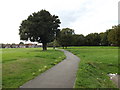
CM13 1HG represents a specific residential cluster located within the wider Hutton North Ward of Brentwood, Essex. This small area covers just 2.1 hectares, supporting a local population of 1,263 people. Living in CM13 1HG means residing in a tightly knit environment where the built-up area feels immediately accessible. Hutton itself lies approximately 5 km east of Brentwood town centre, situated on the eastern edge of the town's urban sprawl. The name derives from historical origins linked to a farm settlement on a hill spur, a legacy that dates back to the Domesday Book of 1086. You will find this neighbourhood characterised by established residential streets rather than commercial hubs or industrial zones. The area is part of the larger Hutton suburb, which historically functioned as an ancient parish in the Barstable Hundred before absorbing into the Brentwood urban district in 1934. Residents enjoy proximity to significant local landmarks such as All Saints Church, a parish structure dating to the early 14th century. Historical points of interest include Hutton Poplars, a former residential home for destitute children now operating as a community learning centre. This location offers a blend of local heritage and modern convenience, serving families who seek stability within a defined geographical boundary.
- Area Type
- Postcode
- Area Size
- 2.1 hectares
- Population
- Not available
- Population Density
- Not available
The housing market in CM13 1HG is defined by a strong culture of home ownership. Exactly 75% of residents in this postcode area own their homes, meaning the local market operates largely as an owner-occupied sector rather than a letting estate. This high ownership rate suggests that buyers looking at homes in CM13 1HG will often contend with existing owners who have lived there for decades. The accommodation type is exclusively houses, eliminating options for flats or purpose-built apartments. If you are considering purchasing property here, you are entering a market where tenures are likely long-standing. The small size of the area, covering only 2.1 hectares, limits the volume of available stock compared to larger borough centres. This scarcity tends to attract buyers who value locality over choice, often resulting in competitive bidding for suitable listings. There is no indication of a large student rental market or young professional leases, pointing instead to families or retirees seeking permanence. Prospective buyers should expect to deal with traditional brick-and-mortar houses built across different centuries, some with roots tracing back to the 14th century.
House Prices in CM13 1HG
Showing 33 properties
| Address | Type | Beds | Baths | Last Sale Price | Last Sale Date | |
|---|---|---|---|---|---|---|
| 73 Woodland Avenue, Hutton, CM13 1HG | Semi-detached | 2 | 1 | £456,000 | May 2025 | |
| 43 Woodland Avenue, Hutton, CM13 1HG | Semi-detached | 3 | 1 | £510,000 | Feb 2025 | |
| 63 Woodland Avenue, Hutton, CM13 1HG | Bungalow | 3 | 2 | £475,000 | Oct 2024 | |
| 38 Woodland Avenue, Hutton, CM13 1HG | Bungalow | 2 | 1 | £430,000 | Sep 2024 | |
| 65 Woodland Avenue, Hutton, CM13 1HG | Semi-detached | 4 | 2 | £600,000 | May 2024 | |
| 61 Woodland Avenue, Hutton, CM13 1HG | Bungalow | 3 | 2 | £460,000 | Sep 2023 | |
| 59 Woodland Avenue, Hutton, CM13 1HG | Bungalow | 3 | 2 | £685,000 | Mar 2023 | |
| 57 Woodland Avenue, Hutton, CM13 1HG | house | - | - | £480,000 | Feb 2023 | |
| 44 Woodland Avenue, Hutton, CM13 1HG | Bungalow | 2 | 1 | £412,500 | Jan 2023 | |
| 71 Woodland Avenue, Hutton, CM13 1HG | Semi-detached | 3 | 1 | £475,000 | Nov 2020 |
Energy Efficiency in CM13 1HG
Daily life in CM13 1HG is characterised by proximity to essential amenities while retaining a suburban feel. Residents have access to five notable retail locations within easy reach, including Co-op Rayleigh, Tesco Brentwood, and the Chelmsford Star Co-operative Society Co. These venues provide for weekly grocery shopping and local goods without requiring long car journeys. For travel needs, the area offers access to five railway stations, specifically Shenfield Railway Station, Brentwood Railway Station, and Ingatestone Railway Station. This rail connectivity allows you to reach central London or other eastern counties without relying solely on road networks. Cultural and leisure options are embedded within the local history and community structures. All Saints Church, dating to the early 14th century, serves as a focal point for any religious community events or historical interest groups. Nearby, Hutton Poplars operates as an Adult Community Learning centre for the Mid Essex Adult Community College, offering courses and social activities for residents. Living in CM13 1HG means you are steps away from these established institutions. The area lacks a bustling nightlife but compensates with reliable, community-focused facilities that support a stable domestic routine.
Amenities
Schools
Families living in CM13 1HG benefit from two primary schools located within a practical distance of their homes. Long Ridings Primary School holds a Ofsted rating of good, offering a standard of education that satisfies most parental requirements. Nearby, St Joseph the Worker Catholic Primary School also carries a good Ofsted rating, providing a faith-based alternative for families seeking that specific religious curriculum. The concentration of good-rated institutions indicates a supportive educational environment for children growing up in the ward. Both schools serve the local catchment, including children from the CM13 1HG postcode cluster. Having two options within close proximity means you do not need to look far for quality primary education. This mix includes a community school and a voluntary aided Catholic school, ensuring variety in tuition and ethos while maintaining similar standards of performance. For residents working in Brentwood or commuting via the local railway stations, these schools offer peace of mind regarding weekly drop-offs and pick-ups. The presence of these specifically named and rated institutions confirms that schooling is a straightforward consideration for parents choosing this address.
| Rank | School | Type | Entry gender | Ages |
|---|
Explore more schools in this area
Go to Schools tabDemographics
The community profile in CM13 1HG reflects a stable, family-oriented demographic. The median age stands at 47, with the most common age range comprising adults between 30 and 64 years. This concentration indicates a neighbourhood with established households rather than a transient population of students or young professionals. You will find a high rate of residential security, as 75% of residents own their homes outright. This figure confirms that the area is predominantly an owner-occupied market where families have anchored themselves for the long term. Housing stock consists primarily of houses, consistent with the suburb's historical development as a residential fringe rather than a high-rise zone. The predominant ethnic group in the area is White, aligning with the broader patterns seen in many Essex suburbs. While the area does not boast a massive population density of 58,780 people per square kilometre over its entire 2.1-hectare footprint, the concentration of residents creates a distinct local character. Living in CM13 1HG involves interacting with a demographic that prioritises property ownership and stability. The lack of significant youth dependency groups suggests a quiet, mature atmosphere where neighbours likely know each other well.
Household Size
Accommodation Type
Tenure
Ethnic Group
Religion
Household Composition
Age
Household Deprivation
NS-SEC
Explore more demographic insights in this area
Go to Demographics tabPlanning
Planning Constraints
- Flood RiskPremium
- Ramsar Wetland SitesPremium
- Area of Outstanding Natural BeautyPremium
- Protected Nature ReservePremium
- Protected WoodlandPremium