Area Overview for CM13 1DH
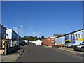
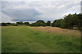
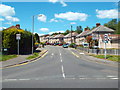
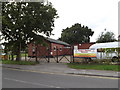
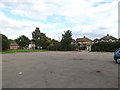
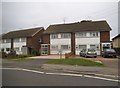
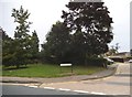
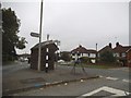
Photos of CM13 1DH


Area Information
Living in CM13 1DH means residing within Hutton North Ward, a specific residential cluster in Brentwood, Essex. This postcode covers a small area of 1,061 square metres, accommodating a population of 1,546 residents. The location sits on the eastern edge of the built-up area, approximately three miles from Brentwood town centre. The name Hutton derives from a farm or settlement on a hill spur, reflecting its rural origins despite its integration into the wider town. The community includes a historic parish church dedicated to All Saints, which dates to the early 14th century. Hutton retains significant historical presence, having been recorded in the Domesday Book of 1086 with 24 households given to Battle Abbey. Daily life for residents balances suburban convenience with historical depth. You can access practical amenities nearby, including a Co-op Rayleigh and a Tesco Brentwood within a short journey. The area is close to several railway stations, facilitating commute links to Shenfield, Ingatestone, and Brentwood. Living in CM13 1DH offers a quiet setting with a strong sense of locality. The community is dominated by house owners, and the housing stock consists primarily of traditional houses rather than flats. The space you occupy is intimate yet part of a larger, documented settlement with ties stretching back nearly a thousand years.
- Area Type
- Postcode
- Area Size
- 1061 m²
- Population
- Not available
- Population Density
- Not available
The property market in CM13 1DH is characterised by a high level of home ownership. Exactly 44% of residents in this postcode own their homes. This statistic indicates a stable market where purchased properties dominate the landscape rather than private rentals. The predominant accommodation type is houses, meaning you will not find many high-rise blocks or large estates of apartments here. The housing stock consists primarily of detached, semi-detached, or terraced houses typical of the Hutton suburb. This high ownership rate often suggests a search for move-up properties, retirement homes, or established family dwellings. Buyers looking at homes in CM13 1DH should expect a tenure mix heavily weighted towards freehold properties. The area is not a student rental hub or a commuter field of short-term lets. Instead, the market reflects people seeking permanence. Given the small size of the area covering only the Hutton North Ward, the number of listings is naturally limited. You are entering a market defined by individual property sales rather than large-scale tenancy developments. The 44% ownership figure is a concrete indicator of the area's maturity. When purchasing, you can assume the vendor is part of a long-term local establishment rather than a short-term housing solution.
House Prices in CM13 1DH
Showing 12 properties
| Address | Type | Beds | Baths | Last Sale Price | Last Sale Date | |
|---|---|---|---|---|---|---|
| 4, Theydon Bold, Woodland Avenue, Hutton, CM13 1DH | Flat | 2 | 1 | - | - | |
| 2, Theydon Bold, Woodland Avenue, Hutton, CM13 1DH | Flat | 2 | 1 | - | - | |
| 12, Theydon Bold, Woodland Avenue, Hutton, CM13 1DH | Flat | - | - | - | - | |
| 6, Theydon Bold, Woodland Avenue, Hutton, CM13 1DH | Flat | - | - | - | - | |
| 7, Theydon Bold, Woodland Avenue, Hutton, CM13 1DH | Flat | - | - | - | - | |
| 9, Theydon Bold, Woodland Avenue, Hutton, CM13 1DH | Flat | - | - | - | - | |
| 11, Theydon Bold, Woodland Avenue, Hutton, CM13 1DH | Flat | - | - | - | - | |
| 8, Theydon Bold, Woodland Avenue, Hutton, CM13 1DH | Flat | - | - | - | - | |
| 1, Theydon Bold, Woodland Avenue, Hutton, CM13 1DH | Flat | - | - | - | - | |
| 10, Theydon Bold, Woodland Avenue, Hutton, CM13 1DH | Flat | - | - | - | - |
Energy Efficiency in CM13 1DH
Your lifestyle in CM13 1DH benefits from a practical range of nearby amenities. Within practical reach are five retail outlets, including a Co-op Rayleigh, Chelmsford Star Co-operative Society Co, and Tesco Brentwood. These shops provide access to groceries, daily essentials, and general shopping needs without the need for long drives. For those who commute, rail connectivity is strong. There are five railway stations effectively serving the area, with Shenfield, Ingatestone, and Brentwood Railway Station being the notable hubs. Travelling to work or visiting family is straightforward thanks to these rail links. The Co-op Rayleigh offers convenience for quick trips, while the larger Tesco Brentwood stocks a broader range of household goods. Dining options and leisure facilities are accessible through these retail and transport nodes. The area feels connected despite its small physical footprint. Living in CM13 1DH means you do not have to go far for ordinary needs. The proximity to Ingatestone and Brentwood stations ensures you are well-positioned for travel across London and the eastern counties. Daily life strikes a balance between local independence and regional access. You can handle most daily shopping locally while retaining easy rail access for weekends or business.
Amenities
Schools
Families residing near CM13 1DH have access to supported primary education immediately within their vicinity. Hutton All Saints Church of England Primary School is the nearest educational institution to the postcode. This school is rated 'good' by Ofsted, providing a positive starting point for younger children. The rating reflects a standard of education that meets expected benchmarks for the sector. You will find this primary school covers the early years curriculum needs for residents in the ward. There is limited data provided regarding secondary schools in the immediate vicinity of this specific postcode. The mix of school types here is currently dominated by this single primary provision. Living in CM13 1DH means you are close to an institution with a 'good' rating, which is a key consideration for parents. The area does not boast multiple secondary options directly within the cluster, so families may need to commute for older children. The presence of Hutton All Saints is the clearest educational asset available to those buying homes in this specific location.
| Rank | School | Type | Entry gender | Ages |
|---|
Explore more schools in this area
Go to Schools tabDemographics
The community in CM13 1DH is defined by an established population profile. The median age stands at 47 years, indicating an older demographic compared to the national average. Adults aged between 30 and 64 years make up the most common age range in this postcode. House ownership is prevalent, with 44% of residents owning their homes outright or with a mortgage. This ownership figure reflects a settled community where long-term living is typical. The predominant ethnic group in the area is White, consistent with the broader demographic trends of the region. The majority of residents live in houses, as this is the predominant accommodation type for CM13 1DH. Flats and high-density living are not the primary building style here. The population density reaches 1,457,161 people per square kilometre based on the recorded area size, which is a calculated metric for this specific small residential cluster. You will find a mix of households, but the structure supports family life and retirement living equally. The age profile suggests you are dealing with a mature environment where children often grow up locally. With 44% home ownership, many residents have built equity and are unlikely to move frequently. The demographic data shows a stable, non-transient population with deep roots in the local history and infrastructure.
Household Size
Accommodation Type
Tenure
Ethnic Group
Religion
Household Composition
Age
Household Deprivation
NS-SEC
Explore more demographic insights in this area
Go to Demographics tabPlanning
Planning Constraints
- Flood RiskPremium
- Ramsar Wetland SitesPremium
- Area of Outstanding Natural BeautyPremium
- Protected Nature ReservePremium
- Protected WoodlandPremium