Area Overview for CM12 9PP
Photos of CM12 9PP
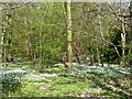
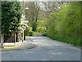
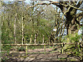
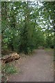
15 photos from this area
Area Information
Key information about the CM12 9PP including its size, population, and administrative classification.
- Area Type
- Postcode
- Area Size
- 22.6 hectares
- Population
- 1502
- Population Density
- 156 people/km²
House Prices in CM12 9PP
30
Properties
£425,694
Average Sold Price
£129,000
Lowest Price
£690,000
Highest Price
Showing 30 properties
| Address | Type | Beds | Baths | Last Sale Price | Last Sale Date | |
|---|---|---|---|---|---|---|
| 39 Second Avenue, Billericay, CM12 9PP | house | - | - | £500,000 | Mar 2022 | |
| 51 Second Avenue, Billericay, CM12 9PP | house | - | - | £560,000 | Apr 2021 | |
| 35 Second Avenue, Billericay, CM12 9PP | Detached | 4 | 2 | £615,000 | Jan 2021 | |
| 40 Second Avenue, Billericay, CM12 9PP | Bungalow | 4 | - | £690,000 | Jan 2021 | |
| 41 Second Avenue, Billericay, CM12 9PP | Detached | 4 | 3 | £690,000 | Jul 2019 | |
| 44 Second Avenue, Billericay, CM12 9PP | Bungalow | 4 | 1 | £510,000 | Nov 2018 | |
| 47 Second Avenue, Billericay, CM12 9PP | Semi-detached | 4 | - | £470,000 | Oct 2018 | |
| 52 Second Avenue, Billericay, CM12 9PP | Semi-detached | 3 | 1 | £470,000 | Aug 2018 | |
| 48 Second Avenue, Billericay, CM12 9PP | Semi-detached | 3 | - | £395,000 | Mar 2015 | |
| 53 Second Avenue, Billericay, CM12 9PP | Semi-detached | 3 | - | £310,000 | Sep 2013 |
Page 1 of 3
Energy Efficiency in CM12 9PP
Amenities
Schools
| Rank | School | Type | Entry gender | Ages |
|---|
Explore more schools in this area
Go to Schools tabDemographics
Household Size
Family (3-5 people)
most common
Accommodation Type
Houses
most common
Tenure
94
majority
Ethnic Group
White
most common
Religion
N/A
most common
Household Composition
N/A
most common
Age
47
median
Adults (30-64 years)
most common
Household Deprivation
N/A
with no deprivation
NS-SEC
42
in Lower managerial occupations
Explore more demographic insights in this area
Go to Demographics tabPlanning
Planning Constraints
- Flood RiskPremium
- Ramsar Wetland SitesPremium
- Area of Outstanding Natural BeautyPremium
- Protected Nature ReservePremium
- Protected WoodlandPremium