Area Overview for CM12 9LR
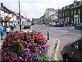
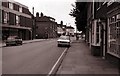
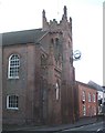
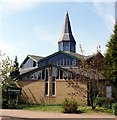
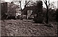
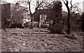
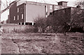
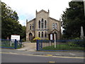
Photos of CM12 9LR


Area Information
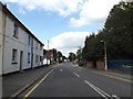
CM12 9LR covers a specific residential cluster of 2.2 hectares in Billericay, Essex. This compact postcode supports a population of 1,545 residents, creating a tightly knit environment. You live on a defined patch of land where neighbours are likely within walking distance. The area is not a sprawling suburb but a concentrated settlement. Billericay itself sits approximately 27 miles east of London on a low north-south ridge. The High Street divides the parishes of Great Burstead and Mountnessing. Archaeological evidence suggests the area has been inhabited since the Bronze Age, with burial mounds found in the local Norsey Wood. Daily life here is practical and grounded. The postcode represents a functional part of a historic market town that originated in the late 13th century. You benefit from proximity to a town with a railway line established in 1889. The environment is low on major planning constraints, meaning there are no protected nature reserves or Areas of Outstanding Natural Beauty directly over the postcode. Flood risk is also negligible for this specific location. Living in CM12 9LR means accessing a community with deep historical roots while enjoying modern connectivity. The area is stable, safe from environmental hazards, and integrated into the wider Billericay infrastructure without being overshadowed by larger urban developments.
- Area Type
- Postcode
- Area Size
- 2.2 hectares
- Population
- 1545
- Population Density
- 3112 people/km²
Homes in CM12 9LR are overwhelmingly owner-occupied, with 80% of properties in the postcode held by residents. This figure clearly indicates a stable market rather than a volatile rental sector. Houses constitute the standard accommodation type here. You are unlikely to encounter flats or apartments within the boundaries of this 2.2-hectare cluster. The high ownership rate suggests that the property stock consists of established dwellings rather than new build complexes. For buyers looking at CM12 9LR, the market presents an opportunity to join an existing community. The area's definition as a small residential cluster means you are purchasing within a specific, manageable zone. The presence of 1,545 residents in such a confined space suggests a mix of family homes and possibly some ground-floor units adapted for owner-occupiers. There are no luxury or exclusive complexes listed in the available data for this postcode. Instead, the focus is on standard residential housing that caters to the majority of the local population. The property choices will reflect the needs of adults aged 30 to 64, who form the core demographic. Buying here offers security through tenure stability.
House Prices in CM12 9LR
Showing 15 properties
| Address | Type | Beds | Baths | Last Sale Price | Last Sale Date | |
|---|---|---|---|---|---|---|
| 97 Chapel Street, Billericay, CM12 9LR | Semi-detached | 5 | 3 | £895,000 | Oct 2024 | |
| 91 Chapel Street, Billericay, CM12 9LR | Maisonette | - | - | £230,000 | Jun 2022 | |
| 79 Chapel Street, Billericay, CM12 9LR | house | 3 | - | £533,000 | Jan 2022 | |
| 85 Chapel Street, Billericay, CM12 9LR | Maisonette | - | - | £230,000 | Feb 2021 | |
| 73 Chapel Street, Billericay, CM12 9LR | house | - | - | £665,000 | Feb 2021 | |
| 89 Chapel Street, Billericay, CM12 9LR | Maisonette | 2 | 1 | £208,000 | Apr 2020 | |
| 87 Chapel Street, Billericay, CM12 9LR | Maisonette | 2 | - | £185,000 | Apr 2019 | |
| 75 Chapel Street, Billericay, CM12 9LR | Semi-detached | 3 | - | £495,000 | May 2017 | |
| 77 Chapel Street, Billericay, CM12 9LR | Semi-detached | - | - | £295,000 | Jun 2003 | |
| 71 Chapel Street, Billericay, CM12 9LR | Semi-detached | 3 | 1 | £59,000 | Dec 1996 |
Energy Efficiency in CM12 9LR
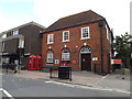
Daily living in CM12 9LR benefits from convenient access to key amenities within Billericay. You have five retail options close by, including Cook Billericay, Waitrose Billericay, and Iceland Billericay. These stores are located within practical reach for weekly shopping and daily essentials. Transportation links are equally accessible, with five rail stations nearby. Billericay Railway Station, Ingatestone Railway Station, and Laindon Railway Station provide direct rail connections. These stations were critical additions when the railway arrived in 1889. For non-rail users, Nelsons Coach Station offers bus connections. This single bus stop expands your mobility to areas without direct train services. The proximity of these facilities ensures you do not need to travel far for basic needs. The historic High Street, though not immediately within the 2.2-hectare boundary, shapes the identity of the town you access. It serves as the main market axis, lined with historic brick buildings dating back to the 14th century. While you reside in a modern postcode, your lifestyle connects to centuries of market history. You are hours from London but have immediate access to the practical infrastructure of a functioning market town.
Amenities
Schools
| Rank | School | Type | Entry gender | Ages |
|---|
Explore more schools in this area
Go to Schools tabDemographics
The community in CM12 9LR is predominantly adult-led. A median age of 47 indicates that families with young children are less common here than in younger urban hubs. The most common age range comprises adults between 30 and 64 years old. This demographic profile suggests active households, likely including established couples and those supporting elderly relatives. Home ownership stands at 80%, reflecting a deeply settled population rather than a transient rental market. Houses are the primary accommodation type within this postcode boundary. The predominant ethnic group is White, which aligns with the overall character of Billericay and surrounding Essex parishes. You are buying into an area where residents have likely put down roots for decades. The high rate of ownership means decisions on maintenance and improvement are made by those with a long-term stake in the property value. With only 1,545 people living in 2.2 hectares, the density feels personal rather than anonymous. The population density reaches 68,781 people per square kilometre, indicating that despite the small physical size, the number of residents is significant relative to the land area. This concentration fosters a sense of familiarity among inhabitants.
Household Size
Accommodation Type
Tenure
Ethnic Group
Religion
Household Composition
Age
Household Deprivation
NS-SEC
Explore more demographic insights in this area
Go to Demographics tabPlanning
Planning Constraints
- Flood RiskPremium
- Ramsar Wetland SitesPremium
- Area of Outstanding Natural BeautyPremium
- Protected Nature ReservePremium
- Protected WoodlandPremium