Area Overview for CM12 9HW
Photos of CM12 9HW


Area Information
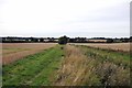
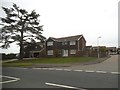
CM12 9HW represents a specific residential cluster within the broader Billericay region of Essex. This postcode covers a small area with a population of 1,769 people. The location sits approximately 27 miles east of London, positioned on a low north-south ridge that straddles the parishes of Great Burstead and Mountnessing. Historically, this area developed as a market settlement around a key crossroads linking routes from the Thames to Chelmsford. The community benefits from a stable environment with no coverage of protected nature reserves or Areas of Outstanding Natural Beauty. Residents enjoy a fixed broadband quality score of 97 out of 100, ensuring robust digital connectivity. Mobile network quality stands at 85 out of 100, providing reliable coverage for daily communication. The area maintains low flood risk, which contributes to long-term stability for homeowners. This post code area serves as a quiet, established residential zone where high home ownership rates define the local character. It offers a distinct alternative to more densely populated urban centres while maintaining practical access to surrounding amenities.
- Area Type
- Postcode
- Area Size
- Not available
- Population
- 1769
- Population Density
- 973 people/km²
The property market within CM12 9HW is characterised by a significant dominance of owner-occupied homes. With 92 percent of the population owning their residences, the area presents itself as a established neighbourhood rather than a rental hub. Accommodation types are exclusively houses, which aligns with the higher income and stability typically associated with such a high ownership rate. This typology appeals to buyers seeking detached or semi-detached family homes rather than shared ownership or investment flats. The sheer concentration of owners suggests a community where residents have deep roots and local knowledge. For prospective buyers, this market dynamic implies that transactions are often motivated by life events such as downsizing or inheritance rather than pure portfolio expansion. The specific postcode cluster offers a clear picture of a settled residential market where property values likely reflect decades of stable maintenance and improvement by previous owners.
House Prices in CM12 9HW
No properties found in this postcode.
Energy Efficiency in CM12 9HW
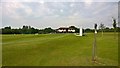
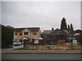
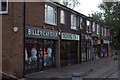
Resident life in CM12 9HW benefits from a compact network of amenities located within practical reach. Retail needs are met by five major stores including Sainsburys Billericay, Iceland Billericay, and Cook Billericay. These venues provide essentials and everyday shopping options without requiring a long journey. Transport links are anchored by five nearby railway stations, offering connections to Billericay Railway Station, Ingatestone Railway Station, and Shenfield Railway Station. This rail network facilitates travel to greater London and other Essex towns efficiently. For those preferring ground transport, one coach service operates from Nelsons Coach Station. The proximity to these transport hubs balances the quiet nature of the residential cluster with necessary outward connectivity. This selection of services delivers convenience for daily errands while maintaining the serene atmosphere that defines living in this specific area.
Amenities
Schools
| Rank | School | Type | Entry gender | Ages |
|---|
Explore more schools in this area
Go to Schools tabDemographics
The community in CM12 9HW is defined by a settled population with a median age of 47 years. The most common age range consists of adults between 30 and 64 years old, indicating a neighbourhood dominated by working-age families and established households. Home ownership stands at 92 percent, creating a stable environment where the majority of residents have a direct financial stake in the locality. Accommodation in this postcode consists primarily of houses rather than flats, aligning with the preferences of a predominantly owner-occupying demographic. The ethnic composition is predominantly White, reflecting a relatively homogenous community structure. High home ownership figures suggest long-term residency, which often correlates with stronger local engagement and lower population turnover. This demographic profile indicates an area where residents have likely been living for extended periods, fostering a sense of continuity and established character within the neighbourhood.
Household Size
Accommodation Type
Tenure
Ethnic Group
Religion
Household Composition
Age
Household Deprivation
NS-SEC
Explore more demographic insights in this area
Go to Demographics tabPlanning
Planning Constraints
- Flood RiskPremium
- Ramsar Wetland SitesPremium
- Area of Outstanding Natural BeautyPremium
- Protected Nature ReservePremium
- Protected WoodlandPremium