Area Overview for CM12 9DY
Photos of CM12 9DY

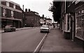


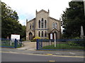
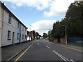

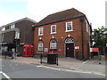
91 photos from this area
Area Information
Key information about the CM12 9DY including its size, population, and administrative classification.
- Area Type
- Postcode
- Area Size
- 2443 m²
- Population
- Not available
- Population Density
- Not available
House Prices in CM12 9DY
18
Properties
£210,250
Average Sold Price
£95,000
Lowest Price
£287,000
Highest Price
Showing 18 properties
| Address | Type | Beds | Baths | Last Sale Price | Last Sale Date | |
|---|---|---|---|---|---|---|
| 7 Western Road, Billericay, CM12 9DY | Terraced | 1 | 1 | £245,000 | Dec 2022 | |
| 1 Western Road, Billericay, CM12 9DY | Terraced | 2 | 1 | £287,000 | Oct 2022 | |
| 5 Western Road, Billericay, CM12 9DY | Terraced | 2 | 1 | £272,500 | Mar 2022 | |
| 3 Western Road, Billericay, CM12 9DY | house | - | - | £185,000 | Oct 2014 | |
| 9 Western Road, Billericay, CM12 9DY | house | 1 | 1 | £177,000 | Aug 2007 | |
| 13 Western Road, Billericay, CM12 9DY | Terraced | - | - | £95,000 | Mar 2003 | |
| Essex Steel, Westgate Court, 17 Western Road, Billericay, CM12 9DY | warehouse | - | - | - | - | |
| Serca, Westgate Court, 17 Western Road, Billericay, CM12 9DY | warehouse | - | - | - | - | |
| Advance Modelling And Promotions Limited, Westgate Court, 17 Western Road, Billericay, CM12 9DY | Office | - | - | - | - | |
| Morgan Richardson, Second Floor, Westgate Court, 17 Western Road, Billericay, CM12 9DY | Office | - | - | - | - |
Page 1 of 2
Energy Efficiency in CM12 9DY
Amenities
Schools
| Rank | School | Type | Entry gender | Ages |
|---|
Explore more schools in this area
Go to Schools tabDemographics
Household Size
One person
most common
Accommodation Type
Houses
most common
Tenure
61
majority
Ethnic Group
White
most common
Religion
N/A
most common
Household Composition
N/A
most common
Age
47
median
Adults (30-64 years)
most common
Household Deprivation
N/A
with no deprivation
NS-SEC
43
in Lower managerial occupations
Explore more demographic insights in this area
Go to Demographics tabPlanning
Planning Constraints
- Flood RiskPremium
- Ramsar Wetland SitesPremium
- Area of Outstanding Natural BeautyPremium
- Protected Nature ReservePremium
- Protected WoodlandPremium