Area Overview for CM11 2SF
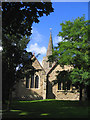
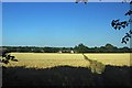
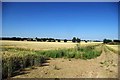
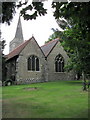
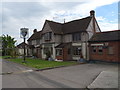
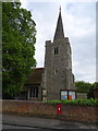
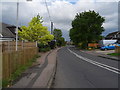
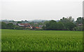
Photos of CM11 2SF
Area Information
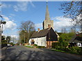
Living in CM11 2SF means being part of a small, tightly knit residential cluster in the Borough of Basildon, Essex. This postcode covers just 3.7 hectares, housing 1,571 people in a population density of 362 per square kilometre. The area sits within Great Burstead and South Green, historically significant settlements dating back to AD 500. While it is now part of the Billericay built-up area, CM11 2SF retains a distinct character shaped by its medieval roots and 19th-century evolution. Residents benefit from proximity to Billericay town centre, just 1.5 miles away, and a mix of local amenities. The community is predominantly middle-aged, with a median age of 47, and 88% of homes are owner-occupied. This suggests a stable, long-term resident base, with a focus on family living. The area’s compact size means daily life revolves around nearby shops, schools, and transport links, offering a balance between suburban convenience and historical charm.
- Area Type
- Postcode
- Area Size
- 3.7 hectares
- Population
- 1571
- Population Density
- 362 people/km²
The property market in CM11 2SF is dominated by owner-occupied homes, with 88% of properties owned by residents rather than rented. This high rate of home ownership suggests a community focused on long-term residency rather than transient rental markets. The accommodation type is exclusively houses, which is unusual for a small postcode area but may reflect the historical development of the region. Given the area’s limited size—just 3.7 hectares—housing stock is likely constrained, meaning properties are closely spaced. Buyers should consider the proximity to Billericay’s amenities, as the immediate surroundings offer more options. The focus on houses may appeal to families seeking space, but the small area means potential buyers must evaluate whether the location’s convenience justifies the limited property selection. The market is unlikely to be competitive in terms of volume, but demand could be steady due to the area’s safety and connectivity.
House Prices in CM11 2SF
Showing 39 properties
| Address | Type | Beds | Baths | Last Sale Price | Last Sale Date | |
|---|---|---|---|---|---|---|
| 12 Mill Road, Billericay, CM11 2SF | Detached | 4 | 2 | £730,000 | Feb 2023 | |
| 19 Mill Road, Billericay, CM11 2SF | Bungalow | - | - | £436,000 | May 2021 | |
| 12A Mill Road, Billericay, CM11 2SF | house | 4 | 2 | £680,000 | Oct 2020 | |
| 32 Mill Road, Billericay, CM11 2SF | Bungalow | 2 | 4 | £440,000 | Aug 2020 | |
| 21 Mill Road, Billericay, CM11 2SF | Bungalow | - | - | £385,000 | Feb 2020 | |
| 29 Mill Road, Billericay, CM11 2SF | Semi-detached | 3 | 1 | £420,000 | Jul 2019 | |
| 8 Mill Road, Billericay, CM11 2SF | Semi-detached | 3 | 1 | £345,000 | May 2018 | |
| 14 Mill Road, Billericay, CM11 2SF | Detached | 4 | 3 | £580,000 | May 2017 | |
| 17 Mill Road, Billericay, CM11 2SF | Semi-detached | 4 | 1 | £415,000 | Jan 2017 | |
| 10 Mill Road, Billericay, CM11 2SF | Bungalow | 3 | 1 | £360,000 | Aug 2016 |
Energy Efficiency in CM11 2SF
The lifestyle in CM11 2SF is shaped by its proximity to retail, transport, and local hubs. Nearby amenities include five retail outlets, such as Tesco Grange, Tesco Billericay, and Cook Billericay, offering everyday shopping convenience. The area’s rail network, with stations like Billericay and Laindon, connects residents to broader Essex and London. South Green, the main shopping district, provides additional retail and leisure options. While the data does not specify dining or parks, the presence of multiple shops and transport links suggests a practical, community-focused lifestyle. The area’s small size means amenities are within walking or short driving distance, fostering a sense of accessibility. For residents, this balance of local services and easy access to Billericay ensures a lifestyle that is both self-contained and connected to larger urban centres.
Amenities
Schools
The nearest school to CM11 2SF is St Peter’s Catholic Primary School, which serves the area with an outstanding Ofsted rating. This school is a primary institution, catering to younger children and providing a key educational resource for families in the postcode. The presence of a high-rated primary school is a significant draw for parents seeking quality education for their children. While no secondary schools are listed in the data, the proximity to Billericay town centre—just 1.5 miles away—means access to broader educational options is likely available. The single primary school in the immediate vicinity underscores the importance of St Peter’s to the community, offering a reliable foundation for early education. Families prioritising strong local schools may find this a compelling reason to consider CM11 2SF.
| Rank | School | Type | Entry gender | Ages |
|---|
Explore more schools in this area
Go to Schools tabDemographics
CM11 2SF has a median age of 47, with the majority of residents falling into the 30–64 age range. This indicates a mature, family-oriented community, likely with established careers and long-term commitments to the area. Home ownership is high at 88%, reflecting a preference for stable, long-term housing. The accommodation type is predominantly houses, which aligns with the area’s small size and residential character. The predominant ethnic group is White, though specific data on diversity is not provided. The population density of 362 people per square kilometre suggests a modestly sized community where social interactions are likely to be frequent. For quality of life, the high home ownership rate and age profile suggest a low turnover of residents, fostering a sense of continuity and familiarity. This stability may contribute to a cohesive local identity, though the data does not specify levels of deprivation or socioeconomic variation.
Household Size
Accommodation Type
Tenure
Ethnic Group
Religion
Household Composition
Age
Household Deprivation
NS-SEC
Explore more demographic insights in this area
Go to Demographics tabPlanning
Planning Constraints
- Flood RiskPremium
- Ramsar Wetland SitesPremium
- Area of Outstanding Natural BeautyPremium
- Protected Nature ReservePremium
- Protected WoodlandPremium