Area Overview for CM11 2LZ
Photos of CM11 2LZ
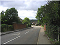

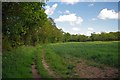

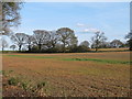
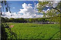
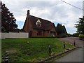
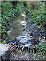
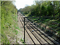
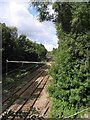
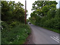
11 photos from this area
Area Information
Key information about the CM11 2LZ including its size, population, and administrative classification.
- Area Type
- Postcode
- Area Size
- 1.3 hectares
- Population
- 1252
- Population Density
- 1564 people/km²
House Prices in CM11 2LZ
23
Properties
£329,285
Average Sold Price
£60,000
Lowest Price
£725,000
Highest Price
Showing 23 properties
| Address | Type | Beds | Baths | Last Sale Price | Last Sale Date | |
|---|---|---|---|---|---|---|
| 364 Outwood Common Road, Billericay, Billericay, CM11 2LZ | Terraced | 3 | 1 | £400,000 | Feb 2025 | |
| 351 Outwood Common Road, Billericay, Billericay, CM11 2LZ | Bungalow | 2 | 1 | £725,000 | Aug 2024 | |
| 370 Outwood Common Road, Billericay, Billericay, CM11 2LZ | Terraced | 3 | 1 | £395,000 | May 2023 | |
| 380 Outwood Common Road, Billericay, Billericay, CM11 2LZ | Terraced | 4 | 2 | £450,000 | Jan 2023 | |
| 358 Outwood Common Road, Billericay, Billericay, CM11 2LZ | house | - | - | £380,000 | Apr 2021 | |
| 353 Outwood Common Road, Billericay, Billericay, CM11 2LZ | Detached | 4 | 1 | £500,000 | Dec 2015 | |
| 378 Outwood Common Road, Billericay, Billericay, CM11 2LZ | Terraced | 3 | 1 | £250,000 | Jul 2014 | |
| 363 Outwood Common Road, Billericay, Billericay, CM11 2LZ | Semi-detached | 3 | - | £355,000 | May 2014 | |
| 374 Outwood Common Road, Billericay, Billericay, CM11 2LZ | Terraced | - | - | £193,000 | Jul 2006 | |
| 357 Outwood Common Road, Billericay, Billericay, CM11 2LZ | house | - | - | £335,000 | Jan 2004 |
Page 1 of 3
Energy Efficiency in CM11 2LZ
Amenities
Schools
| Rank | School | Type | Entry gender | Ages |
|---|
Explore more schools in this area
Go to Schools tabDemographics
Household Size
Family (3-5 people)
most common
Accommodation Type
Houses
most common
Tenure
89
majority
Ethnic Group
White
most common
Religion
N/A
most common
Household Composition
N/A
most common
Age
47
median
Adults (30-64 years)
most common
Household Deprivation
N/A
with no deprivation
NS-SEC
45
in Lower managerial occupations
Explore more demographic insights in this area
Go to Demographics tabPlanning
Planning Constraints
- Flood RiskPremium
- Ramsar Wetland SitesPremium
- Area of Outstanding Natural BeautyPremium
- Protected Nature ReservePremium
- Protected WoodlandPremium