Area Overview for CM11 1WT
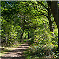
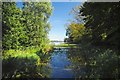
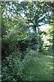
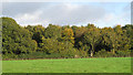
Photos of CM11 1WT


Area Information
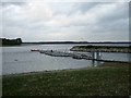
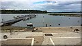
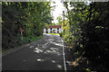
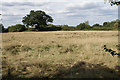
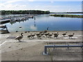
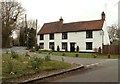
CM11 1WT is a small, tightly knit residential area in Essex, nestled near the Hanningfield Reservoir, a major local landmark. The postcode covers 2.3 km², home to 2,332 residents, giving it a population density of 272 people per square kilometre. This compact cluster of homes sits on the south bank of the reservoir, approximately 6 miles from Chelmsford city centre and 2½ miles north of Wickford. Daily life here is shaped by its rural setting, with the reservoir dominating the landscape and offering recreational opportunities. The village of South Hanningfield, which includes this postcode, has a historical legacy dating back to the Domesday Book, with its green at the heart of the community. While the area is small, it is well-connected to nearby towns via rail and bus services, making it a practical choice for commuters. The presence of the reservoir and its surrounding nature reserve adds a unique character, though the area’s limited size means it is best suited for those prioritising proximity to natural spaces over urban amenities.
- Area Type
- Postcode
- Area Size
- 2.3 km²
- Population
- 2332
- Population Density
- 272 people/km²
The property market in CM11 1WT is characterised by high home ownership (89%) and a predominance of houses over flats. This suggests a market skewed towards owner-occupied properties rather than rentals, with limited availability of apartments. The small area size (2.3 km²) means the housing stock is concentrated, potentially making it a competitive market for buyers. The presence of houses indicates a focus on family homes, though the limited number of properties may mean that buyers need to consider nearby areas for more options. Given the high home ownership rate, the market is likely to be stable, with fewer short-term rentals or speculative investments. Prospective buyers should note that the area’s small size may limit the range of properties available, requiring a broader search beyond CM11 1WT itself.
House Prices in CM11 1WT
No properties found in this postcode.
Energy Efficiency in CM11 1WT
The lifestyle in CM11 1WT is shaped by its proximity to the Hanningfield Reservoir, a major recreational asset. The reservoir offers opportunities for bird-watching, fishing, and picnicking, with a dedicated café and car park. Nearby, residents can access retail amenities such as Co-op Wickford, Budgens Stock, and Iceland Wickford, providing everyday shopping convenience. The area’s rail links to Wickford, Battlesbridge, and Billericay ensure easy access to urban centres, while the single bus stop connects to local routes. The village green at the heart of South Hanningfield adds a communal feel, though the area’s small size means amenities are limited to essential services. The blend of natural beauty and practical connectivity creates a balanced lifestyle, ideal for those seeking a quieter, nature-focused environment without sacrificing accessibility.
Amenities
Schools
The nearest school to CM11 1WT is the Downham Church of England Voluntary Controlled Primary School, which serves the local community with a primary education offering. The school holds an Ofsted rating of “good,” reflecting its quality of teaching and facilities. As a primary school, it caters to younger children, making it a crucial consideration for families with young dependents. The absence of secondary schools in the immediate vicinity means that students may need to commute to nearby towns such as Wickford or Chelmsford for further education. The single primary school in the area highlights the importance of its role in the community, though it may not meet the needs of larger families requiring multiple educational stages.
| Rank | School | Type | Entry gender | Ages |
|---|
Explore more schools in this area
Go to Schools tabDemographics
The population of CM11 1WT has a median age of 47, with the majority of residents falling in the 30-64 age range. This suggests a community of established adults, many of whom are likely to be homeowners. Home ownership is exceptionally high at 89%, indicating a stable, long-term resident base. The area is predominantly composed of houses rather than flats, reflecting a traditional, family-oriented housing stock. The predominant ethnic group is White, which aligns with broader trends in the region. With a population density of 272 people per square kilometre, the area is neither overcrowded nor sparse, offering a balance between space and community cohesion. The age profile implies a mature demographic, potentially with fewer young families, though the presence of a primary school nearby suggests some households with children. The high home ownership rate and stable age distribution point to a community with low turnover and a focus on settled living.
Household Size
Accommodation Type
Tenure
Ethnic Group
Religion
Household Composition
Age
Household Deprivation
NS-SEC
Explore more demographic insights in this area
Go to Demographics tabPlanning
Planning Constraints
- Flood RiskPremium
- Ramsar Wetland SitesPremium
- Area of Outstanding Natural BeautyPremium
- Protected Nature ReservePremium
- Protected WoodlandPremium