Area Overview for CM11 1SZ
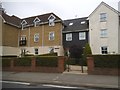
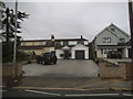
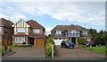
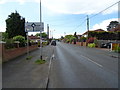
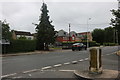
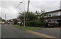
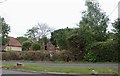
Photos of CM11 1SZ

Area Information
Living in CM11 1SZ means residing within a small residential cluster measuring 3,463 square metres with a population of 1,367. This postcode sits within the wider context of Billericay, a historic market town in Essex located approximately 27 miles east of London. The area straddles the parishes of Great Burstead and Mountnessing, historically linked by a key crossroads connecting the Thames to Chelmsford and Wickford. Despite its modest footprint, the location offers established roots dating back to the late 13th century when it developed into a settlement on marginal land. You will find yourself in a setting defined by its structured residential nature rather than sprawling diversity. The environment reflects a community that has grown alongside significant local landmarks, including St Mary Magdalen Church and the historic High Street axis. Daily life here is characterised by proximity to these heritage sites while maintaining a quiet, contained atmosphere typical of a specific postcode sector. The area represents a snapshot of English suburban evolution, where modern living intersects with centuries of history without claiming to be a major commercial hub.
- Area Type
- Postcode
- Area Size
- 3463 m²
- Population
- 1367
- Population Density
- 1471 people/km²
The property market in CM11 1SZ is defined by stability and traditional tenure. With home ownership standing at 94 per cent, this area functions as a quintessential owner-occupied zone rather than a rental playground. Buyers looking at this specific postcode will encounter a housing stock dominated entirely by houses, with zero recorded flats or apartments in the available data. This structure speaks to a area where residents typically buy to stay, often in properties they have inherited or accumulated over generations. The scarcity of rental stock means that the market does not cater to transient populations or short-term investors. If you are considering homes in CM11 1SZ, you are entering a market where proof of affordability and mortgage readiness are the primary gatekeepers. The lack of mixed-use density or high-rise housing suggests that new developments here are unlikely to change the established character of the built environment. Prospective buyers should view this as a traditional suburban setting where property values and maintenance culture remain central to the local economy.
House Prices in CM11 1SZ
Showing 6 properties
| Address | Type | Beds | Baths | Last Sale Price | Last Sale Date | |
|---|---|---|---|---|---|---|
| 4 Derby Close, Billericay, CM11 1SZ | Detached | 4 | - | £620,000 | Jun 2016 | |
| 1 Derby Close, Billericay, CM11 1SZ | house | - | - | £306,000 | Apr 2003 | |
| 6 Derby Close, Billericay, CM11 1SZ | Detached | - | - | £195,000 | Oct 1998 | |
| 3 Derby Close, Billericay, CM11 1SZ | Detached | - | - | - | - | |
| 5 Derby Close, Billericay, CM11 1SZ | Detached | - | - | - | - | |
| 2 Derby Close, Billericay, CM11 1SZ | house | 4 | - | - | - |
Energy Efficiency in CM11 1SZ
Residents of CM11 1SZ enjoy convenient access to a variety of amenities within practical reach, despite the small size of the postcode itself. Retail options include five notable venues, featuring branches of Co-op Billericay and a Tesco Billericay, ensuring that daily grocery needs and household shopping are easily met without long journeys. For those who prefer public transit to local centres, five railway stations lie nearby, including Billericay Railway Station, Ingatestone Railway Station, and Wickford Railway Station. One bus stop situated at Nelsons Coach Station further expands transport choices. Given that Billericay originated as a market settlement in the late 13th century, the presence of these modern retail and transport hubs integrates historical trade routes with contemporary convenience. You do not need to travel far to find essential services, yet the area retains the quiet character of a residential cluster rather than a busy high street. This balance allows you to run local errands while keeping the home environment tranquil. The proximity to these specific named facilities, from the Co-op to the railway stations, forms the backbone of daily convenience for households in this postcode.
Amenities
Schools
Families considering schools near CM11 1SZ have access to Mayflower High School, which appears in the local data under two distinct categories. Records list the institution as a primary school, while other official listings identify Mayflower High School as an academy with a satisfactory Ofsted rating. This dual categorisation in available records highlights the importance of checking specific admission guidelines directly with the school administration. For parents navigating the local education landscape, the presence of Mayflower High School provides a singular option within the immediate vicinity. There are no other schools listed in the provided data for this specific postcode sector. This concentration suggests a reliance on one main institution for primary and secondary education within walking or short driving distance. When evaluating educational provision for children living in CM11 1SZ, the satisfactory grading of the academy serves as a baseline metric for quality, though parents may need to consider transport times to this sole named option before making final decisions on their children's schooling.
| Rank | School | Type | Entry gender | Ages |
|---|
Explore more schools in this area
Go to Schools tabDemographics
The community in CM11 1SZ is distinctly mature, with a median age of 47 years. Overwhelmingly, the residents fall into the 30 to 64-year-old age range, indicating a neighbourhood populated primarily by adults in their middle years rather than young families or retirees. This age profile is supported by a startlingly high homeownership rate of 94 per cent. Such a figure suggests that the vast majority of households in this postcode have long-term residential stability and are free from rental constraints. The property stock consists almost exclusively of houses, with no recorded flats or apartments in the immediate data set. The population is culturally homogenous, with White residents forming the predominant ethnic group. As a result, you can expect a community atmosphere shaped by long-standing local traditions rather than rapid demographic shifts. The density of 394,722 people per square kilometre reflects the small geographical footprint of the postcode, concentrating these 1,367 individuals into a tightly knit, neighbourhood-focused environment where local history and tenure stability are central to daily life.
Household Size
Accommodation Type
Tenure
Ethnic Group
Religion
Household Composition
Age
Household Deprivation
NS-SEC
Explore more demographic insights in this area
Go to Demographics tabPlanning
Planning Constraints
- Flood RiskPremium
- Ramsar Wetland SitesPremium
- Area of Outstanding Natural BeautyPremium
- Protected Nature ReservePremium
- Protected WoodlandPremium