Area Overview for CM11 1SF
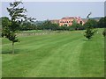
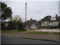
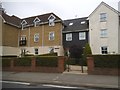
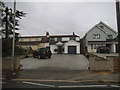
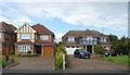
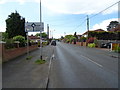
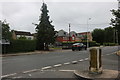
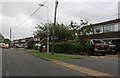
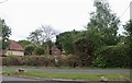
Photos of CM11 1SF
Area Information
You are entering a small, densely packed residential cluster in the heart of Billericay. This specific postcode covers just over six and a half thousand square metres, making it a very compact neighbourhood. Despite its tiny footprint, it supports a population of 1,367 people. This high density of 211,320 people per square kilometre means houses are built close together, creating an intimate community feel rather than a sprawling suburban landscape. Living in CM11 1SF places you in a historic town that originated as a market settlement atop a low north-south ridge. The area sits at a key crossroads linking routes from the Thames to Chelmsford and Hutton to Wickford. Since First recorded as 'Byllyrica' in 1291, the town has evolved from a Cistercian abbey holding to a market town where the High Street acts as the historic axis. Four locals from this vicinity actually sailed on the Mayflower in 1620, leaving a unique piece of maritime history on the spine of Essex. Your daily life here is defined by proximity to the wider town amenities while residing in a distinct, low-density cluster within the larger parish boundaries. The compact nature of the postcode means you walk to local services, yet the broader area offers the established facilities of Billericay. This specific postcode area covers a small residential cluster within a town rich in history from the Bronze Age burial mounds in Norsey Wood to the Roman fort evidence at Blunts Wall.
- Area Type
- Postcode
- Area Size
- 6469 m²
- Population
- 1367
- Population Density
- 1471 people/km²
The housing market in CM11 1SF is characterised by a overwhelmingly owner-occupied sector. With 94% of residents owning their homes, this postcode represents a stronghold of resident ownership rather than the rental market. The predominant accommodation type in this small area is houses, which forms the backbone of the local housing stock. This lack of a significant private rental sector means that when properties become available, they are frequently sold by owners looking to move into different properties within the wider Billericay area. Living in CM11 1SF means you are joining a community where residents have invested financially in their local homes. The high ownership rate often contributes to a stable property market less susceptible to rapid rent-driven fluctuations common in university towns or major city centres. When searching for homes in this postcode, you will find that the inventory is mostly detached or semi-detached houses typical of the Billericay market. The accommodation type data confirms that you will not find flats or converted buildings as a primary category here. This uniformity in housing stock creates a consistent architectural character typical of market towns established in the medieval period. For buyers, the 94% ownership figure suggests that the local estate agents will spend much of their time marketing sales rather than letting properties. The small area size of 6,469 square metres further concentrates the housing stock, meaning that the total number of available properties increases or decreases with the minimum of new developments. This concentration also means that property values are heavily influenced by the overall performance of the Billericay town market.
House Prices in CM11 1SF
Showing 13 properties
| Address | Type | Beds | Baths | Last Sale Price | Last Sale Date | |
|---|---|---|---|---|---|---|
| 14 Smythe Close, Billericay, CM11 1SF | Detached | 4 | 2 | £780,000 | Sep 2023 | |
| 11 Smythe Close, Billericay, CM11 1SF | house | - | - | £783,000 | Aug 2020 | |
| 1 Smythe Close, Billericay, CM11 1SF | house | 4 | 2 | £465,000 | Nov 2012 | |
| 3 Smythe Close, Billericay, CM11 1SF | house | 4 | - | £435,000 | Aug 2010 | |
| 12 Smythe Close, Billericay, CM11 1SF | Detached | - | - | £335,000 | Dec 2002 | |
| 6 Smythe Close, Billericay, CM11 1SF | Detached | - | - | £375,000 | Nov 2002 | |
| 10 Smythe Close, Billericay, CM11 1SF | Detached | - | - | £182,500 | Aug 1998 | |
| 8 Smythe Close, Billericay, CM11 1SF | Detached | - | - | £218,000 | Jun 1998 | |
| 4 Smythe Close, Billericay, CM11 1SF | Detached | - | - | - | - | |
| 2 Smythe Close, Billericay, CM11 1SF | Detached | - | - | - | - |
Energy Efficiency in CM11 1SF
Your daily lifestyle in CM11 1SF is defined by strong retail and rail connectivity to the wider town centre. You will find five retail options within practical reach, including Co-op Billericay, Tesco Billericay, and another Co-op branch. These supermarkets provide essential food and general goods without the need for long commutes. For commuting, the area benefits from five rail connections linking you to Billericay Railway Station, Ingatestone Railway Station, and Wickford Railway Station. These stations facilitate easy travel across the wider Essex region and towards London, given the town's position 27 miles from the capital. Only one bus service is noted, associated with the Nelsons Coach Station, meaning train travel is likely the primary public transport method for longer journeys. The historic character of the area is visible in the linear High Street, which serves as the main market axis and is flanked by St Mary Magdalen Church. Originally a chantry chapel built in 1342, this church features 15th-century bricks and Spanish tiles in the bell tower. Beyond man-made structures, the landscape includes Norsey Wood, which holds burial mounds from the Bronze and Iron Ages, offering a connection to the region's deep past. This blend of modern convenience and historical depth creates a lifestyle where you can grocery shop, catch a train, and explore archaeological sites within the same neighbourhood.
Amenities
Schools
Families living in CM11 1SF have access to specific educational facilities within immediate practical reach. The nearest school listed for your area is Mayflower High School. This institution operates on two distinct levels, functioning as both a primary school and an academy. The academy status of Mayflower High School is a key detail for parents, as it places the school within the national academy network rather than as a standard local authority school. The Ofsted rating for Mayflower High School is listed as satisfactory. This rating provides a factual baseline for educational quality, suggesting that the school meets national standards but leaves room for improvement. The mix of school types, with this single institution serving primary and academy roles, indicates a cohesive local provision where children can potentially move through different educational stages in the same building or linked campuses. When searching for schools near CM11 1SF, you will find that Mayflower High School is the primary option listed in your immediate vicinity. This concentration of provision in a small postcode area means that access to education is convenient for residents. The satisfactory rating is not a failure, but a specific metric you must consider alongside the school's curriculum and extracurricular offerings. For households with children in the adult age range of 30-64, this school is a central part of the local infrastructure.
| Rank | School | Type | Entry gender | Ages |
|---|
Explore more schools in this area
Go to Schools tabDemographics
The community in CM11 1SF is dominated by adults, with the median age standing at 47 years. The most common age range for residents is between 30 and 64 years old. This age profile suggests a neighbourhood populated by working-age families and empty nesters rather than young professionals or students. Home ownership is exceptionally high at 94%, indicating that most occupants have purchased their own homes and settled in the area. The predominant form of accommodation consists of houses, which aligns with the lack of rental sector presence found in this postcode. The predominant ethnic group is White, reflecting the historical development of the locality since its origins as a market settlement in the late 13th century. The high rate of home ownership and the age profile create a stable environment where residents have lived in these specific locations for extended periods. You will find a population that values stability, evidenced by the fact that nearly every household owns their property. This stability often correlates with stronger community ties in such small clusters where everyone knows everyone else. The demographic stability means that local schools and amenities cater to established families and those approaching retirement. The age distribution lacks a significant youth population, as the median age is well into middle age. This demographic structure influences local demand, focusing on practical living spaces rather than student accommodation or high-walk-to-school zones.
Household Size
Accommodation Type
Tenure
Ethnic Group
Religion
Household Composition
Age
Household Deprivation
NS-SEC
Explore more demographic insights in this area
Go to Demographics tabPlanning
Planning Constraints
- Flood RiskPremium
- Ramsar Wetland SitesPremium
- Area of Outstanding Natural BeautyPremium
- Protected Nature ReservePremium
- Protected WoodlandPremium