Area Overview for CM11 1AY
Photos of CM11 1AY


Area Information
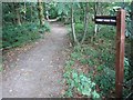
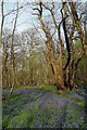
Living in CM11 1AY offers a quiet residential experience within a town deeply rooted in local history. This specific postcode covers a small residential cluster with a population of 1,450 people, situated in Billericay, Essex. The area sits atop a low north-south ridge approximately 27 miles east of London, straddling the parishes of Great Burstead and Mountnessing. Historically significant, Billericay originated as a market settlement likely planted in the late 13th century. The town developed as a key crossroads linking routes from the Thames to Chelmsford and Hutton to Wickford. Its name first appeared as 'Byllyrica' in 1291, established by the Abbot of West Ham Abbey on manor land. Today, the linear High Street serves as the historic market axis, flanked by housing that has evolved over centuries since the area gained independence as a parish in 1860. Residents enjoy a setting defined by its strategic location and deep historical connections, including Roman fort evidence at Blunts Wall and burial mounds in Norsey Wood. For those seeking homes in CM11 1AY, the environment is characterised by established neighbourhood architecture and proximity to these significant historical landmarks. Daily life centres around this historic core while maintaining a distinct residential calm away from the busiest commercial thoroughfares.
- Area Type
- Postcode
- Area Size
- Not available
- Population
- Not available
- Population Density
- Not available
The property market in CM11 1AY is overwhelmingly characterised by owner-occupied homes, making it a prime example of an established residential postcode. A striking 93% of properties in this area are in the hands of their owners, leaving only a small fraction for the rental sector. This statistic indicates a market driven by family stability and long-term investment rather than transient tenancy. The predominant accommodation type found here is housing arranged as houses, which aligns with the historical development of the town and the demand for space in Billericay. Prospective buyers looking in this specific cluster will find few rental options compared to the abundance of homes available for purchase. This high rate of ownership often results in a property market where values remain insulated from the volatility seen in high-demand rental hubs. Residents have invested in their surroundings for decades, fostering a degree of care for external areas and private gardens. When selling or purchasing in CM11 1AY, the transaction dynamics differ from newer developments because the majority of stalls are being taken over by new owners in an existing, rooted community. The focus for buyers is on finding a house within this specific cluster rather than navigating a diverse range of apartment complexes or manicured rental developments.
House Prices in CM11 1AY
No properties found in this postcode.
Energy Efficiency in CM11 1AY
Residents of CM11 1AY enjoy a convenient lifestyle supported by a cluster of retail, rail, and commercial amenities within practical reach. Five notable retail locations serve the daily needs of households, including branches for Co-op Billericay and the M&S Mayflower BP fuel station. These shops provide essentials and daily shopping opportunities without requiring a significant journey. Transport links are bolstered by five accessible railway stations, specifically Billericay, Ingatestone, and Wickford Railway Stations, which facilitate easy commutes. For those preferring road travel, Nelsons Coach Station offers a single major bus hub close to the residential area. While the area is primarily residential, its proximity to Billericay's High Street connects it to wider town amenities found a short distance away. The lifestyle here balances the quiet of a 1,450-people cluster with the accessibility of a larger town centre. Schools near CM11 1AY are situated in the immediate surroundings, catering to the large population of adults and families. The domain of amenities such as Co-op and the railway stations ensures that daily errands are manageable. For those who prefer walking or cycling, the location sits near the historic ridge that defines the town, offering pleasant routes away from the main road traffic.
Amenities
Schools
| Rank | School | Type | Entry gender | Ages |
|---|
Explore more schools in this area
Go to Schools tabDemographics
The community in CM11 1AY is defined by stability and a mature population profile. Nine out of ten households in this postcode belong to the majority White ethnic group, reflecting the established nature of the settlement. Ownership rates are exceptionally high, with 93% of residents owning their homes outright or with a mortgage rather than renting. This high level of tenure suggests long-term residents and a community focused on building equity rather than short-term stays. The demographic makeup is dominated by adults aged between 30 and 64 years, and the median age for residents is 47. This age range indicates the area attracts families and professionals established in their careers, rather than young students or retirees moving to their final homes. The population of 1,450 people lives primarily in houses, with no data suggesting a significant presence of flats or apartments. The homogeneity of the demographic profile, combined with high home ownership, creates a neighbourhood character where neighbours often know each other over generations. This stability means the school catchment areas near CM11 1AY typically contain families who have lived in the local authority area for many years. The absence of large rental blocks further reinforces a family-oriented and settled atmosphere within these specific housing estates.
Household Size
Accommodation Type
Tenure
Ethnic Group
Religion
Household Composition
Age
Household Deprivation
NS-SEC
Explore more demographic insights in this area
Go to Demographics tabPlanning
Planning Constraints
- Flood RiskPremium
- Ramsar Wetland SitesPremium
- Area of Outstanding Natural BeautyPremium
- Protected Nature ReservePremium
- Protected WoodlandPremium