Area Overview for CM1 7HG
Photos of CM1 7HG
Area Information
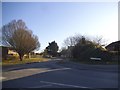
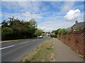
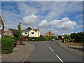
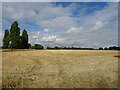
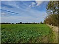
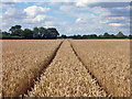
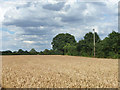
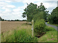
CM1 7HG represents a small residential cluster within the broader suburb of Broomfield in Essex. This postcode covers exactly 6.3 hectares, which accommodates a population of 2,404 residents. With a density of 480 people per square kilometre, the area balances suburban living with a relatively low concentration of housing. The location sits on the northern edge of Chelmsford, roughly 2 to 2.5 miles from the city centre. This positioning places you near the River Chelmer while maintaining a distinct village character amid cultivated farmland. The main settlement in this district spans 55 hectares along the B1008 Main Road, home to a wider population of 6,756 as of the 2021 census. Living in CM1 7HG means accessing easy rail connections to London and local amenities without the density of the city core. The terrain varies slightly, rising to between 50 and 60 metres in elevation across the parish. You will find yourself in a civil parish with a history dating back to the Domesday Book of 1086, offering a sense of continuity alongside modern suburban convenience. Daily life here is defined by access to practical transport links and a quiet, residential environment that retains historic charm. The area is situated away from major planning constraints, allowing for standard development patterns typical of established Essex suburbs.
- Area Type
- Postcode
- Area Size
- 6.3 hectares
- Population
- 2404
- Population Density
- 480 people/km²
The housing stock in CM1 7HG is overwhelmingly characterised by houses rather than flats or apartments. This accommodation type preference reflects the area's established suburban nature and its appeal to families seeking space. Sixty-two per cent of residents own their homes outright, creating a highly stable market with low tenant turnover. The remaining ownership splits between those with mortgages and other tenure types, but the overall picture is one of owner-occupation. Looking at homes in CM1 7HG, buyers are entering a market dominated by traditional British house styles. The area covers a small cluster of 6.3 hectares, suggesting limited large-scale expansion within the immediate postcode boundary. Instead, the main settlement extends 55 hectares along the B1008 Main Road, offering a wider variety of property options in the immediate vicinity. This small footprint means the local market can be tight, with competition potentially higher for properties that match specific family needs. The high proportion of owner-occupied dwellings implies that available properties for sale or rent will represent a selection of long-held households possibly moving down-market or upgrading. Prospective buyers should look beyond the narrow postcode boundary to find the full range of sizes and prices available in the broader Broomfield parish. The lack of managed estate housing or high-rise blocks is confirmed by the data, which lists houses as the sole predominant accommodation type.
House Prices in CM1 7HG
Showing 2 properties
| Address | Type | Beds | Baths | Last Sale Price | Last Sale Date | |
|---|---|---|---|---|---|---|
| 2, Scotts Green, Hollow Lane, Broomfield, Chelmsford, CM1 7HG | Detached | 5 | - | - | - | |
| 1, Scotts Green, Hollow Lane, Broomfield, Chelmsford, CM1 7HG | house | - | - | - | - |
Energy Efficiency in CM1 7HG
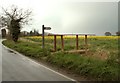
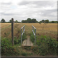
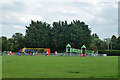
Daily life in CM1 7HG benefits from immediate access to essential retail and transport hubs. Five retail outlets sit within practical reach, offering a variety of shopping options. Notable venues include Morrisons Melbourne, which provides a large supermarket for weekly grocery needs. The Chelmsford Star Co-operative Society Co and Tesco Chelmsford further expand your immediate shopping radius without requiring town centre travel. For journeys beyond the local cluster, residents have access to two railway stations. Chelsmford Railway Station offers direct connections to national networks, while Hatfield Peverel Railway Station serves as another vital interchange. This dual-rail access provides flexibility for commuting and leisure travel. The area is centred on Broomfield, a village known for its conservation areas like Church Green and Angel Green. These green spaces feature historical elements such as a 15th-century tithe barn and a 15th-century pub. Sports culture is present with Broomfield F.C., a football club established in 1905, and a cricket club operating within the parish. The River Chelmer weir and associated footpaths offer recreational walking opportunities near the elevated terrain of 50 to 60 metres. Residents also enjoy proximity to Broomfield Hospital, a major A&E facility and national centre for specialist treatments. This medical hub adds a layer of certainty for healthcare access. The lifestyle here blends village character with urban convenience, anchored by historic sites like the Church of St Mary with St Leonard and modern supermarkets.
Amenities
Schools
Family education in CM1 7HG relies on a single local institution with a strong reputation. Chelmer Valley High School serves as the primary educational provision for residents in this cluster. The school operates as an academy and holds a 'good' Ofsted rating, signifying consistent educational standards. This singular academy provides secondary education for the local population, removing the uncertainty of mixed-ranking schools. There are no primary schools listed in the immediate proximity data, meaning year-rounders would travel to Chelmer Valley High School or other institutions outside the immediate postcode for early years education. The presence of a good-rated academy is a significant positive factor for families considering moves into this area. It offers a formal assessment of quality that parents and educators trust. While the data does not detail league table positions or specific curriculum offerings, the 'good' rating is a verified benchmark of performance. This single option suggests a close-knit community where one institution shapes the educational experience for students residing in CM1 7HG. Prospective homebuyers will need to consider travel times to this specific school alongside other local options not detailed in the current dataset. The concentration of only one named school highlights the need to research the wider catchment area for complete primary education options.
| Rank | School | Type | Entry gender | Ages |
|---|
Explore more schools in this area
Go to Schools tabDemographics
The community in CM1 7HG is defined by a mature population profile. The median age stands at 47 years, reflecting a demographic dominated by adults between 30 and 64 years old. This age range suggests a neighbourhood suited for established families and professionals rather than young people entering the market for the first time. Sixty-two per cent of households in this cluster are owner-occupied, indicating a stable community with long-term residents who have invested in their homes. The remaining 38 per cent of households comprise owners with mortgages, private tenants, or other rental arrangements. Houses form the predominant accommodation type throughout the postcode area, appealing to those seeking detached or semi-detached family living. The predominant ethnic group is White, which aligns with typical demographics for suburban Essex locations. Safety concerns currently outweigh other social factors, as assessment data shows a critical level of crime risk with a safety score of 0 out of 100. High crime rates are confirmed as above average for the region. This statistical reality requires residents to consider enhanced security measures when living in this specific area. While the population density is moderate at 480 people per square kilometre, the high home ownership rate creates a distinct character compared to nearby rental-heavy urban zones.
Household Size
Accommodation Type
Tenure
Ethnic Group
Religion
Household Composition
Age
Household Deprivation
NS-SEC
Explore more demographic insights in this area
Go to Demographics tabPlanning
Planning Constraints
- Flood RiskPremium
- Ramsar Wetland SitesPremium
- Area of Outstanding Natural BeautyPremium
- Protected Nature ReservePremium
- Protected WoodlandPremium