Area Overview for CM1 7HF
Photos of CM1 7HF

Area Information
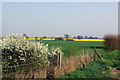
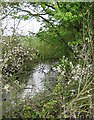
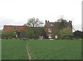
Living in CM1 7HF places you within a small residential cluster covering just 56.6 hectares. This specific postcode sits in Broomfield, a suburban village and civil parish located approximately 2-2.5 miles north of Chelmsford. The area is defined by its compact nature, holding a population of 2404 residents across this limited land. You will find yourself surrounded by cultivated countryside and footpaths, with the main settlement of Broomfield spanning 55 hectares just nearby. The terrain rises gently to an elevation between 50 and 60 metres, offering elevated views of the surroundings. History permeates the landscape, with records from the Domesday Book of 1086 and a prominent Saxon burial site near Patching Hall adding depth to the local narrative. The Church of St Mary with St Leonard, a landmark dating to the late 11th century, stands as a testament to the locality's enduring character. For those considering homes in this postcode, the setting combines a quiet village atmosphere with proximity to the River Chelmer. The area feels like a distinct civil parish within the Chelmsford district, providing a buffer from the city centre while remaining connected to it by road and rail links.
- Area Type
- Postcode
- Area Size
- 56.6 hectares
- Population
- 2404
- Population Density
- 480 people/km²
The property market in CM1 7HF is characterised by a strong leaning towards owned accommodation. With 62 per cent of homes owner-occupied, this postcode is not a primary rental market. Instead, the housing stock is dominated by houses, catering to families or individuals seeking long-term stability. This high ownership figure generally correlates with the area's suburban village character, where properties hold significant local value. You are likely to find a mix of older homes and renovated properties suited to the needs of the 30 to 64-year-old demographic that predominates here. The accumulation of owner-occupiers suggests that homes in CM1 7HF serve as a home for generations rather than short-term lets. Consequently, the market may experience slower price fluctuations compared to high-turnover city centres. Buyers looking at homes in this specific cluster can expect a traditional market where sellers often have a vested interest in maintaining property quality. The predominance of houses means you will not find large blocks of flats or high-density blocks within this small postcode boundary. This structure supports a stable neighbourhood where the local community is deeply rooted in the existing housing stock.
House Prices in CM1 7HF
Showing 5 properties
| Address | Type | Beds | Baths | Last Sale Price | Last Sale Date | |
|---|---|---|---|---|---|---|
| Pennyfields, Parsonage Green, Broomfield, Chelmsford, CM1 7HF | house | - | - | £338,000 | Feb 2016 | |
| The Cottage, Parsonage Green, Broomfield, Chelmsford, CM1 7HF | Semi-detached | 4 | - | £457,500 | Sep 2014 | |
| Staceys Farm Barn, School Lane, Broomfield, Chelmsford, CM1 7HF | Semi-detached | - | - | - | - | |
| Staceys, School Lane, Broomfield, Chelmsford, CM1 7HF | Semi-detached | - | - | - | - | |
| Staceys Farm Cottage, School Lane, Broomfield, Chelmsford, CM1 7HF | Semi-detached | - | - | - | - |
Energy Efficiency in CM1 7HF
Daily life in CM1 7HF is anchored by a selection of retail and transport amenities within practical reach. Residents have access to five retail venues, including M&S Broomfield, Morrisons Melbourne, and the Chelmsford Star Co-operative Society Co. These shops provide for everyday needs without requiring a significant journey into the city centre. For travel, two railway stations support your weekly commute: Chelmsford Railway Station and Hatfield Peverel Railway Station. The area feels serviced, meaning most household essentials are available locally. The character of the neighbourhood is further enhanced by its location near the River Chelmer and the main B1008 route. While specific dining or leisure venues like pubs are detailed in broader research about the parish, the immediate postcode amenity list focuses on essential retail and rail access. This setup supports a low-maintenance lifestyle where routine shopping and commuting are efficient. You benefit from the proximity of major supermarkets and retail chains that cater to the suburban household. The presence of these specific retailers ensures that food and general goods are easily accessible for residents of this residential cluster.
Amenities
Schools
Education for children in this neighbourhood is supported by Chelmer Valley High School. This institution serves as both a primary school and an academy. It currently holds a good Ofsted rating, indicating a performance level that meets national standards for education quality. For parents researching schools near CM1 7HF, this single named provider is the specific option listed within the immediate data coverage. The academy status implies a framework of autonomy with central oversight, which often benefits curriculum delivery and resource management. You do not have multiple competing school options listed for this specific postcode cluster, pointing to a perhaps more rural or semi-rural educational arrangement. The presence of a school with a good rating provides reassurance for families considering this location for their children. While there are no other named institutions in the provided data, the existence of Chelmer Valley High School as a primary and academy facility suggests localised educational support without the need for long commutes to Chelmsford city centre.
| Rank | School | Type | Entry gender | Ages |
|---|
Explore more schools in this area
Go to Schools tabDemographics
The community in CM1 7HF is defined by a mature demographic profile. The population has a median age of 47 years, indicating a concentration of settled residents. Most commonly, the inhabitants fall within the adult age range of 30 to 64 years. This suggests a neighbourhood where long-term settlement is the norm rather than a transient population. Security through ownership is high, with 62 per cent of households classified as owner-occupied. This indicates a stable community where residents have invested in their properties. The majority of the accommodation consists of houses, reflecting a preference for detached or semi-detached living over flats. Demographically, the predominant group is White, aligning with the broader Essex statistics. The mix of homes and the high ownership rate create an environment typical of established suburbs. You are joining an area where the primary residents are likely families or empty-nesters who have built their lives locally. These figures paint a picture of a settled community rather than a bustling development site where turnover is frequent. The low density of 480 people per square kilometre supports a quieter way of living compared to denser urban zones.
Household Size
Accommodation Type
Tenure
Ethnic Group
Religion
Household Composition
Age
Household Deprivation
NS-SEC
Explore more demographic insights in this area
Go to Demographics tabPlanning
Planning Constraints
- Flood RiskPremium
- Ramsar Wetland SitesPremium
- Area of Outstanding Natural BeautyPremium
- Protected Nature ReservePremium
- Protected WoodlandPremium