Area Overview for CM1 6TU
Photos of CM1 6TU
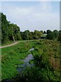
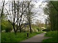
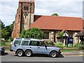
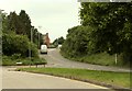

15 photos from this area
Area Information
Key information about the CM1 6TU including its size, population, and administrative classification.
- Area Type
- Postcode
- Area Size
- 2.6 hectares
- Population
- 1226
- Population Density
- 3528 people/km²
House Prices in CM1 6TU
56
Properties
£249,526
Average Sold Price
£59,995
Lowest Price
£430,000
Highest Price
Showing 56 properties
| Address | Type | Beds | Baths | Last Sale Price | Last Sale Date | |
|---|---|---|---|---|---|---|
| 56 Downsway, Chelmsford, CM1 6TU | Terraced | 3 | 1 | £330,000 | Oct 2025 | |
| 12 Downsway, Springfield, Chelmsford, CM1 6TU | Detached | 2 | 1 | £380,000 | Oct 2023 | |
| 66 Downsway, Chelmsford, CM1 6TU | house | - | - | £210,900 | Dec 2022 | |
| 106 Downsway, Chelmsford, CM1 6TU | house | - | - | £375,000 | Jun 2022 | |
| 104 Downsway, Chelmsford, CM1 6TU | house | - | - | £322,000 | May 2022 | |
| 54 Downsway, Chelmsford, CM1 6TU | Terraced | 3 | 1 | £350,000 | Feb 2022 | |
| 78 Downsway, Chelmsford, CM1 6TU | house | 2 | 1 | £328,000 | Jan 2022 | |
| 30 Downsway, Springfield, Chelmsford, CM1 6TU | house | - | - | £405,000 | Jan 2021 | |
| 20 Downsway, Springfield, Chelmsford, CM1 6TU | Semi-detached | 3 | - | £380,000 | Dec 2020 | |
| 24 Downsway, Springfield, Chelmsford, CM1 6TU | Semi-detached | 3 | 1 | £400,000 | Jun 2020 |
Page 1 of 6
Energy Efficiency in CM1 6TU
Amenities
Schools
| Rank | School | Type | Entry gender | Ages |
|---|
Explore more schools in this area
Go to Schools tabDemographics
Household Size
Two person
most common
Accommodation Type
Houses
most common
Tenure
90
majority
Ethnic Group
White
most common
Religion
N/A
most common
Household Composition
N/A
most common
Age
47
median
Adults (30-64 years)
most common
Household Deprivation
N/A
with no deprivation
NS-SEC
40
in Lower managerial occupations
Explore more demographic insights in this area
Go to Demographics tabPlanning
Planning Constraints
- Flood RiskPremium
- Ramsar Wetland SitesPremium
- Area of Outstanding Natural BeautyPremium
- Protected Nature ReservePremium
- Protected WoodlandPremium