Area Overview for CM1 6LR
Photos of CM1 6LR


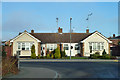
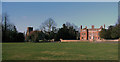
13 photos from this area
Area Information
Key information about the CM1 6LR including its size, population, and administrative classification.
- Area Type
- Postcode
- Area Size
- 1.3 hectares
- Population
- 1226
- Population Density
- 3528 people/km²
House Prices in CM1 6LR
30
Properties
£306,700
Average Sold Price
£89,000
Lowest Price
£429,950
Highest Price
Showing 30 properties
| Address | Type | Beds | Baths | Last Sale Price | Last Sale Date | |
|---|---|---|---|---|---|---|
| 9 Sidmouth Road, Chelmsford, CM1 6LR | Semi-detached | 2 | 1 | £410,000 | May 2024 | |
| 6 Sidmouth Road, Chelmsford, CM1 6LR | Bungalow | 2 | 1 | £426,500 | Oct 2022 | |
| 10 Sidmouth Road, Chelmsford, CM1 6LR | Bungalow | 2 | 1 | £411,000 | Aug 2022 | |
| 25 Sidmouth Road, Chelmsford, CM1 6LR | Retail | 2 | 1 | £423,000 | Jul 2022 | |
| 28A Sidmouth Road, Chelmsford, CM1 6LR | house | - | - | £390,000 | Jun 2022 | |
| 26 Sidmouth Road, Chelmsford, CM1 6LR | Semi-detached | 2 | 1 | £380,000 | Aug 2021 | |
| 23 Sidmouth Road, Chelmsford, CM1 6LR | Semi-detached | 2 | 1 | £337,500 | Jul 2021 | |
| 18 Sidmouth Road, Chelmsford, CM1 6LR | Semi-detached | 2 | 1 | £335,000 | Feb 2021 | |
| 4 Sidmouth Road, Chelmsford, CM1 6LR | Bungalow | - | - | £380,000 | Jul 2019 | |
| 24 Sidmouth Road, Chelmsford, CM1 6LR | Bungalow | - | - | £340,000 | Aug 2017 |
Page 1 of 3
Energy Efficiency in CM1 6LR
Amenities
Schools
| Rank | School | Type | Entry gender | Ages |
|---|
Explore more schools in this area
Go to Schools tabDemographics
Household Size
Two person
most common
Accommodation Type
Houses
most common
Tenure
90
majority
Ethnic Group
White
most common
Religion
N/A
most common
Household Composition
N/A
most common
Age
47
median
Adults (30-64 years)
most common
Household Deprivation
N/A
with no deprivation
NS-SEC
40
in Lower managerial occupations
Explore more demographic insights in this area
Go to Demographics tabPlanning
Planning Constraints
- Flood RiskPremium
- Ramsar Wetland SitesPremium
- Area of Outstanding Natural BeautyPremium
- Protected Nature ReservePremium
- Protected WoodlandPremium