Area Overview for CM1 6LB
Photos of CM1 6LB

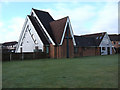

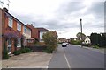
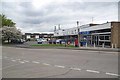
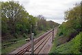
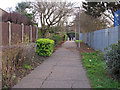
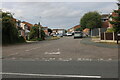
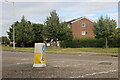
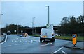
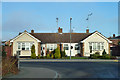
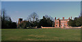
13 photos from this area
Area Information
Key information about the CM1 6LB including its size, population, and administrative classification.
- Area Type
- Postcode
- Area Size
- 1.5 hectares
- Population
- 1465
- Population Density
- 5285 people/km²
House Prices in CM1 6LB
85
Properties
£158,615
Average Sold Price
£33,500
Lowest Price
£417,500
Highest Price
Showing 85 properties
| Address | Type | Beds | Baths | Last Sale Price | Last Sale Date | |
|---|---|---|---|---|---|---|
| 45 Canvey Walk, Springfield, Chelmsford, CM1 6LB | Flat | 2 | 1 | £195,000 | Oct 2025 | |
| 37 Canvey Walk, Springfield, Chelmsford, CM1 6LB | Flat | 2 | 1 | £177,000 | Mar 2025 | |
| 4 Canvey Walk, Springfield, Chelmsford, CM1 6LB | Terraced | 3 | 1 | £350,000 | Nov 2023 | |
| 15 Canvey Walk, Springfield, Chelmsford, CM1 6LB | Flat | - | - | £180,000 | Sep 2023 | |
| 56 Canvey Walk, Springfield, Chelmsford, CM1 6LB | Maisonette | 1 | 1 | £176,500 | Jul 2023 | |
| 23 Canvey Walk, Springfield, Chelmsford, CM1 6LB | Flat | - | - | £187,000 | Jul 2023 | |
| 2 Canvey Walk, Springfield, Chelmsford, CM1 6LB | Terraced | 4 | 2 | £417,500 | May 2023 | |
| 9 Canvey Walk, Springfield, Chelmsford, CM1 6LB | Flat | - | - | £205,650 | May 2023 | |
| 49 Canvey Walk, Springfield, Chelmsford, CM1 6LB | Flat | 2 | 1 | £210,000 | Dec 2022 | |
| 28 Canvey Walk, Springfield, Chelmsford, CM1 6LB | Flat | 1 | 1 | £205,000 | Sep 2022 |
Page 1 of 9
Energy Efficiency in CM1 6LB
Amenities
Schools
| Rank | School | Type | Entry gender | Ages |
|---|
Explore more schools in this area
Go to Schools tabDemographics
Household Size
Two person
most common
Accommodation Type
Houses
most common
Tenure
66
majority
Ethnic Group
White
most common
Religion
N/A
most common
Household Composition
N/A
most common
Age
47
median
Adults (30-64 years)
most common
Household Deprivation
N/A
with no deprivation
NS-SEC
35
in Lower managerial occupations
Explore more demographic insights in this area
Go to Demographics tabPlanning
Planning Constraints
- Flood RiskPremium
- Ramsar Wetland SitesPremium
- Area of Outstanding Natural BeautyPremium
- Protected Nature ReservePremium
- Protected WoodlandPremium