Area Overview for CM1 5ZW
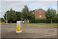
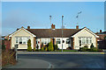
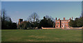
Photos of CM1 5ZW

Area Information
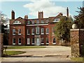
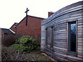
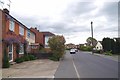
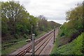
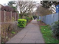
CM1 5ZW lies in Springfield, a suburban area within the Chelmsford district of Essex, approximately 1 mile north-east of Chelmsford city centre. This postcode covers a small residential cluster with a population of 1,428, primarily composed of houses built in the 1970s on former arable land. Springfield’s history dates back to the Domesday Book, with its name linked to William Pynchon, who inspired Springfield, Massachusetts. Today, it is Chelmsford’s most populous suburb, blending semi-rural heritage with modern housing. Residents benefit from proximity to Chelmsford’s amenities, including its railway station, which offers frequent services to London Liverpool Street in 35–40 minutes. The area’s character is defined by its conservation zone around Springfield Green, historic buildings like All Saints Church, and the Springfield Spring, a geological curiosity. Living here offers a balance of suburban tranquillity and urban accessibility, with a focus on family-friendly infrastructure and community-rooted traditions.
- Area Type
- Postcode
- Area Size
- Not available
- Population
- 1428
- Population Density
- 6142 people/km²
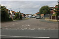
CM1 5ZW is an owner-occupied area, with 80% of homes owned by residents rather than rented. The accommodation type is predominantly houses, which are typical for suburban settings and suggest a focus on family homes. This contrasts with areas dominated by flats or rental properties, indicating a preference for private ownership and long-term stability. The small size of the postcode means the housing stock is limited, but the immediate surroundings offer a range of properties, particularly within Chelmsford’s broader built-up area. Buyers should consider the area’s proximity to city amenities, which may influence property values. The presence of houses also implies potential for larger living spaces, though availability may be constrained by the postcode’s compact nature.
House Prices in CM1 5ZW
No properties found in this postcode.
Energy Efficiency in CM1 5ZW
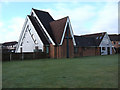
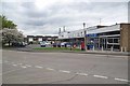
CM1 5ZW’s residents have access to 5 retail venues, including Tesco Springfield, Aldi Springfield, and the Chelmsford Star Co-operative Society Co, ensuring convenience for daily shopping. The area’s proximity to Chelmsford city centre allows access to broader leisure and dining options. While specific parks or recreational facilities are not detailed, the historic Springfield Green conservation area offers green space and heritage sites like All Saints Church and Springfield Place. The suburban character of the area balances practicality with a touch of historical charm, making it suitable for those seeking a settled lifestyle with easy access to urban amenities.
Amenities
Schools
Near CM1 5ZW are two primary schools: The Bishops’ Church of England and Roman Catholic Primary School, rated ‘good’ by Ofsted, and Bishop Wilson CofE Primary School. Both cater to younger children, providing families with two state-funded options. The presence of two primary schools within practical reach suggests a focus on local education, reducing the need for long commutes. The ‘good’ rating at The Bishops’ school indicates a reliable standard of teaching, which is crucial for parents prioritising academic outcomes. Families in the area benefit from a mix of faith-based and secular education, though no secondary schools are listed, meaning students may need to travel to Chelmsford or nearby towns for further education.
| Rank | School | Type | Entry gender | Ages |
|---|
Explore more schools in this area
Go to Schools tabDemographics
The population of CM1 5ZW is predominantly adults aged 30–64, with a median age of 47. Home ownership is high at 80%, reflecting a stable, long-term resident base. The accommodation type is primarily houses, suggesting a mix of family homes and larger properties. The predominant ethnic group is White, indicating a homogenous community. This demographic profile suggests a mature, settled population with established roots. The absence of specific deprivation data means the quality of life is likely shaped by the area’s infrastructure, such as schools and transport links. The age range implies a community with a strong presence of working-age adults and possibly retirees, contributing to a balanced social dynamic.
Household Size
Accommodation Type
Tenure
Ethnic Group
Religion
Household Composition
Age
Household Deprivation
NS-SEC
Explore more demographic insights in this area
Go to Demographics tabPlanning
Planning Constraints
- Flood RiskPremium
- Ramsar Wetland SitesPremium
- Area of Outstanding Natural BeautyPremium
- Protected Nature ReservePremium
- Protected WoodlandPremium