Area Overview for CM1 5WU
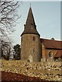
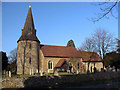
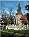
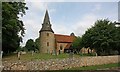
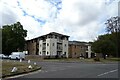
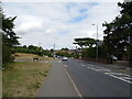
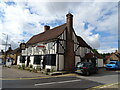
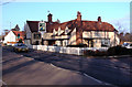
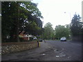
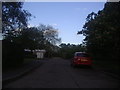
Photos of CM1 5WU


Area Information
Living in CM1 5WU means residing in a small, tightly knit residential cluster within the suburban village of Broomfield, Essex. With a population of 2,404 and a density of 480 people per square kilometre, this area retains a village character despite its proximity to Chelmsford, just 2–2.5 miles to the south. Broomfield’s history stretches back to the Domesday Book, with evidence of pre-Roman and Saxon activity, and its modern layout blends cultivated farmland with conservation areas like Church Green and Parsonage Green. The River Chelmer runs nearby, offering scenic footpaths, while the B1008 Main Road serves as the primary route through the settlement. Residents benefit from easy access to Chelmsford’s amenities, including rail links to London, and a mix of historical sites, such as the 12th-century Church of St Mary with St Leonard. This area suits those seeking a quieter, community-focused lifestyle with a balance of rural charm and urban connectivity.
- Area Type
- Postcode
- Area Size
- Not available
- Population
- 2404
- Population Density
- 480 people/km²
The property market in CM1 5WU is dominated by owner-occupied homes, with 62% of properties owned outright. This high ownership rate suggests a mature, settled community rather than a transient rental market. The accommodation type is primarily houses, which aligns with the suburban character of Broomfield and its low density. For buyers, this means a focus on family-friendly homes rather than apartments or flats. The small area’s limited housing stock means competition may be higher for properties, though proximity to Chelmsford offers additional options. The mix of historical and modern homes, combined with conservation areas, ensures properties retain distinct character, appealing to those prioritising heritage and space over high-density living.
House Prices in CM1 5WU
No properties found in this postcode.
Energy Efficiency in CM1 5WU
The lifestyle in CM1 5WU is shaped by its mix of retail, leisure, and historical amenities. Within practical reach are five retail venues, including the Chelmsford Star Co-operative Society, M&S Broomfield, and Waitrose Little, offering convenience for daily shopping. The area’s village greens, such as Parsonage Green and Angel Green, provide communal spaces for recreation, while the River Chelmer’s footpaths cater to walkers and nature enthusiasts. Nearby sports clubs, including Broomfield F.C. and a cricket club, add to the active community spirit. This blend of local shops, green spaces, and historical sites fosters a lifestyle that prioritises both practicality and heritage.
Amenities
Schools
Near CM1 5WU, Chelmer Valley High School serves as both a primary and academy school, with an Ofsted rating of ‘good’. This dual role provides families with a seamless transition from primary to secondary education within the same institution. The presence of a single school with a strong rating indicates a focus on consistent, quality education, though the absence of other schools in the immediate area means families may need to travel further for alternative options. The school’s rating suggests reliable standards, but its role as both primary and secondary may limit specialist provision. For parents prioritising local schooling, this is a key advantage, though broader educational diversity is not reflected in the data.
| Rank | School | Type | Entry gender | Ages |
|---|
Explore more schools in this area
Go to Schools tabDemographics
The population of CM1 5WU has a median age of 47, with the majority of residents aged between 30 and 64. This suggests a community of established adults, many of whom are likely homeowners, as 62% of homes are owner-occupied. The predominant accommodation type is houses, reflecting a suburban rather than urban layout. The predominant ethnic group is White, indicating a homogenous demographic profile. While no specific deprivation data is provided, the age distribution and home ownership rate suggest a stable, long-term resident base. The absence of detailed diversity metrics means the community’s social fabric is not fully quantified, but the presence of village greens, conservation areas, and historical sites implies a focus on local heritage and community cohesion.
Household Size
Accommodation Type
Tenure
Ethnic Group
Religion
Household Composition
Age
Household Deprivation
NS-SEC
Explore more demographic insights in this area
Go to Demographics tabPlanning
Planning Constraints
- Flood RiskPremium
- Ramsar Wetland SitesPremium
- Area of Outstanding Natural BeautyPremium
- Protected Nature ReservePremium
- Protected WoodlandPremium