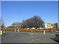
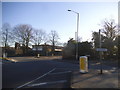
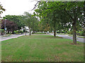
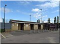
Area Overview for CM1 4HZ
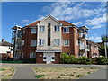
Photos of CM1 4HZ
Area Information
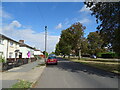
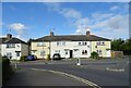
This postcode acts as a small residential cluster within the larger Marconi ward in Chelmsford, covering just 6,439 square metres yet housing 1,710 people. The resulting population density reaches an extremely high 265,555 people per square kilometre, creating a distinct urban environment rather than a typical suburban neighbourhood. You are looking at a central location that mixes commercial and residential elements, stretching from the railway line north of the police station up to Melbourne Avenue. This specific location forms part of the West End, a significant proportion of Chelmsford city centre known for its dense built-up character. The area has a strong historical link to Guglielmo Marconi, whose radio operations based in Chelmsford from the early 1900s founded the British Broadcasting Company and established local factories that operated for over a century. Daily life here revolves around a tight-knit, high-density urban setting where residences blend closely with commercial premises. The ward contains 153 properties, including 146 purpose-built flats, reflecting the modernist planning approaches associated with Marconi's legacy. Residents benefit from proximity to the city's core machinery while living in one of the most densely populated pockets in the district. This is a location defined by its intensive use of space and its deep roots in the local industrial history.
- Area Type
- Postcode
- Area Size
- 6439 m²
- Population
- 1710
- Population Density
- 8253 people/km²
Homes in CM1 4HZ form part of a distinct market where only 27% of residents own their accommodation. This low ownership rate contrasts with many other parts of Chelmsford, suggesting a heavy reliance on the rental sector. The area contains 146 purpose-built flats located within the Marconi ward, alongside other residences totalling 153 properties. The ward data indicates that 73 of these units are rented privately, reinforcing the conclusion that this is primarily a rental locality rather than an owner-occupied estate. For buyers looking at this specific postcode, the housing stock is likely comprised of Thesecond-hand flat conversions or original post-war builds typical of the Marconi wirelopers' housing legacy. The mix of commercial and residential areas means new single-family builds are rare here; instead, you will find apartment-style living integrated into the city centre fabric. The high employment rate of 60% among working-age residents drives consistent demand for rented accommodation from professionals working in the city core. Caution is required for anyone assuming this is a family suburb; the density and rental nature point to a lifestyle oriented towards independence and urban convenience. The property market operates under different rules here compared to outer boroughs due to the 90% or so reliance on renting.
House Prices in CM1 4HZ
Showing 34 properties
| Address | Type | Beds | Baths | Last Sale Price | Last Sale Date | |
|---|---|---|---|---|---|---|
| 3 Tennyson Road, Chelmsford, CM1 4HZ | house | - | - | £170,000 | Sep 2016 | |
| 16 Tennyson Road, Chelmsford, CM1 4HZ | house | 3 | - | £189,000 | Jan 2010 | |
| 13 Tennyson Road, Chelmsford, CM1 4HZ | Flat | 1 | 1 | £89,000 | Dec 2005 | |
| 5 Tennyson Road, Chelmsford, CM1 4HZ | house | - | - | £160,000 | Sep 2005 | |
| 18 Tennyson Road, Chelmsford, CM1 4HZ | house | - | - | £172,000 | Aug 2005 | |
| 39 Tennyson Road, Chelmsford, CM1 4HZ | Flat | 3 | 1 | - | - | |
| 14 Tennyson Road, Chelmsford, CM1 4HZ | house | - | - | - | - | |
| 15 Tennyson Road, Chelmsford, CM1 4HZ | Maisonette | - | - | - | - | |
| 20 Tennyson Road, Chelmsford, CM1 4HZ | house | - | - | - | - | |
| 21 Tennyson Road, Chelmsford, CM1 4HZ | Flat | - | - | - | - |
Energy Efficiency in CM1 4HZ
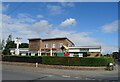
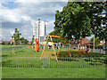
Daily life in CM1 4HZ is defined by immediate access to essential retail and transport hubs. Within practical reach, you can find five retail outlets, including Morrisons Daily and Chelmsford Star Co-operative Society Co, ensuring everyday shopping needs are met without long journeys. The area functions as heart of the urban ward, situated alongside commercial premises and the wider West End of Chelmsford. Two major rail stations serve the neighbourhood: Chelmsford Railway Station and Hatfield Peverel Railway Station. These lines provide the primary lifeline for residents who work nearby or commute long distance. A councillor holds monthly surgeries at Subway on the Anglia Ruskin University campus, adding a touch of civic accessibility to the local FUne. The ward consists of a mix of commercial and residential areas, meaning you will encounter businesses alongside homes in the streets and plazas of the West End. This integration means leisure activities and work opportunities are often a short walk away. The character is urban and busy, fitting for a location that includes 146 purpose-built flats and supports local shops and businesses. You are living in an environment where community interaction happens in public spaces rather than secluded garden settings.
Amenities
Schools
| Rank | School | Type | Entry gender | Ages |
|---|
Explore more schools in this area
Go to Schools tabDemographics
The community living in CM1 4HZ reflects a mature demographic with a median age of 47 years. Adults between 30 and 64 years old represent the most common age range, indicating a workforce-oriented population. Only 27% of residents own their homes, suggesting a significant rental presence alongside the private renting sector which dominates the local housing stock. The area consists predominantly of houses, though the ward profile notes a high number of purpose-built flats, creating a diverse living environment within this small footprint. The predominant ethnic group is White, aligning with the wider demographic trends of East Anglia. Economic activity is robust, with 60% of working-age residents employed full-time, a figure significantly higher than the national average of 34.3%. This employment rate suggests a stable community where most adults commute for work, likely taking advantage of the nearby rail links. Health outcomes are positive, with 82% of residents rating their health as very good or good. Qualifications are also high, with 54% holding degree-level qualifications, indicating a well-educated populace capable of securing skilled roles in the surrounding city. This demographic mix supports a vibrant local economy with high engagement in the labour market.
Household Size
Accommodation Type
Tenure
Ethnic Group
Religion
Household Composition
Age
Household Deprivation
NS-SEC
Explore more demographic insights in this area
Go to Demographics tabPlanning
Planning Constraints
- Flood RiskPremium
- Ramsar Wetland SitesPremium
- Area of Outstanding Natural BeautyPremium
- Protected Nature ReservePremium
- Protected WoodlandPremium