Area Overview for CM1 3JL
Photos of CM1 3JL
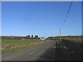
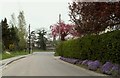
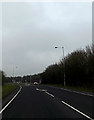
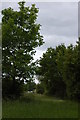
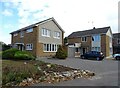
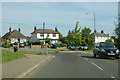
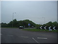

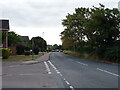
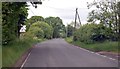

11 photos from this area
Area Information
Key information about the CM1 3JL including its size, population, and administrative classification.
- Area Type
- Postcode
- Area Size
- 1.0 hectares
- Population
- 1387
- Population Density
- 1216 people/km²
House Prices in CM1 3JL
27
Properties
£331,336
Average Sold Price
£30,210
Lowest Price
£510,000
Highest Price
Showing 27 properties
| Address | Type | Beds | Baths | Last Sale Price | Last Sale Date | |
|---|---|---|---|---|---|---|
| 55 Long Brandocks, Writtle, Chelmsford, CM1 3JL | Semi-detached | 3 | 1 | £422,167 | Oct 2024 | |
| 67 Long Brandocks, Writtle, Chelmsford, CM1 3JL | Semi-detached | 3 | 1 | £485,000 | Jul 2023 | |
| 79 Long Brandocks, Writtle, Chelmsford, CM1 3JL | Semi-detached | 3 | 1 | £410,000 | Mar 2023 | |
| 71 Long Brandocks, Writtle, Chelmsford, CM1 3JL | house | - | - | £510,000 | Jun 2021 | |
| 51 Long Brandocks, Writtle, Chelmsford, CM1 3JL | house | - | - | £497,500 | Mar 2021 | |
| 83 Long Brandocks, Writtle, Chelmsford, CM1 3JL | Semi-detached | 2 | 1 | £320,000 | Sep 2019 | |
| 73 Long Brandocks, Writtle, Chelmsford, CM1 3JL | house | - | - | £415,000 | Mar 2018 | |
| 45 Long Brandocks, Writtle, Chelmsford, CM1 3JL | house | - | - | £425,000 | Feb 2018 | |
| 85 Long Brandocks, Writtle, Chelmsford, CM1 3JL | Semi-detached | 2 | - | £185,000 | May 2012 | |
| 65 Long Brandocks, Writtle, Chelmsford, CM1 3JL | house | - | - | £277,500 | Jul 2009 |
Page 1 of 3
Energy Efficiency in CM1 3JL
Amenities
Schools
| Rank | School | Type | Entry gender | Ages |
|---|
Explore more schools in this area
Go to Schools tabDemographics
Household Size
Two person
most common
Accommodation Type
Houses
most common
Tenure
77
majority
Ethnic Group
White
most common
Religion
N/A
most common
Household Composition
N/A
most common
Age
47
median
Adults (30-64 years)
most common
Household Deprivation
N/A
with no deprivation
NS-SEC
43
in Lower managerial occupations
Explore more demographic insights in this area
Go to Demographics tabPlanning
Planning Constraints
- Flood RiskPremium
- Ramsar Wetland SitesPremium
- Area of Outstanding Natural BeautyPremium
- Protected Nature ReservePremium
- Protected WoodlandPremium