Area Overview for CM1 3JA
Photos of CM1 3JA
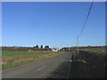
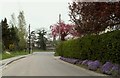
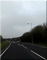
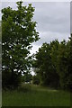
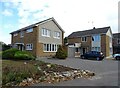
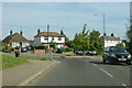
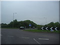

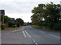

11 photos from this area
Area Information
Key information about the CM1 3JA including its size, population, and administrative classification.
- Area Type
- Postcode
- Area Size
- 6699 m²
- Population
- 1465
- Population Density
- 96 people/km²
House Prices in CM1 3JA
12
Properties
£447,250
Average Sold Price
£320,000
Lowest Price
£615,000
Highest Price
Showing 12 properties
| Address | Type | Beds | Baths | Last Sale Price | Last Sale Date | |
|---|---|---|---|---|---|---|
| 123 Lodge Road, Writtle, Chelmsford, CM1 3JA | Detached | 4 | 2 | £615,000 | Jun 2025 | |
| 111 Lodge Road, Writtle, Chelmsford, CM1 3JA | Semi-detached | 3 | 1 | £485,000 | May 2024 | |
| 115 Lodge Road, Writtle, Chelmsford, CM1 3JA | Semi-detached | 4 | 1 | £561,250 | Oct 2023 | |
| 107 Lodge Road, Writtle, Chelmsford, CM1 3JA | Detached | 4 | - | £512,000 | Oct 2018 | |
| 119 Lodge Road, Writtle, Chelmsford, CM1 3JA | Detached | 4 | 2 | £430,000 | Jun 2014 | |
| 105 Lodge Road, Writtle, Chelmsford, CM1 3JA | Detached | 4 | - | £395,000 | Oct 2013 | |
| 117 Lodge Road, Writtle, Chelmsford, CM1 3JA | Detached | 4 | - | £327,000 | Jul 2013 | |
| 127 Lodge Road, Writtle, Chelmsford, CM1 3JA | Semi-detached | 4 | - | £380,000 | Aug 2012 | |
| 109 Lodge Road, Writtle, Chelmsford, CM1 3JA | Semi-detached | - | - | £320,000 | May 2006 | |
| 125 Lodge Road, Writtle, Chelmsford, CM1 3JA | Semi-detached | - | - | - | - |
Page 1 of 2
Energy Efficiency in CM1 3JA
Amenities
Schools
| Rank | School | Type | Entry gender | Ages |
|---|
Explore more schools in this area
Go to Schools tabDemographics
Household Size
Two person
most common
Accommodation Type
Houses
most common
Tenure
85
majority
Ethnic Group
White
most common
Religion
N/A
most common
Household Composition
N/A
most common
Age
47
median
Adults (30-64 years)
most common
Household Deprivation
N/A
with no deprivation
NS-SEC
43
in Lower managerial occupations
Explore more demographic insights in this area
Go to Demographics tabPlanning
Planning Constraints
- Flood RiskPremium
- Ramsar Wetland SitesPremium
- Area of Outstanding Natural BeautyPremium
- Protected Nature ReservePremium
- Protected WoodlandPremium