Area Overview for CM1 2DQ
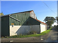
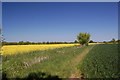
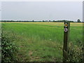
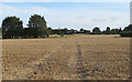
Photos of CM1 2DQ

Area Information
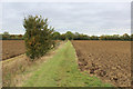
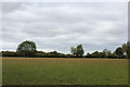
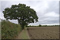
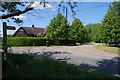
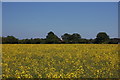
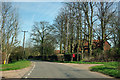
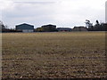
CM1 2DQ is a small residential postcode area in Essex, encompassing parts of the village of Willingale. With a population of 2464 and a low density of 54 people per square kilometre, it reflects a quiet, spread-out community. The area’s history is rooted in Saxon origins, with the name deriving from “Willingehala,” meaning “the nook of land of Willa’s people.” Willingale is home to two historic churches—St Andrew and All Saints, and St Christopher—which share a unique churchyard divided by the Essex Way. This village, along with nearby Shellow Bowells and Miller’s Green, offers a mix of rural charm and practical amenities. Daily life here is characterised by proximity to local shops, rail links, and community hubs like the village hall. The area’s low population density suggests a slower pace, with homes predominantly in private ownership. For buyers, CM1 2DQ balances historical significance with modern connectivity, making it appealing to those seeking a peaceful yet accessible lifestyle.
- Area Type
- Postcode
- Area Size
- Not available
- Population
- 2464
- Population Density
- 54 people/km²
The property market in CM1 2DQ is dominated by owner-occupied homes, with 74% of properties in private hands. This suggests a community of long-term residents rather than a rental-heavy area. The accommodation type is primarily houses, which aligns with the village’s traditional character and low density. Given the small size of the postcode area, the housing stock is limited, making it a niche market for buyers seeking characterful properties in a rural setting. The focus on houses rather than flats or apartments may appeal to those prioritising space and privacy. However, the limited number of properties means competition could be fierce, and buyers should consider the proximity to nearby towns like Chelmsford for broader amenities. The area’s historical and environmental features may also influence property values, with heritage elements adding to their appeal.
House Prices in CM1 2DQ
No properties found in this postcode.
Energy Efficiency in CM1 2DQ
The lifestyle in CM1 2DQ is shaped by its proximity to local amenities and community spaces. Within practical reach are five retail venues, including the Chelmsford Star Co-operative Society, offering everyday shopping needs. Two railway stations—Ingatestone and Chelmsford—provide access to wider networks, while the village hall and cricket club in Willingale Doe contribute to a sense of local identity. The area’s historical churches and rural setting offer a contrast to urban environments, appealing to those seeking tranquillity. For leisure, the cricket club and village hall host events, fostering community engagement. The combination of practical retail options, transport links, and cultural heritage creates a balanced lifestyle, blending convenience with a connection to the area’s history.
Amenities
Schools
The nearest school to CM1 2DQ is High Ongar Primary School, which serves the local community with a primary education offering. The school holds an Ofsted rating of “good,” indicating a satisfactory standard of teaching and facilities. As a primary school, it caters to younger children, making it a key consideration for families with young dependents. The absence of secondary schools in the immediate area means students may need to travel to nearby towns for further education. However, the “good” rating suggests that the school provides a reliable foundation for early learning. For families prioritising quality education, the proximity of High Ongar Primary School is a significant advantage, though additional research into secondary options would be necessary for long-term planning.
| Rank | School | Type | Entry gender | Ages |
|---|
Explore more schools in this area
Go to Schools tabDemographics
The population of CM1 2DQ is predominantly adults aged 30–64, with a median age of 47. This suggests a mature, stable community with a strong presence of families and long-term residents. Home ownership is high at 74%, indicating a preference for private property over rentals. The area is largely composed of houses, reflecting a traditional housing stock rather than flats or apartments. The predominant ethnic group is White, with no specific data on other demographics. The low population density of 54 people per square kilometre implies a more spacious, less congested environment. While no deprivation data is provided, the high home ownership and age profile suggest a relatively secure, low-turnover community. For buyers, this demographic profile may indicate a focus on long-term residency and stability, with fewer transient populations.
Household Size
Accommodation Type
Tenure
Ethnic Group
Religion
Household Composition
Age
Household Deprivation
NS-SEC
Explore more demographic insights in this area
Go to Demographics tabPlanning
Planning Constraints
- Flood RiskPremium
- Ramsar Wetland SitesPremium
- Area of Outstanding Natural BeautyPremium
- Protected Nature ReservePremium
- Protected WoodlandPremium