Area Overview for Claydon & Barham Ward
Photos of Claydon & Barham Ward
Area Information
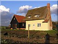
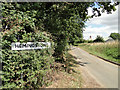
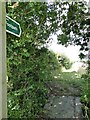
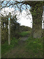
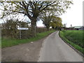
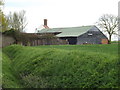
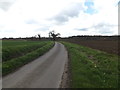
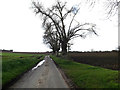
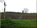
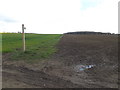
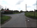
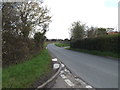
Living in Claydon & Barham Ward offers a distinct rural experience within the Mid Suffolk district. This ward spans 50.0 km² and includes the settlements of Claydon and Barham, situated approximately six miles north of Ipswich. Barham sits specifically within the Gipping Valley, positioned along the River Gipping and the A14 road. The area is defined by its quiet village atmosphere rather than urban bustle. Historical depth characterises the location, with Barham holding claims to having inspired Charles Dickens during his visit to the local workhouse in 1766. You will find modern amenities mixed with heritage sites, such as the Barham Picnic site and The Sorrel Horse pub. Daily life here moves at a slower pace than city living, yet practical connectivity remains accessible via the A14. The ward's identity is rooted in its status as a village community surrounded by nearby parishes like Great Blakenham and Baylham. Natural features play a significant role in the landscape, with the River Gipping cutting through the centre of the village. For those considering homes in Claydon & Barham Ward, the area represents a established rural setting with a clear sense of place. The proximity to Ipswich ensures that larger towns are reachable while maintaining the secluded feel of the Gipping Valley.
- Area Type
- District Borough Unitary Ward
- Area Size
- 50.0 km²
- Population
- Not available
- Population Density
- Not available
Demographics
The community in Claydon & Barham Ward reflects a settled, mature population. The median age stands at 70, indicating that the ward serves primarily older residents. This age profile suggests a neighbourhood where life is likely quieter and property values may reflect long-term residency rather than transient trends. Home ownership is exceptionally high, with 79% of the population owning their homes outright or with a mortgage. This statistic strongly indicates a community built on stability and rooted families rather than a rental market. Household composition data points to a demographic focused on established living arrangements rather than young professionals or students. The high rate of home ownership typically correlates with a slower life pace and a preference for spacious accommodation. While specific ethnicity and religion data are not detailed in the current records, the overarching picture is one of a homogeneous, mature community. This demographic reality means you will engage with neighbours who have lived in the area for decades. The community feel likely prioritises local clubs, village greens, and established social routines over fast-paced development. Consequently, living in Claydon & Barham Ward suits those seeking a tranquil environment amidst an older, established group of residents.
Household Size
Accommodation Type
Tenure
Ethnic Group
Religion
Household Composition
Age
Household Deprivation
NS-SEC
Explore more demographic insights in this area
Go to Demographics tabPlanning
Planning Constraints
- Flood RiskPremium
- Ramsar Wetland SitesPremium
- Area of Outstanding Natural BeautyPremium
- Protected Nature ReservePremium
- Protected WoodlandPremium
- Crime RiskPremium