Area Overview for Claydon
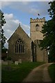
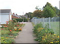
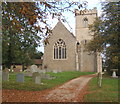
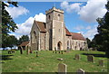
Photos of Claydon


Area Information
Claydon is a compact built-up area in England, spanning 95 hectares, with a population characterised by a median age of 70. This suggests a community shaped by older residents, many of whom may have lived in the area for decades. The area’s small size means it is likely a close-knit neighbourhood, where local amenities and services are within easy reach. Daily life here is influenced by the surrounding infrastructure, including nearby rail links and a mix of retail options. Claydon’s proximity to rail stations like Westerfield and Needham Market offers connectivity to larger towns, while its schools—both primary and secondary—serve the local population. The area’s home ownership rate of 80% indicates a stable housing market, with many residents choosing to stay in their properties long-term. For those considering living in Claydon, the blend of practical amenities and a mature demographic offers a distinct lifestyle compared to more dynamic urban centres. The area’s smaller footprint ensures a quieter, more community-focused environment, though it may lack the diversity of larger cities.
- Area Type
- Built Up Area 250
- Area Size
- 95.0 hectares
- Population
- Not available
- Population Density
- Not available
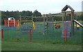
Claydon’s lifestyle is shaped by its proximity to retail and rail amenities. Within practical reach are five retail outlets, including East of England Co-operative Co, Budgens Great, and Lidl Ipswich, offering everyday shopping needs. These stores provide convenience for residents, reducing the need to travel further for groceries or household items. The area’s rail network, with stations like Westerfield and Needham Market, enhances mobility, connecting residents to nearby towns for work, leisure, or socialising. While the data does not specify parks or leisure facilities, the presence of retail and rail options suggests a focus on practicality over expansive recreational spaces. The combination of local shops and transport links creates a self-contained environment, ideal for those prioritising convenience over large-scale amenities.
Amenities
Schools
Claydon has two primary schools—Claydon Primary School and another named Claydon High School, though the latter is listed as both primary and academy, which may indicate a change in status or a dual designation. One primary school has an Ofsted rating of ‘good’, providing families with a reliable educational option. The presence of a mix of school types, including an academy, suggests a range of teaching approaches and resources. For families, this diversity can be advantageous, offering choices between traditional state schools and academies, which often have more autonomy in curriculum and governance. However, the data does not clarify whether the academy serves the same age group as the primary schools, so prospective parents should verify details directly with the schools. The overall school infrastructure appears to cater to local needs, though further information on performance or capacity would be needed for a full assessment.
| Rank | School | Type | Entry gender | Ages |
|---|
Explore more schools in this area
Go to Schools tabDemographics
Claydon’s population has a median age of 70, placing it well above the national average, which suggests a community dominated by older residents. This age profile may influence local services, with healthcare and leisure facilities tailored to older adults. Home ownership is high at 80%, indicating a strong presence of long-term residents who have invested in property. The data does not specify household composition or ethnic diversity, but the ‘total’ category for these fields implies a lack of detailed breakdowns. The accommodation types are similarly aggregated, though the high home ownership rate suggests a mix of owner-occupied homes, possibly including semi-detached or terraced properties. The absence of specific figures on deprivation or diversity means that quality of life assessments must rely on the available metrics, such as safety and connectivity. The area’s older demographic may contribute to a slower pace of life, with fewer young families compared to other regions.
Household Size
Accommodation Type
Tenure
Ethnic Group
Religion
Household Composition
Age
Household Deprivation
NS-SEC
Explore more demographic insights in this area
Go to Demographics tabPlanning
Planning Constraints
- Crime RiskPremium