Area Overview for Chrishall
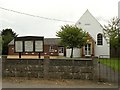
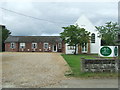
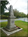
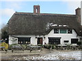
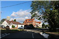
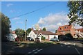
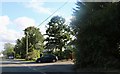
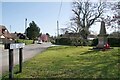
Photos of Chrishall


Area Information
Living in Chrishall offers a compact, well-defined community nestled within a 24.3-hectare built-up area in England. The area’s small size fosters a close-knit environment, where daily life is shaped by proximity to essential services and transport links. With a median age of 70, the population reflects a mature demographic, suggesting a community with established residents and a focus on stability. Chrishall’s location provides practical access to nearby amenities, including five rail stations such as Great Chesterford and Audley End, which connect residents to surrounding towns. Retail options like Spar, Co-op Melbourn, and Tesco Priory are within easy reach, supporting a straightforward lifestyle. The presence of Chrishall Holy Trinity and St Nicholas CofE Primary School, rated ‘good’ by Ofsted, ensures families have access to quality education. While the area’s size is modest, its infrastructure and services cater to residents’ needs, making it a viable option for those prioritising convenience over sprawling urban spaces.
- Area Type
- Built Up Area 250
- Area Size
- 24.3 hectares
- Population
- Not available
- Population Density
- Not available
Residents of Chrishall benefit from a network of nearby amenities that support daily life. Five rail stations, including Great Chesterford and Audley End, provide straightforward access to regional transport, facilitating commutes to larger towns or cities. Retail options such as Spar, Co-op Melbourn, and Tesco Priory offer essential shopping, while the proximity of these stores ensures convenience for routine purchases. The area’s compact size means that these services are within practical reach, reducing the need for long journeys. Although parks or leisure facilities are not explicitly mentioned in the data, the availability of rail and retail amenities suggests a lifestyle that prioritises accessibility over expansive recreational spaces. The combination of transport links and retail options creates a functional, if modest, environment for residents.
Amenities
Schools
The primary school nearest to Chrishall is Chrishall Holy Trinity and St Nicholas CofE (Aided) Primary School and Pre-School, which holds a ‘good’ Ofsted rating. This institution serves the local community, providing education for younger children in a setting that aligns with the area’s demographic profile. The absence of secondary schools or other educational institutions in the data means that families may need to look beyond Chrishall for comprehensive schooling options. The presence of a rated primary school is a positive factor for families with young children, though the limited range of educational facilities may be a consideration for those requiring a broader spectrum of schools.
| Rank | A + A* % | School | Type | Entry gender | Ages |
|---|---|---|---|---|---|
| 1 | N/A | Chrishall Holy Trinity and St Nicholas CofE (Aided) Primary School and Pre-School | primary | N/A | N/A |
Explore more schools in this area
Go to Schools tabDemographics
Chrishall’s population is characterised by a median age of 70, with the most common age range encompassing all age groups. This suggests a community skewed towards older residents, though specific data on household composition or accommodation types is not provided. Home ownership stands at 76%, indicating a majority of residents live in properties they own rather than rent. This high ownership rate may reflect long-term residency and a preference for settled living. The data does not specify ethnic diversity or religious composition, but the figures provided confirm that the area’s demographic profile is defined by age and property ownership. The absence of detailed information on deprivation or socioeconomic factors means that quality of life considerations beyond age and ownership remain unexplored in this dataset.
Household Size
Accommodation Type
Tenure
Ethnic Group
Religion
Household Composition
Age
Household Deprivation
NS-SEC
Explore more demographic insights in this area
Go to Demographics tabPlanning
Planning Constraints
- Crime RiskLocked