Area Overview for Chorleywood North & Sarratt Ward
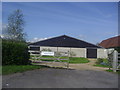
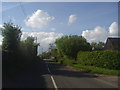
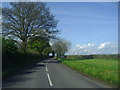
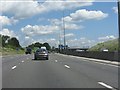
Photos of Chorleywood North & Sarratt Ward
Area Information
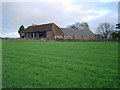
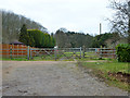
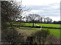
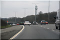
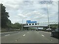
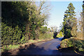
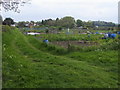
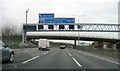
Living in Chorleywood North & Sarratt Ward offers a specific type of rural semi-rural experience within Hertfordshire. This electoral ward covers 27.2 square kilometres and sits on the border between Hertfordshire and Buckinghamshire. The location positions you just miles away from the Chiltern Hills Area of Outstanding Natural Beauty while remaining near the M25 motorway. The northern part of the larger village of Chorleywood lies within this boundary, separated from the southern section by a railway line. You also find the entirety of Sarratt parish here, which includes recognisable hamlets like Chandlers Cross, Belsize, Commonwood, and Bucks Hill. The ward serves the Three Rivers District Council area. The population stands at 1,080 residents across this landscape. This figure reflects a very low population density of 40 people per square kilometre. Such a sparse distribution means wide-open spaces and quiet roads are your daily reality. The area coordinates sit around 51.6745°N, 0.4830°W, placing it approximately 20 miles northwest of Charing Cross in central London. Daily life here revolves around the proximity to key junctions, specifically junctions 17 and 18 of the M25. You are also close to the A404 national primary route. The 336 bus route provides a physical link between High Wycombe and Watford. This infrastructure supports mobility without the usual congestion of a dense urban environment. ### The community within Chorleywood North & Sarratt Ward is markedly older than the national average. The median age for residents is 70 years. This high midpoint indicates that many households are composed of older adults who may have down-sized from other locations or have lived there for decades. Age profiles show that the most common age grouping covers the total range, though the skew heavily favours those over sixty. With a population of only 1,080 people, the social fabric is likely close-knit, reliant on local institutions rather than external entertainment hubs. Home ownership is the defining characteristic of this neighbourhood. An impressive 85% of households own their properties outright or with a mortgage. This dominance suggests a stable, non-transient population where families invest in their local surroundings permanently. The low levels of renting correlate with this high ownership rate. You will find few temporary lettings or student accommodation within these boundaries. Household composition data reflects this stability, showing that accommodation types are largely traditional family homes or retirement properties. Diversity metrics and religious affiliations are not specified in the available records, but the homogeneity of ownership implies a shared economic status. The demographic reality is a nostalgic, settled community where long-term residents shape the rhythm of daily life in Chorleywood North & Sarratt Ward. ### The housing market in Chorleywood North & Sarratt Ward is almost exclusively owner-occupied. With home ownership standing at 85%, the area is not a hub for private landlords or short-term renters. This statistic tells a clear story: if you are looking at homes in Chorleywood North & Sarratt Ward, you are entering a market of established residents. The property stock likely consists of terraced houses within the urbanised parts of Chorleywood and Sarratt, alongside detached bungalows or semi-detached homes in the more rural hamlets of Commonwood and Bucks Hill. The accommodation type breakdown is not detailed in the provided records, but the high ownership percentage strongly implies a conventional house market rather than flats or purpose-built rentals. Buyers looking in this ward should expect to compete for a limited pool of properties because 85% of them already belong to owners. The area covers 27.2 square kilometres, and this land mass contains no significant student hubs or high-density social housing blocks. The 1,080 residents occupying this space suggests a quiet market with steady, rather than frenetic, price movements. You are buying into an asset that stays in one family's control for generations. This lack of a rental sector means the local economy relies heavily on equity generation rather than rental yields. When inspecting your potential purchase, remember that the previous owners were almost certainly locals who grew old in their current homes. ### Digital connectivity in Chorleywood North & Sarratt Ward is excellent. The fixed broadband quality score reaches 89 out of 100. This high rating indicates that high-speed internet infrastructure is well-established across the 27.2 square kilometre ward. For residents who work from home, the connection quality is reliable. You can expect fast download speeds even while staying in remote locations like Commonwood or Belsize. This connectivity supports video conferencing, cloud storage, and streaming without interruption. The landline infrastructure, often part of similar fixed-broadband packages, is also robust given the electrical score trends in the region, though that specific metric is not listed. Public transport connections are centred on Chorleywood station. While the station technically falls in the southern ward, it serves the northern residents of Chorleywood North & Sarratt Ward. The Metropolitan line provides direct access to Zone 7 of the London Underground network. This line runs between Rickmansworth and Chalfont & Latimer, offering a busy commute into central London via Marylebone. Chiltern Railways services the same station, linking London Marylebone to Aylesbury. Junctions 17 and 18 of the M25 are nearby, providing a straightforward motorway link for drivers. The A404 is another major artery passing through Chorleywood. The 336 bus route offers additional flexibility, running between High Wycombe and Watford. These routes ensure that although the population density is low at 40 people per square kilometre, you are never truly isolated from the wider transport network. ### Safety assessments for Chorleywood North & Sarratt Ward show a demanding landscape of planning constraints rather than widespread environmental dangers. The crime risk level is marked as a pass. The safety score is 80 out of 100. This rating confirms that the area has below-average crime rates. Residents here face a lower likelihood of burglary or theft compared to the national average. Low flood risk is another reassurance. The assessment score for flood risk is 1.77. This is a very low figure on a scale where higher numbers indicate greater danger. Consequently, waterlogging or property damage from heavy rainfall is not a primary concern for homeowners. There are no Ramsar wetland sites within the ward, removing the risk of ecological restrictions affecting specific plots. However, you must consider planning limitations carefully. Part of the ward lies within an Area of Outstanding Natural Beauty, known as a warning. The score for this designation is 18.69. This means building extensions or new developments are heavily restricted to protect the landscape. Furthermore, protected woodland exists within the boundary, carrying a warning status. The woodlands have a score of 8.32. These constraints are not safety hazards per se but are critical for anyone planning renovations or extensions on homes in Chorleywood North & Sarratt Ward. The combined effect of the AONB and woodlands ensures that the character of places like Bucks Hill and Chandlers Cross remains unchanged. You have a safe home, but your ability to alter it is limited by the preservation of the surrounding environment. ### What is the population density and general community feel of Chorleywood North & Sarratt Ward?The population density is 40 people per square kilometre across the ward. With only 1,080 residents spread over 27.2 square kilometres, the area feels spacious and discreet. The community is small enough to be close-knit but large enough to include dispersed hamlets like Chandlers Cross and Belsize. Who typically lives in Chorleywood North & Sarratt Ward?The area has a significantly older demographic. The median age is 70 years. This suggests a community of established homeowners rather than a transient population of young professionals or students. How good is the internet and public transport connection in the ward?Fixed broadband quality scores 89 out of 100, indicating excellent connectivity for remote work. For travel, Chorleywood station provides access to the Metropolitan line and Chiltern Railways. The 336 bus links the area to Watford and High Wycombe. Are there any safety concerns or planning restrictions I should know about?Crime risk is low with a safety score of 80. Flood risk is negligible at 1.77. However, parts of the ward are within the Chiltern Hills Area of Outstanding Natural Beauty. This designation restricts building extensions and development to protect the landscape.
- Area Type
- District Borough Unitary Ward
- Area Size
- 27.2 km²
- Population
- 1080
- Population Density
- 40 people/km²
Demographics
The community within Chorleywood North & Sarratt Ward is markedly older than the national average. The median age for residents is 70 years. This high midpoint indicates that many households are composed of older adults who may have down-sized from other locations or have lived there for decades. Age profiles show that the most common age grouping covers the total range, though the skew heavily favours those over sixty. With a population of only 1,080 people, the social fabric is likely close-knit, reliant on local institutions rather than external entertainment hubs. Home ownership is the defining characteristic of this neighbourhood. An impressive 85% of households own their properties outright or with a mortgage. This dominance suggests a stable, non-transient population where families invest in their local surroundings permanently. The low levels of renting correlate with this high ownership rate. You will find few temporary lettings or student accommodation within these boundaries. Household composition data reflects this stability, showing that accommodation types are largely traditional family homes or retirement properties. Diversity metrics and religious affiliations are not specified in the available records, but the homogeneity of ownership implies a shared economic status. The demographic reality is a nostalgic, settled community where long-term residents shape the rhythm of daily life in Chorleywood North & Sarratt Ward. ### The housing market in Chorleywood North & Sarratt Ward is almost exclusively owner-occupied. With home ownership standing at 85%, the area is not a hub for private landlords or short-term renters. This statistic tells a clear story: if you are looking at homes in Chorleywood North & Sarratt Ward, you are entering a market of established residents. The property stock likely consists of terraced houses within the urbanised parts of Chorleywood and Sarratt, alongside detached bungalows or semi-detached homes in the more rural hamlets of Commonwood and Bucks Hill. The accommodation type breakdown is not detailed in the provided records, but the high ownership percentage strongly implies a conventional house market rather than flats or purpose-built rentals. Buyers looking in this ward should expect to compete for a limited pool of properties because 85% of them already belong to owners. The area covers 27.2 square kilometres, and this land mass contains no significant student hubs or high-density social housing blocks. The 1,080 residents occupying this space suggests a quiet market with steady, rather than frenetic, price movements. You are buying into an asset that stays in one family's control for generations. This lack of a rental sector means the local economy relies heavily on equity generation rather than rental yields. When inspecting your potential purchase, remember that the previous owners were almost certainly locals who grew old in their current homes. ### Digital connectivity in Chorleywood North & Sarratt Ward is excellent. The fixed broadband quality score reaches 89 out of 100. This high rating indicates that high-speed internet infrastructure is well-established across the 27.2 square kilometre ward. For residents who work from home, the connection quality is reliable. You can expect fast download speeds even while staying in remote locations like Commonwood or Belsize. This connectivity supports video conferencing, cloud storage, and streaming without interruption. The landline infrastructure, often part of similar fixed-broadband packages, is also robust given the electrical score trends in the region, though that specific metric is not listed. Public transport connections are centred on Chorleywood station. While the station technically falls in the southern ward, it serves the northern residents of Chorleywood North & Sarratt Ward. The Metropolitan line provides direct access to Zone 7 of the London Underground network. This line runs between Rickmansworth and Chalfont & Latimer, offering a busy commute into central London via Marylebone. Chiltern Railways services the same station, linking London Marylebone to Aylesbury. Junctions 17 and 18 of the M25 are nearby, providing a straightforward motorway link for drivers. The A404 is another major artery passing through Chorleywood. The 336 bus route offers additional flexibility, running between High Wycombe and Watford. These routes ensure that although the population density is low at 40 people per square kilometre, you are never truly isolated from the wider transport network. ### Safety assessments for Chorleywood North & Sarratt Ward show a demanding landscape of planning constraints rather than widespread environmental dangers. The crime risk level is marked as a pass. The safety score is 80 out of 100. This rating confirms that the area has below-average crime rates. Residents here face a lower likelihood of burglary or theft compared to the national average. Low flood risk is another reassurance. The assessment score for flood risk is 1.77. This is a very low figure on a scale where higher numbers indicate greater danger. Consequently, waterlogging or property damage from heavy rainfall is not a primary concern for homeowners. There are no Ramsar wetland sites within the ward, removing the risk of ecological restrictions affecting specific plots. However, you must consider planning limitations carefully. Part of the ward lies within an Area of Outstanding Natural Beauty, known as a warning. The score for this designation is 18.69. This means building extensions or new developments are heavily restricted to protect the landscape. Furthermore, protected woodland exists within the boundary, carrying a warning status. The woodlands have a score of 8.32. These constraints are not safety hazards per se but are critical for anyone planning renovations or extensions on homes in Chorleywood North & Sarratt Ward. The combined effect of the AONB and woodlands ensures that the character of places like Bucks Hill and Chandlers Cross remains unchanged. You have a safe home, but your ability to alter it is limited by the preservation of the surrounding environment. ### What is the population density and general community feel of Chorleywood North & Sarratt Ward?The population density is 40 people per square kilometre across the ward. With only 1,080 residents spread over 27.2 square kilometres, the area feels spacious and discreet. The community is small enough to be close-knit but large enough to include dispersed hamlets like Chandlers Cross and Belsize. Who typically lives in Chorleywood North & Sarratt Ward?The area has a significantly older demographic. The median age is 70 years. This suggests a community of established homeowners rather than a transient population of young professionals or students. How good is the internet and public transport connection in the ward?Fixed broadband quality scores 89 out of 100, indicating excellent connectivity for remote work. For travel, Chorleywood station provides access to the Metropolitan line and Chiltern Railways. The 336 bus links the area to Watford and High Wycombe. Are there any safety concerns or planning restrictions I should know about?Crime risk is low with a safety score of 80. Flood risk is negligible at 1.77. However, parts of the ward are within the Chiltern Hills Area of Outstanding Natural Beauty. This designation restricts building extensions and development to protect the landscape.
Household Size
Accommodation Type
Tenure
Ethnic Group
Religion
Household Composition
Age
Household Deprivation
NS-SEC
Explore more demographic insights in this area
Go to Demographics tabPlanning
Planning Constraints
- Flood RiskPremium
- Ramsar Wetland SitesPremium
- Area of Outstanding Natural BeautyPremium
- Protected Nature ReservePremium
- Protected WoodlandPremium
- Crime RiskPremium