Area Overview for Chigwell with Lambourne Ward
Photos of Chigwell with Lambourne Ward
Area Information
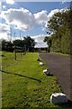
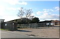
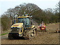
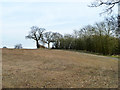
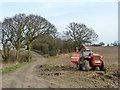
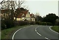
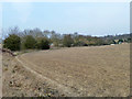
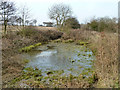
Chigwell with Lambourne Ward occupies a distinct position within the Epping Forest district of Essex. This district borough unitary ward spans 24.1 km² and serves a population of 1,411 residents. You are purchasing homes in an area that blends residential corridors with significant open countryside. The ward encompasses parts of Chigwell parish, including the Chigwell Row ward, alongside the civil parish of Lambourne. Your daily life here involves a transition from suburban neighbourhoods near Grange Hill to open fields and adjacent forest. Lambourne Road acts as a central spine, separating mixed housing from open fields in places and running alongside woodland in others. To the south, Hainault Forest Country Park extends from the border, while the River Roding forms the northern boundary. You live close to the Green Belt, benefiting from proximity to Epping Forest yet maintaining a rural character. The location offers direct links to Buckhurst Hill and Loughton, providing access to wider amenities without the density of central Chigwell Village. Living in this ward means you engage with a landscape defined by lanes, varied housing, and significant natural reserves.
- Area Type
- District Borough Unitary Ward
- Area Size
- 24.1 km²
- Population
- 1411
- Population Density
- 59 people/km²
Demographics
Your neighbours in Chigwell with Lambourne Ward reflect a mature living demographic. The community has a median age of 70 years, indicating a population heavily weighted towards older residents. Every resident contributes to this demographic profile regardless of specific age bracket, creating a settled neighbourly environment. Eighty per cent of households own their homes, establishing the area as entirely owner-occupied territory. This high rate of home ownership suggests long-term stability within the community rather than short-term tenancies. The ward contains a total population spread across its fields and lanes, with no specific breakdown for younger families or student populations visible in current records. You will likely interact with families, retirees, and those who have established roots locally. The low population density of 59 people per km² means less traffic and noise compared to urban settings. Although diversity data is presented as a total for the parish, the area maintains a quiet residential rhythm defined by its rural setting. Buying here means joining a community where property is held by the occupants for the long term.
Household Size
Accommodation Type
Tenure
Ethnic Group
Religion
Household Composition
Age
Household Deprivation
NS-SEC
Explore more demographic insights in this area
Go to Demographics tabPlanning
Planning Constraints
- Flood RiskPremium
- Ramsar Wetland SitesPremium
- Area of Outstanding Natural BeautyPremium
- Protected Nature ReservePremium
- Protected WoodlandPremium
- Crime RiskPremium