Area Overview for Cheshunt South and Theobalds Ward
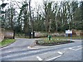
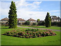
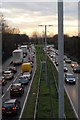
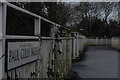
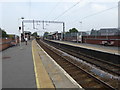
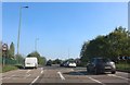
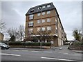
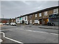
Photos of Cheshunt South and Theobalds Ward
Area Information
Living in Cheshunt South and Theobalds Ward offers a distinct suburban experience within the Borough of Broxbourne. This electoral ward sits approximately 51.6989°N, -0.0350°W, marking a residential postcode north of London with deep historical roots. The landscape centres on the legacy of Theobalds Palace, an Elizabethan manor that once hosted Queen Elizabeth I. Although largely demolished during the Commonwealth era, the site still defines the local character through surviving fragments, parkland, and a hotel. Theobalds Park, a Georgian house built in the 1760s, now functions as a conference centre. Cedars Park sits adjacent to this on the former palace grounds, where local rules prohibit ball games to protect the historic setting. You navigate a compact district covering only 2.1 square kilometres. This small footprint supports a population of around 2,130 people, creating a tightly knit environment rather than a sprawling town. The area feels like an older domestic estate where history and modern living intersect. Daily life revolves around this preserved Georgian and Elizabethan heritage, mixed with the practicalities of suburbia. There are no major commercial high streets within the immediate ward boundaries, so residents typically rely on wider Cheshunt for shopping needs. The scale remains intimate, allowing you to move quickly between the modern housing areas and the protected greenspaces that link Theobalds to the rest of the borough.
- Area Type
- District Borough Unitary Ward
- Area Size
- 2.1 km²
- Population
- 2130
- Population Density
- 1038 people/km²
Demographics
The community profile of Cheshunt South and Theobalds Ward reflects a settled, mature neighbourhood with significant home ownership. Data indicates that 62% of households own their homes, suggesting a base of residents who have long-term ties to the area. With a median age of 70, the population skews considerably older than the national average. This age distribution aligns with the quiet, established nature of the ward. You will encounter a predominantly older demographic living in accommodation types suited to decades of continuous settlement. The specific breakdown of household composition across the total population points to families and single-occupancy homes rather than high-density rentals. The age structure means the area is less of a hub for young professionals or students and more of a retirement or established family zone. You might find larger family homes alongside smaller cottages fitted for elderly residents. The total population count of 2,130 living across 2.1 square kilometres results in a density of 1,038 people per square kilometre. This density is moderate for urban planning but high for such a small parish, meaning houses are likely situated close together. The demographic data confirms this is a stable area where neighbours have probably co-existed for many years. There are no notable gaps in ethnic or religious data for this specific ward, meaning the community composition relies on the broader Hertfordshire mix without specific outliers recorded here.
Household Size
Accommodation Type
Tenure
Ethnic Group
Religion
Household Composition
Age
Household Deprivation
NS-SEC
Explore more demographic insights in this area
Go to Demographics tabPlanning
Planning Constraints
- Flood RiskPremium
- Area of Outstanding Natural BeautyPremium
- Protected Nature ReservePremium
- Protected WoodlandPremium
- Crime RiskPremium